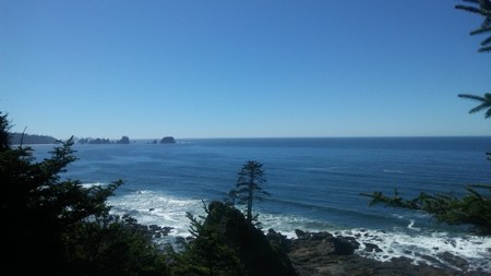
Four friends and I set out to enjoy the beach for a two night backpack adventure at Shi Shi Beach. We drove up from Olympia to Port Angeles on US-101 to pick up our overnight permits at the Wilderness Information Center (WIC) on East Park Avenue. From there we continued on US-101 to the junction of SR-112, taking it towards Neah Bay.
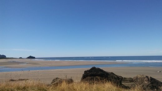 View from Tsoo-Yess Beach | Photo by Regina robinson
SR-112 is a twisty turny drive following the rugged coastline with views of the Strait of Juan de Fuca and Canada. Several small towns are points of interests along the drive. Joyce is one such town; known for its general store, their motto is, “If we don’t have it, you don’t need it.” Truth is, they pretty much have everything you can think of, from cast iron camping cookware to chainsaws and marshmallows for s’mores - it’s definitely worth a quick stop.
Arriving at Neah Bay, we stopped at Washburn’s General Store for last-minute items and the Makah recreation permit. After one last visit to the facilities we were on our way to the trailhead. As we drove down the road we determined that we’d head directly to the overnight parking area instead of dropping folks at the trailhead - at just over half a mile the walk was a welcome relief to being in the car for four hours.
We chose to park our vehicles at the furthest overnight parking area, away from the Shi Shi day use parking area. We had five backpackers on this trip, so getting the cars parked, gear rearranged, and packs on took us about ten minutes. Thankfully the day was sunny and warm and the walk to the trailhead got our stiff car-bound muscles ready to hike.
At the trailhead we stopped briefly to read the information regarding the Olympic Wilderness Coast and travel warnings about beach safety and awareness.
Heading off on the trail, the forest is dense and dark, with older fir, hemlock, and spruce. The salal berries were ripe with big black juicy berries, and the salmonberry (when not picked clean) held plump and delicious berries.
The trail crosses over two bridges. Some of the trail is boardwalk, but much of the trail is deep muddy patches with thick brushy areas. At a little under one mile the trail bears right at a marked fork. Reach the park boundary at two miles, then drop down a steep slope about 160 feet to the beach below. If you have stability or knee issues, I suggest caution on this portion of the trail as it is steep, unstable, and the ropes can be frayed. At the bottom of the bluff head down the trail and out towards the beach, turning left toward Point of Arches.
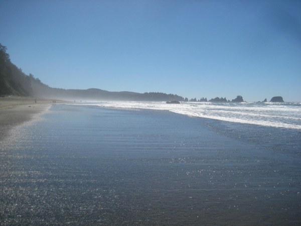 Shi Shi Beach with Point of Arches in the distance | Photo by Regina Robinson
I love walking on the beach. I can walk for miles and just lose myself in the peaceful rhyme of the constant sway of the water crashing and receding. It is easy to slip into a silent reverie and become one with the sounds of the gently lapping waves as they dip and plunge along my feet.
I chose to hike closer to the water on the hard packed sand - it is way easier to walk and my feet and legs do not ache. I suggest taking precautions and wear shoes that are good for you. The first time I hiked on the beach as an adult, I wore my heavy-duty boots because trail reports said, “too much mud,” etc. I could have hiked better in all that sand with a more flexible shoe. This time I opted for an old pair of tennis shoes, using my beach water shoes as my spare pair. For the most part I had no issues with walking in my old tennis shoes. They were light – had an insole, which provided my feet with support and dried out fairly quickly (unlike my boots on the previous trip).
While walking I constantly scanned the ground for rocks, spying a plethora of colors including gray, black and white, coral and light pinks, greens, yellows, and reds. Most were tumbled smooth by the sand. Others were rough conglomerates, looking like crushed-up cement.
As we continued to walk down the beach campsites began to appear. Many of them were located near Petroleum Creek at just about 3.25 miles. Many folks to camp here, and sometimes river otters can be seen running out into the surf.
We searched for a spot that would hold us, and out of the three sites we surveyed one had a wide enough spot – up above the high tide line, so that three of us could pitch tents. Thankfully there were plenty of trees that would provide valuable shade on the hot sunny days we were backpacking. Two of us pitched tents closer to the highest tide line on the beach. I was very nervous, as a friend on a previous beach trip had to get up in the middle of the night and move tents and gear because of the rising tide and a sneaker wave washing them off the beach. Knowing their story I chose the highest ground, leaving a good 250 feet between myself and the river and staying clear of any major driftwood log jams.
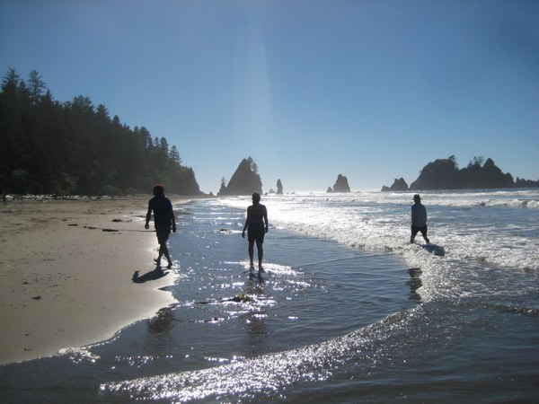 Walking in the Surf | Photo by Regina robinson
After pitching tents and making sure the bear cans were stashed in a secure location from away from crafty critters, the five of us took a stroll along the beach down towards Point of Arches. Shoes off - walking in the water was at first a shock. That water was COLD. Even on warm sunny days hypothermia is something to worry about along the Washington Coastline. The sun would be going down soon, which kept me from going swimming. I vowed to at least go for a dip the next day, early enough to dry off and be warm before the sun set.
Getting down to the Arches the water was higher and access around the point was off-limits due to the incoming tide. We poked around a bit, saving our big adventure for the following day. We chose to head back to camp to gather driftwood for the campfire, play Frisbee, nap in the sun, and read our books; I love the option of having something and nothing to do all at the same time. Being on a beach is wonderfully relaxing and refreshing, with no pressing appointments, obligations, or meetings. It’s just me, the sand, sun, and nothingness.
Even though we spent our time on the beach observing tide pools and habitats, watching the water and shifting winds, reading tide charts, treating and filtering water, and picking up and discarding rocks, we considered ourselves “at play,” not work. We left behind all the constraints, demands, and worries placed upon us during the regular work day, opening us up to absorb, learn, and internalize more of the experience where we can fully relax and engage all our senses.
I was both ready and not ready for the cooler temperature brought on by the slowly sinking sun. Here there are no alarm clocks, buzzing reminders to get up and get going. As the weather cools further, I start to look forward to my cozy warm long underwear and puffy as we head back towards camp to get water, build a fire, and prepare dinner. Night will come all too soon, and with it a well-deserved deep sleep.
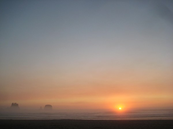 Sunset | Photo by Regina Robinson
The setting sun brings a sigh of relief - “ah we made it!” A collective sigh passes over the group as we relish our common love of the outdoors. Each of us take turns exclaiming that maybe today just might be the day we get to see the “green flash.” For me, I still have not seen the infamous “flash.”
The setting sun sets a peaceful tone, a reflection of our time together as we build a campfire and gather to prepare and cook dinner. Sharing a meal is a powerful moment. It builds and strengthens the human connection. Our dinner with each other on the beach that night was special - this ritual always holds something of the mystical and magical of days long past.
Water duty: no one likes going for water, yet it is an essential task for backpacking. No matter how much we pump sometimes it seems we never have enough. I always strive for more than needed; I can drink three liters in one day, and that isn’t even counting my meals and clean up.
We focused on filtering at least 12 liters from Petroleum creek as each of us like our coffee or tea in the morning. The waters are a deep dark brown in color, because of the rich tannins that leach from decaying organic matter into the streams. As we headed back to camp, I noticed the large amounts of poo and toilet paper scattered close to the creek. I made a mental note that we would all be boiling water tonight. Treating all water for the potential contamination of giardia and cryptosporidia is important. No one wants to be sick after their restful vacation.
Pit and vault toilets are established in the area, but when they are not an option head at least 200 feet away from a water source and dig a cat hole 7-8 inches deep, covering it over when done. All feminine products and toilet paper must be packed out. All I could think about was the water and the salmon who call this area home.
What would this do to the fish? Salmon are important to Washington. Rivers serve as important areas for migrating fish along the beaches. The trees along their riverbanks serve as refuge for the young fry, providing cool waters and much-needed shade. As the adults return from the oceans they head up rivers to spawn. Like nurse logs providing nutrients to the young trees growing from its decaying matter, spawning salmon die and provide nutrients back into the water. I can’t help but think that healthy waterways begin with our decisions. Choosing to backpack on the beach is a choice to either dig deep away from water sources or pack our materials out. LNT is essential for overall ecosystem and habitat health.
Our first morning on the beach we woke up to a little morning fog, accompanied by blue sky and sunshine!
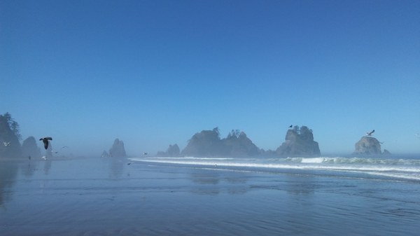 Morning walk along Shi Shi Beach to Point of Arches | Photo by Regina Robinson
We walked down the beach to see how far we could get past Point of Arches. The tide was out for a few hours, and once past this the point there is no safety until the next headwall exit.
There is so much geology and interesting rock formations to look at - crumpled layers in boulders the size of cars. Striated layers in the rock where you can see giant chunks of conglomerate rocks and itty bitty shells!
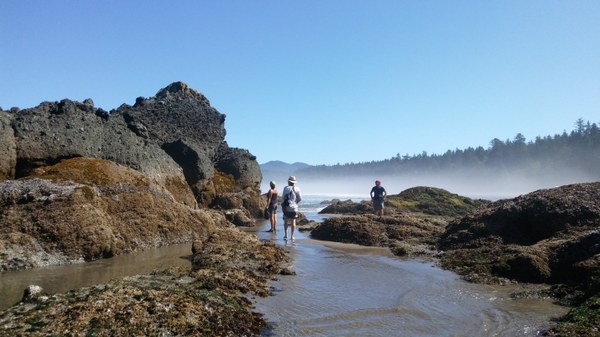 Beachgoers checking out the tide pools and sea stacks at Point of Arches | Photo by Regina Robinson
The rocks at Point of Arches are some of the oldest rock layers found along Washington’s coastline, at least 144 million years old. Eocene conglomerates and breccias can be found among sea stacks and large boulders from the old continental floor.
Having more than one day on the beach affords one the opportunity to enjoy all aspects of exploring. Day two was the tide pools. We even managed a little bit of body surfing in the ocean.
Not sure what type of seaweed or marine creature this is, but I found it really interesting as many of the others were brilliant oranges, reds, and purples.
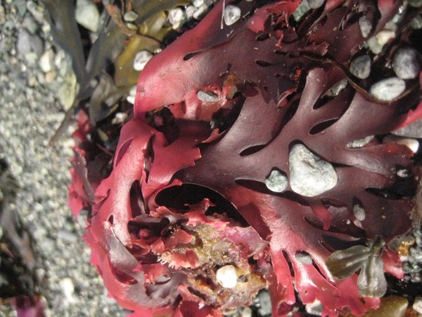 Red seaweed | Photo by Regina Robinson
The adventure at Shi Shi beach was grand. No matter how many times I get out there I still see something new and interesting. If you get a chance to go, don’t hesitate - just do it!
Directions: From Port Angeles, drive on US 101 west for 5 miles. Turn onto SR-112 west for 64 miles to Neah Bay. Continue on Bayview Ave for 1 mile; turn left on Fort St; right onto Third Street; left onto Cape Flattery Road. Drive 2.5 miles, then left onto Hobuck Road. Drive the last 4.3 miles following signs for the fish hatchery, to Shi Shi beach day use parking.
Elevation: Roundtrip elevation is approximately 320 feet (the trail drops from a cliff to the beach for a distance of 160 feet).
Length: 8.6 miles roundtrip if traveling to Point of Arches. We traveled past Point of Arches an additional 2 miles for a total travel distance of 12.6 miles.
Pass/Entry Fee: The Olympic National Wilderness Park Pass ($35), overnight wilderness backpacking fee ($5 per person per night) and the Makah Recreation Pass ($10, must be purchased in Neah Bay and displayed in your vehicle while on Makah Tribal land).
Bring: Camera, water shoes (better than sandals to beach walk and observe tide pools), 10 Essentials, extra sunscreen and sun protection, Tide Chart & coastal map of the headlands, and your sense of adventure.
Note:
- Shi Shi beach trailhead parking lot is day use only.
- No dogs, horses, or bikes allowed.
- Coastal travel can be hazardous. When hiking the coast:
- Bring a Tide Chart and know how to use it
- Be aware when stream crossing or walking on unstable terrain
- Be very cautious if swimming
- Be aware that beach logs are often unstable
- Overnight stays require a bear canister along the Olympic National Park Wilderness Coast.
- Hanging food, using buckets, and/or using animal resistant containers outside of bear canisters are not permitted.
- Fish and gather shellfish only in accordance with regulations.
- Protect coastal forests by building fires only on the beach using driftwood below the high tide line and away from drift logs.
- Overnight Parking is permitted in designated private parking lots marked by signs 0.6 miles before the Shi Shi Beach trailhead nearest to Tsoo-Yess Beach.
- Parking is $20.00 per night at furthest overnight parking lot.
- Parking is $30.00 per night at the closest overnight parking lot.
- Do not disturb or remove cultural or historical objects. Historic shipwreck remains and Native American artifacts and petroglyphs are protected by state and federal laws.
 Regina Robinson