Trip Report
Whitewater Packraft - Middle Fork Snoqualmie River: Taylor River to Concrete Bridge
Fun trip despite water level close to minimum. Group dealt well with some complicated swims.
- Sat, Apr 13, 2024
- Whitewater Packraft - Snoqualmie River (Middle Fork - Upper Middle): MF Trailhead to Concrete Bridge
- Snoqualmie River (Middle Fork - Upper Middle): MF Trailhead to Concrete Bridge
- Packrafting
- Successful
-

- Road suitable for all vehicles
-
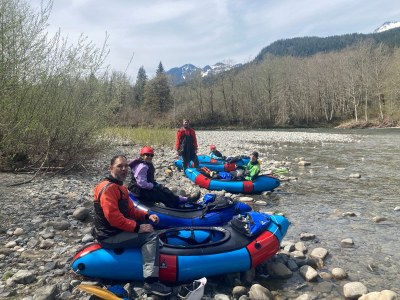
Flow was around 1100 CFS, weather ~60 degrees and sunny. The water level was runnable, but we would have liked to have had more. There was some butt scraping but one rapid in particular was quite challenging at this level.
Logistics before the river were straightforward with a great put-in on the far side of the bridge from the Middle Fork trailhead. The two named rapids early in the run were much tamer than expected at this water level (1100 CFS).
Our first challenging section occurred at about 1.6 miles into the trip - this rapid is obvious from the road, and we noted on the drive up how bony it looked without taking the extra step of pre-planning a line through. I made a poor line choice and was unable to see below the horizon, and we went center-left, where the water looked deeper (as opposed to right which was obviously an extremely shallow gravel bar) and ended up committed to a rock garden ending in a short but steep drop through dense boulders. The first two paddlers made it through - the other four all got stuck in the rocks above the drop and ended up having to get out of their boats. The process of getting the boats and paddles down and the people swimming or walking out took some time and some tense moments but the group took it slow (which helped a lot) and worked very well together. It was a reminder not to miss an opportunity to make a plan from the road, and anyone else doing this stretch at lower water levels would be well-advised to pull over and take a second to look at this one. With more water, it would have been a fairly straightforward float down the right.
The second challenging rapid was about 2.9 miles into the trip - the current went down a drop into a left turn through a mild hole that the paddler has to punch through, with a bit of wood on the shores. One paddler went too far right and was pushed out of their boat by a low-hanging branch - they made it to shore safely, but the boat got inconveniently stuck and took a team effort and some time to knock it free to be recovered downriver. I think this rapid was more difficult in these conditions than either of the named rapids.
The paddle was relatively uneventful downriver of this, although a headwind and the low flow made the miles below the Pratt confluence take a bit longer than expected. Total elapsed time on the river was 4:31 including lunch.
The group worked together well dealing with these challenges and paddlers recently out of the whitewater course had the chance to amply practice and demonstrate their skills. The mountain scenery was excellent and saw lots of birds. Definitely a river to repeat - I think I'll want 1500+ CFS next time though.
 Alex Bond