Trip Report
Basic Glacier Climb - Little Tahoma/East Shoulder
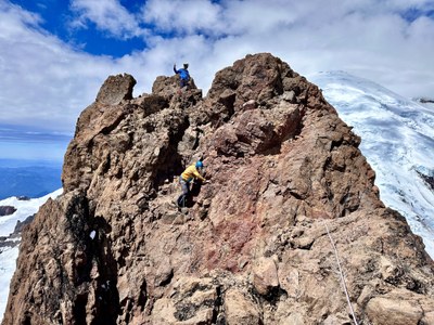
Little Tahoma is a beautiful climb, in a spectacular location, offering a little of everything alpine as far as features throughout the route.
- Fri, Jun 21, 2024 — Sun, Jun 23, 2024
- Basic Glacier Climb - Little Tahoma/East Shoulder
- Meany Crest
- Climbing
- Successful
-

- Road suitable for all vehicles
-
- Along the two mile stretch from camp to the crest across the Fryingpan Glacier there were no signs of cracks opening or any visible.
- Nor was there any rockfall observed or rocks lying on the snow from prior times. It was a blanket of white snow.
- On the Whitman Glacier, we didn't see any cracks either close/near to the route while on the lower traverse.
- While going up the steep slopes of the east face below the summit we saw some rocks on the snow that had fallen at other prior days.
- I didn't see any rock fall while we were going up or down, luckily the potential rock fall condition was stable at the time we moved through. One person did observe a rockfall off to a side slope when we were not climbing.
- We also observed a 2-3 crevasses that are beginning to open on the way/up down the very steep slopes and steered away as far as we could from them. I let the ranger know and she made note of it to share with future parties.
- We saw some signs of top layer snow slides on the steep slopes from the days before with the most recent snow that fell in the area.
Day 1 - We picked up a 2-night camping permit from the White River Wilderness center right when the opened at 7:30am. Getting in line at 7am was perfect to put us first in line. We already had the permit through the early lottery but there was a long line of other climbers coming to get permits for Emmons route.
PERMIT TIP: Have your climbers names, routes climbed at Rainier, emergency contact name/number, tent descriptions and vehicles parked at trailhead - all this info ready to provide to the ranger to expedite the process. You could put this in a grid and bring it with you so that you don't have to rewrite all the info already in the trip planning document or in the wilderness permit. Also, make sure to have the individual copy of the climbers permits or permit numbers. I had ours already printed on a separate sheet and the ranger just attached this to their documents.
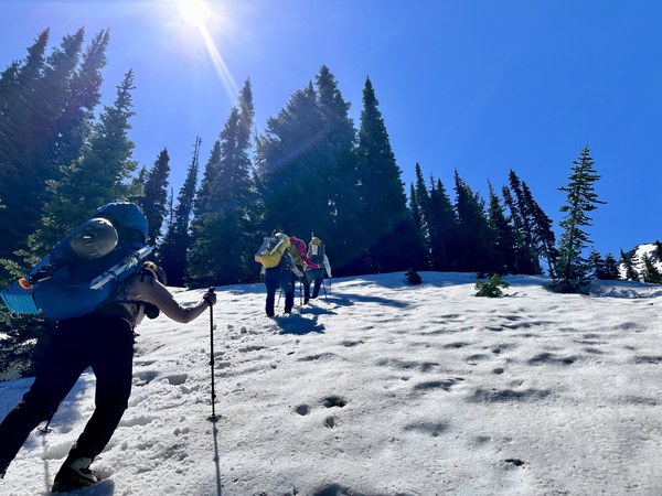
We started off around 8:30am on the trail with glacier packs ranging from 35 lbs. to 45 lbs. in weight. Crossed the Fryingpan Creek and snow started shortly after before the switchbacks up to Summerland. The summer trail switchbacks were too steep with snow so we stayed climbers right making our way up the snow and through a few scrambly brushy sections.
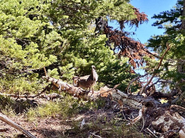
We enjoyed a relaxing lunch break near the shelter at Summerland and checked out the rest of the route to camp. Spotted a colorful grouse who was flexing their feathers at us from a nearby log.
Then we made our way up the steep snow-covered slopes to Meany Crest. Taking turns rotating the leader while kick-stepping for the rest of the group.
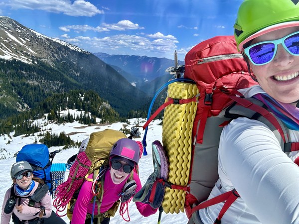
The slopes from Summerland to Meany are great to travel when covered with snow. We didn't have to worry about rockfall here. Heard some water in a few places but was able to move away and avoid anything concerning. These conditions are favorable to the mud, loose rock and challenging conditions described when these slopes melt out.
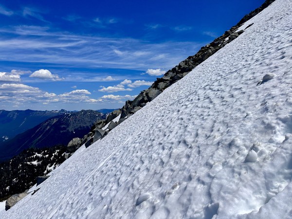 Chatted with a group of Mounties from Bellingham, who were on their way out and gave us some helpful beta for the climb. Thanks @Justin!
We swung by Meany Crest proper summit on the way to camp. It was just a little ways climbers left from the route to Meany camp. We wanted to hit the high point marker on the map/peakbagger point.
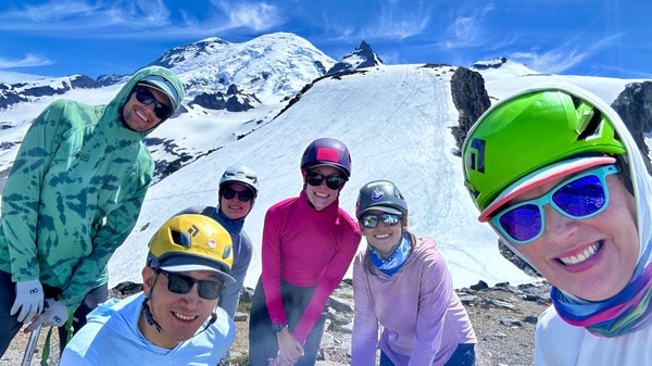
The views of Panhandle Gap and the Wonderland Trail were impressive.
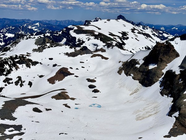
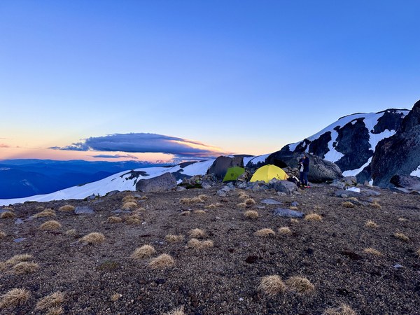
Then made it to Meany Crest camp in 6 hours 25 min (elapsed time) from the trailhead. The camp area is melted out. We fit three tents in the rocks on the left side.
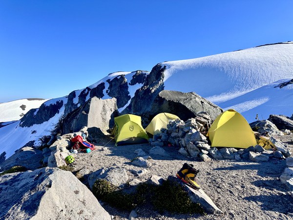
There were many other camp areas to the right side (north end) of the crest camp area that are a little more off the climbers path. We were the only group up there. There was a handy waterfall just around the snow bend (climbers left, south) from camp that made filling our bottles convenient.
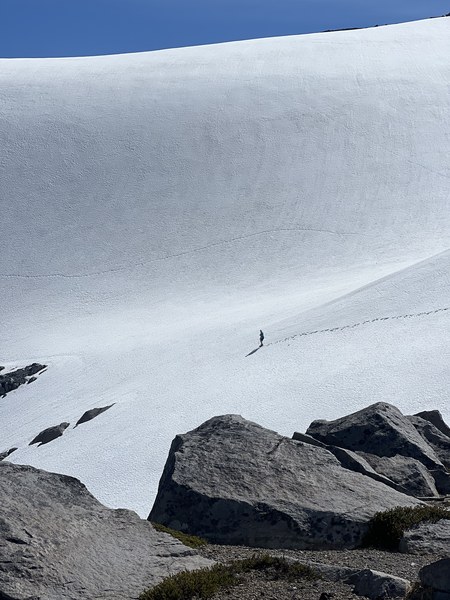
The rocks on the left side of this photo is where the waterfall started. I imagine it's there most of the season, even when the snow melts out.
Day 2 - Alpine start on Saturday with headlights at 1:40 am and two rope teams.
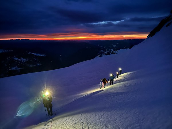
We made to the Whitman Crest notch in a few hours and had a snack break while the sun was coming up.
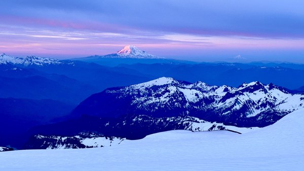
Continued on accessing the Whitman Glacier and traversing 400 more feet to the bottom of the east face.
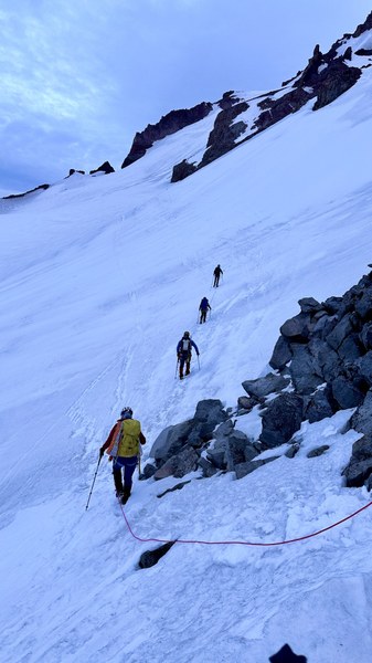
We unroped when reaching the east face. The snow was very firm and it wouldn't have been as safe to be roped up together in these conditions. We needed to be able to catch our own individual falls, luckily that was never an issue. Then we continued on traversing and up the steep slopes that lead up 1,600 more feet to the summit area. We navigated as much as possible by watching the slope angle (via GAIA) to stay in the zones with the lightest shading.
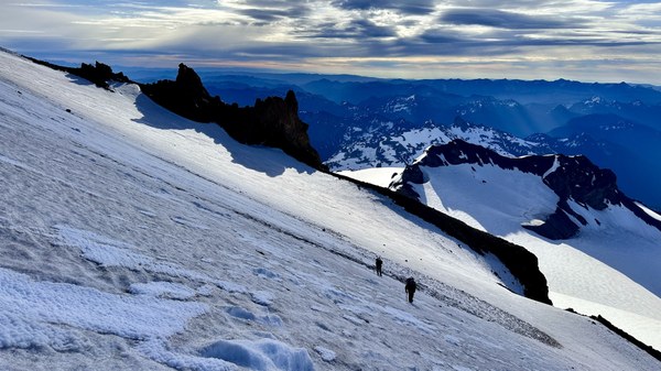
We scrambled up the steep slopes and kicked steps in the hard, icy and firm crust. The snow was angled in the natural shape of where it landed when falling, with no texture or features on it to help us with already made steps or suncups. Eventually made it to around 10,755 where there was a little rock notch that we climbed through with crampons on to the next smaller snowfield. This snowfield was firm and we had beta from the other group who told us to leave our crampons on for this portion.
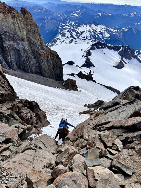
After getting through this we reached the headwall. We didn't take the path that went off from the right side, we continued straight up and went off to the ramp on the left side. We took off our crampons, left our ice axes and began the summit scramble.
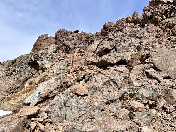
It was fun and easy to find the way up to the ridge. There was some sort of a boot path that weaved up and around to the ridge proper, it was trending a little right. We reached the summit notch (false summit) of apx 11,100 at 10:15am and took a group photo.
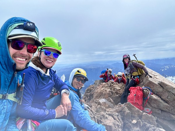
We set up a handline for people to scramble over and tag the summit at 11,138 feet. Building one anchor with a cordelette around a large rock, slung the horn at the top of the summit with a quad for the second anchor, attaching the rope to both sides.
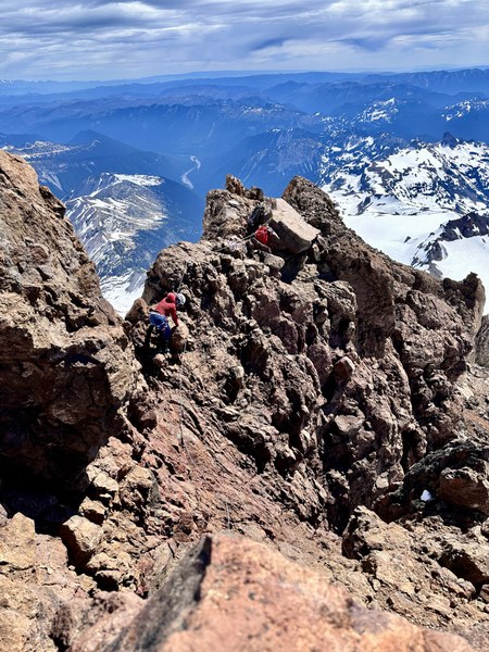
We then took turns scrambling over with our prusik attached to the rope, minding it as we moved along. A few light snow flurry flakes begun swirling while we were on the summit. Behind us up at the Big Tahoma summit there was a cloud and likely many more flakes falling at that time. Four folks scrambled over to the summit and then we packed up all the slings and rope to head down.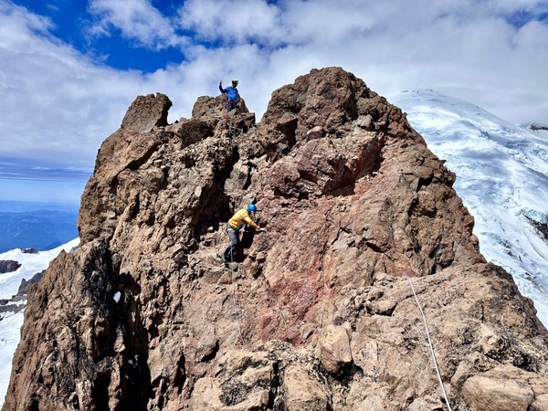
There were a few groups of skiers who headed down before us and we begun the descent. The sun had luckily softened up the snow and we were able to make better steps (in now soft snow) on the way down. The slopes near the top and really all the way down were very steep so the team stared face-in downclimbing right away. Gaia shows these slopes to be mostly 35-45 degree with a few sections of 26-35 degrees sprinkled throughout.
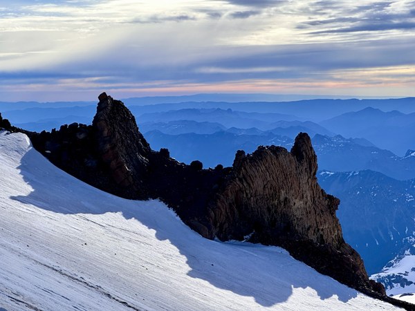
The downclimbing was long (~1,600 feet) and were committed to safely getting to the bottom. Eventually things eased up in a few sections for some traversing but then a few more times switching back to downclimbing. We made it back to the bottom and roped back up. Then headed back to the Whitman Crest notch where we had a water & snack break. Eventually we headed off for the final two miles back to camp. We reached camp just before 6:30pm, making the full day a 16 hr 45 min trip. The day took longer than planned (probably 3-4 hours more) but the conditions contributed to more time needed (in both directions).
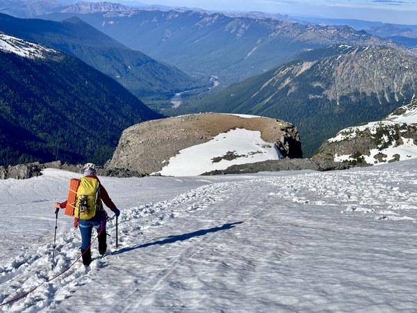
Once back at camp, we decided to enjoy the beautiful high camp for one more night with a hot meal for dinner and get rested before hiking out and driving home. Thankfully we had the permit for the second night.
Packed up in the morning to cloudy skies and hiked out in under three hours. Stopped in Enumclaw for a delicious team lunch at Taco Time/and Starbucks. I am very proud of the team for the effort put forth on this challenging climb. Congrats to the basic students for completing your first glacier climb! Thank you for the strong leadership from the rope leads!
 Laurel Geisbush