
Trip Report
Alpine Scramble - Wallace and Tirzah Peaks
Long day with challenging off-trail routefinding to a seldom visited area of Mount Rainier.
- Sat, Aug 5, 2023
- Alpine Scramble - Tirzah & Wallace Peaks Loop
- Tirzah & Wallace Peaks
- Scrambling
- Successful
-

- Road suitable for all vehicles
According to Peakbagger, Wallace and Tirzah Peaks have the least recorded ascents of all the Rainier 100 peaks. They're known for being unpleasant and difficult, among the least favorite, and typically summited only by those wanting to finish the list. The ridge that separates them is only 1.1 mi, so it’s common to combine both in a loop along the Carbon River.
Planning
Having already completed Pitcher Peak, Pigeon Peak and Third Mother Mountain, I was anxious to summit these so they would not be last on my list. The idea was initiated by my scrambling buddy Adam Dodge. It came down to timing. There were two important considerations. First, the loop involves crossing the Carbon River at the Chenuis Falls Trail and then again at the Lower Crossing. In order to avoid hazardous fording, we wanted both crossings to be in place, which does not typically occur until late July. Secondly, we knew from previous trip reports that it would probably be a 15 hr day, so we wanted plenty of daylight closer to the summer solstice.
We decided to do a counterclockwise loop for two reasons. First, we wanted to verify both river crossings were in place before committing. We originally scheduled this in early July, and the Lower Crossing was still uncertain at the time. It made sense to check the Chenuis Falls Trail, then continue to the Lower Crossing. If it had not been in place, our backup plan was to summit Gove Peak instead. Secondly, we wanted to gain most of the elevation via easier hiking on the Wonderland and Northern Loop Trails. This would allow us to do the difficult scramble mostly downhill. However, the tradeoff would be the steep descent after Tirzah Peak. NOTE: See advice at the end.
Summary
- 6:17am - Bike 3.6 mi (410’ ascent) on Carbon River Trail to Chenuis Falls Trail
- 7:02am - Hike 1.5 mi (230’ ascent) on Carbon River Trail to Ipsut Falls
- 7:41am - Hike 3.9 mi (2,330' ascent) on Wonderland and Northern Loop Trails to turn-off
- 10:20am - Scramble 1.6 mi (1,200’ ascent) to Wallace Peak
- 1:25pm - Scramble 1.1 mi (260’ ascent, 840’ descent) to Tirzah Peak
- 4:04pm - Scramble 1.2 mi (2,390’ descent) to Chenuis Falls Trail at park boundary
- 7:39pm - Hike 0.9 mi (660’ descent) on Chenuis Falls Trail to Carbon River Trail
- 8:42pm - Bike 3.6 mi (410’ descent) on Carbon River Trail
- 9:12pm - Arrive Carbon River Entrance
Details
I called the Carbon River Ranger Station the day prior to verify both Carbon River crossings. We met at the Carbon River Entrance at 6am (sunrise 5:52am) with plenty of parking. We had a group of four which included two scramble leaders and two fairly new scramblers. We spent time reviewing the map and our plan for the day. There was no reliable water source between Ipsut Falls and Chenuis Falls, so we each carried a minimum of four liters water. The day was cloudy with mild temperature. It began with light rain, but stopped by mid-morning.
We departed Carbon River Entrance and rode our bikes to Chenuis Falls Trail, where we verified the crossing and stowed our bikes. We continued on the Carbon River Trail to Ipsut Creek Campground. Shortly after, we made a slight detour to visit Ipsut Falls because I’m also working on the Tacoma Branch Mt. Rainier Waterfall Chaser badge.
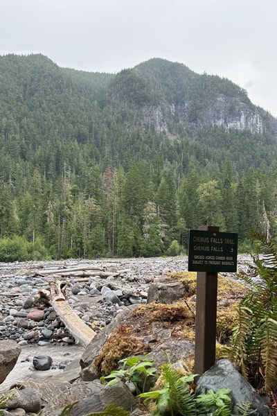 Chenuis Falls Trail and Tirzah Peak
 Ipsut Falls
There was a detour on the Wonderland Trail about 0.5 mi after Ipsut Falls which involved some log crossings on the Carbon River, but got us quickly back on trail. Further on, the Lower Crossing was well maintained and easy to navigate at 8:34am. Soon after, we turned left at the Northern Loop Trail junction, gaining elevation quickly with many switchbacks before reaching our turn-off at elevation 4,600’.
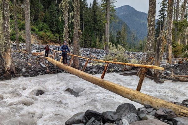 Carbon River Lower Crossing (photo: Adam Dodge)
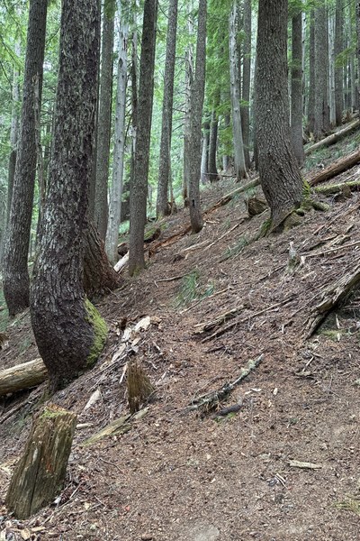 Beginning of Wallace Peak off-trail
While taking a short break, I reviewed some basic map and compass skills, since the primary focus of the scramble was off-trail routefinding. We scrambled north towards a couple of saddles before reaching the summit of Wallace Peak. This section had plenty of side-hilling, blowdowns and periodic brush bashing, plus a tendency to get pulled left. As described in the Guide to 100 Peaks, we avoided Class 5 rock climbing by working our way around south until reaching a very short rock scramble to the summit at 12:49pm. Although I carried a rope and we had our scramble kits, at no point during the entire day did we find anything needing a hand line. We took 36 min to enjoy lunch and our only real summit view of the day, looking at the Carbon River valley and nearby Third Mother Mountain. Mount Rainier was partially obscured by clouds. This would be the first of two summit registers with very few pages of entries, letting us know just how rarely this part of the park is visited. There were many recognizable names on the Rainier 100 completion list.
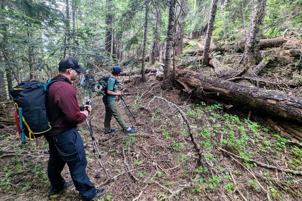 The first of many blowdowns! (photo: Ivan Shepherd)
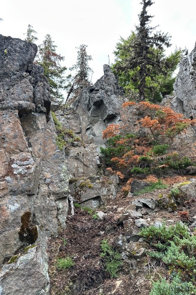 Short rock scramble to Wallace Peak
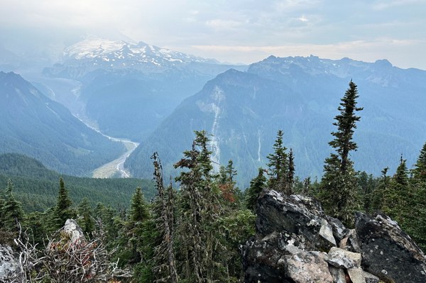 View from Wallace Peak
Previous trip reports told us to expect a relentless 3 hr scramble along the 1.1 mi ridge toward Tirzah Peak. It began with a steep descent through talus and boulders, initially on the north side of the ridge. From there, we tried to stick close to the ridge, choosing left or right of rock croppings as seemed best. The actual summit of Tirzah was a bit confusing since it was simply a pile of rocks among trees with minimal view, and the Gaia map does not show the summit correctly. We stumbled upon a false summit before finding the true summit at 3:44pm with a register. I was super proud of the team for doing the ridge in only 2 hr 19 min. We took a well deserved 20 min break.
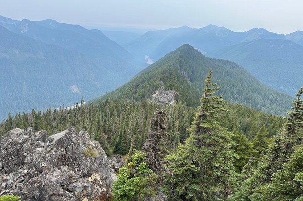 View of ridge and Tirzah Peak from Wallace Peak
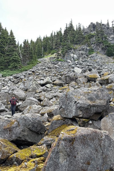 Descending talus and boulder field
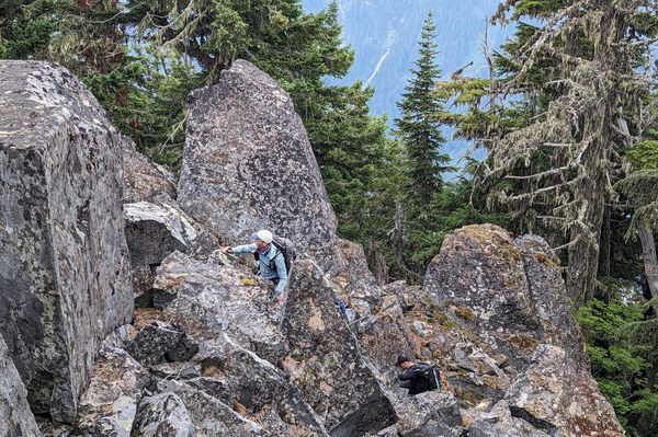 Rock scrambling along ridge (photo: Adam Dodge)
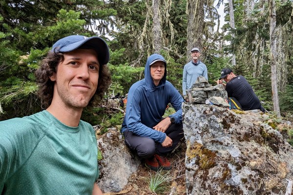 Tirzah Peak (photo: Adam Dodge)
The scramble from Tirzah Peak to Chenuis Falls Trail near the park boundary would prove to be the most challenging part of the day. We were tired by this point and low on energy. This is a very steep descent requiring concentration with several cruxes. The first was a steep gully near the summit. We found a way on the north side (right). The next was a notch that showed clearly on the topo map. We then came upon another large rock cropping with an orange streamer at the top of a notch. Initially, we thought the north side would be steep, so we probed around the south side, but realized this would suck us further down the mountain. So we went back and took the north side (right). From here, we had to carefully work our way to find the correct ridge to follow down to Chenuis Falls Trail. There was another large rock cropping which we ended up going on the north side (right). There is another trip report by John Gilbert which mentions the south side being easier, but we did not explore that option. Many parts of this section had very steep duff. At about 3,400’, I started heading toward the park boundary which quickly got us into dense trees. The USGS map and CalTopo MapBuilder do not show The Chenuis Trail correctly. It actually intersects at about 2,800' elevation.
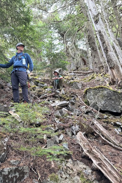 Descending gully
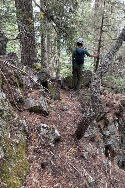 Looking back at notch
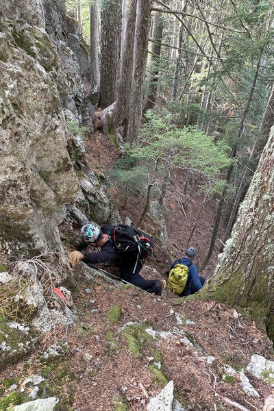 Descending notch
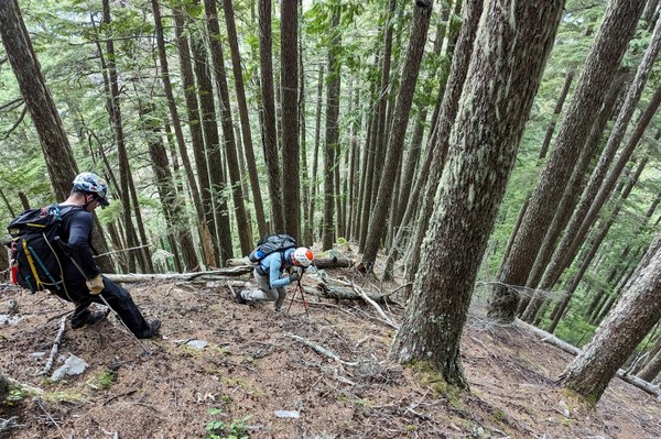 Steep descent along ridge to Chenuis Falls Trail (photo: Adam Dodge)
We finally reached the Chenuis Falls Trail in about 3.5 hr, mainly because of all the careful down-climbing and need for frequent snack and water breaks. The trail above Chenuis Falls was overgrown and unmaintained with occasional blowdowns. We made another brief stop at Chenuis Falls, definitely worth viewing and also on the Tacoma Branch Mt. Rainier Waterfall Chaser badge. Finally, we crossed the Carbon River at 8:25pm before reaching our bikes. Unfortunately, we had trouble unlocking one of the bikes which cost us about 15-20 min. We ended up needing headlamps (sunset 8:40pm) for the bike ride on Carbon River Trail to Carbon River Entrance, arriving in just under 15 hr for the entire day.
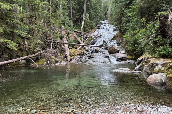 Chenuis Falls
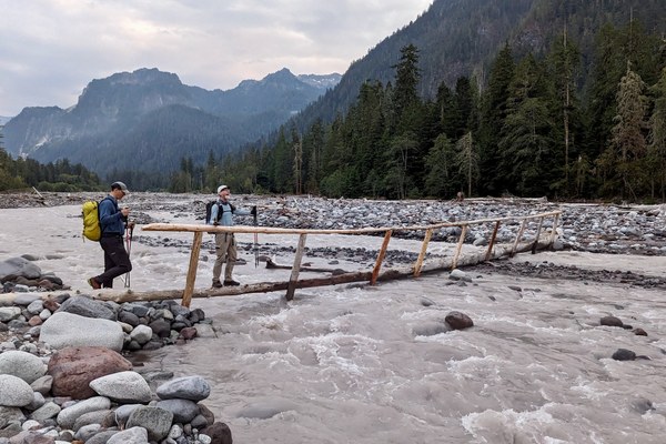 Chenuis Falls Trail over Carbon River (photo: Adam Dodge)
I can’t think of another trip which has such extensive practice with off-trail routefinding. It was a humbling, yet incredible learning opportunity for the participants and really boosted their skill level. Our enthusiastic group worked well together and made this trip as enjoyable as possible!
Advice
For anyone thinking about doing this loop, I would plan on 15 hr to complete, consistent with other trip reports. Don’t let the 1.1 mi ridge fool you. Plan 2.5-3 hr to connect these peaks. You may want to do them separately. Looking back at the difficult descent, it probably would have been easier to climb Tirzah first, doing the loop clockwise. We had the peace of mind knowing that both crossings were in place. Just be aware of the Lower Crossing status before you commit.
 Kurt Mallery