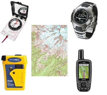
Navigation Tools Information Page
Maps:
MAPS - Hard Copy and Digital
Topographic maps are basically a 2-Dimensional rendering of a 3-D landscape, helping us to orient ourselves and navigate within that landscape. A map is part of the 10 essentials system, so every participant on a mountaineering trip should bring an appropriate one for their activity….but in my experience they often don’t, for a variety of reasons. The types and availability of maps is changing rapidly. The need to be able to read one is not. Pre-printed maps are still available from USGS, Green Trails, National Geographic, etc. But anymore, it's fairly easy to find digital versions online and print sections directly from your computer. Just be sure to include key elements like UTM grid lines, and the datum.
The best local source is the Mountaineers Bookstore, with a 20% members discount (it stays open late on Wednesdays). The required map is also online at USGS.GOV with the product number shown:
USGS Baring, 1:24,000, Version 1982 (1982 Revision of a 1965 map), Product Number 105315
If you download and print a USGS Map on your own plotter, be sure to select the older Baring 1965 map, not the new "2014 US Topo".
Compass:
For the Intro to Map and Compass class, we will loan you a Suunto MC2 USGS compass.
For the Wilderness Navigation Course, you'll need a compass that complies to the "Required Compass Features" document before attending the In-Person Workshop+Field Trip. Unfortunately you can't share a map or compass with a friend of family member during the course. Some local stores might run out of the model you want so it's recommended you buy a compass well in advance. Only specific compasses will be accepted, so before purchasing a compass make sure to read our compass requirements. Please note that the blue "Brunton O.S.S." compasses are not acceptable.
Read generic tips for purchasing a compass
GPS Device:
A device that uses the Global Positioning System (GPS) is an invaluable tool, but not a replacement for basic map and compass tools. And, the skills to use it are not the same as traditional map and compass skills, although there is some overlap. There are dedicated devices for backcountry use, and many smart phones can now be used in the backcountry with appropriate off-line apps. The offline capabilities are key as you move outside cellular data coverage. Battery life and the ability to recharge are also key considerations.
The Wilderness Navigation Course and the Intro to GPS and Trip Planning course teach using GaiaGPS, so you will need to have a smartphone with GaiaGPS installed.
Altimeters:
The availability of altimeters is also changing rapidly, but they are a very useful tool when navigating through variations in elevation. The elevation can help you see where you are on a slope, then use your compass to deduce a line of position from a terrain feature, and where the two lines intersect is your point position.
