Standing on the edge of the water in my camp sandals, boots and pants stowed safely inside my pack, I look longingly across the river. I wish I could teleport myself instead of wading through the bitterly-cold, swift-moving water. It’s June 2021, and the Pacific Northwest’s unseasonable heatwave is melting the snowpack, sending it rushing down the mountain river valleys in record volume.
When I take my first step, my toes cry out. I know a steady pace is the best way to cross, and I do my best to block out the pain as I wade deeper and deeper into the river. The river is maybe 30 feet across, but I can’t see the bottom. The water gets deeper, first chilling my kneecaps, then the bottom of my merino wool boxer-briefs.
“Damnit, this is my only pair of underwear!” I think to myself, knowing this is just the second day in a 5-day trip into the Olympics.
I’m nearly halfway across the river when the water jumps above my belly button.
“Oh, hell no! Nope, nope, nope!” I say, this time out loud. I turn abruptly and head back toward the shore. This trip will have to wait. The water is too deep.
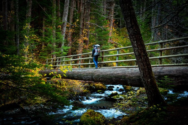 Nate in the Olympics in fall.
Welcome back to the Olympics
In the fall 2020 edition of Mountaineer magazine, I shared an article on my Olympic Mountain Project, a quest to climb 30 peaks in the Olympics. I designed the list based on which peaks I felt best highlighted the diversity of the range while covering the most ground. The project supported the goal I set as an Army Non-Commissioned Officer when I was first transferred to Joint Base Lewis-McChord: to spend more time in the mountains.
I’d completed 10 climbs at the time of publication, which coincided with the end of climbing season. Then Olympic National Park (ONP) closed in early 2020 due to the pandemic, and my project went on indefinite hold. Stuck indoors, I looked at ways I could make up for lost time. I poured over topographic maps, looking for ways to link ridgelines and valleys together. I wanted to have steady access to water, bail out points, and potential campsites mapped out. To move faster, I obsessively weighed and scrutinized my gear to lighten my pack as much as possible. I had 20 peaks to go, and I wanted to be ready.
Once ONP opened in July 2020, I hit the ground running.
My first mission took me to three mountain objectives over three days in the north: Moose Peak, high above the popular Grand Valley; McCartney Peak, towering over the now-extinct Lillian Glacier; and Mount Cameron, the crown jewel of the northern Olympics.
Starting at Obstruction Point with a friend, we quickly racked up miles, gaining the summit of Moose in just a few hours. Then the real work began. We left the trail and started our bushwhacking descent into the Lillian River valley. We found a safe river crossing and continued to bushwhack, this time uphill into the basin below McCartney. The progress was slow and frustrating. Finally, we gained enough elevation to make it above treeline to enjoy wonderful views of the high alpine meadows and ridgelines below the summit.
We found a great campsite near Lake Lillian, set up our tent, and began eyeing the summit for the final push of the day. Despite my body’s objections, we weren’t done yet. I could’ve sat in silence by the lake all evening, enjoying being back in a place that always feels like home; especially on a day when I was feeling particularly gassed. But mountains don’t climb themselves, so off we went, ascending the snow finger leading to the rocky summit pinnacle 1,500 feet above. Atop McCartney, number 12, I could not wait to get back to camp for a well-earned night’s rest.
That was the plan anyway.
Arriving safely at camp, we set about to the usual camp chores. I grabbed our food bags and bear hang kit for safekeeping overnight. I tossed the rock bag attached to the bear line into some branches, and it promptly got stuck. I tugged gently to loosen the line, but it wouldn’t budge. Clearly needing more force, I pulled harder. The line released suddenly, and that little bag filled with rocks came hurtling toward my face.
WHACK!! I saw stars, and not from the gorgeous night sky.
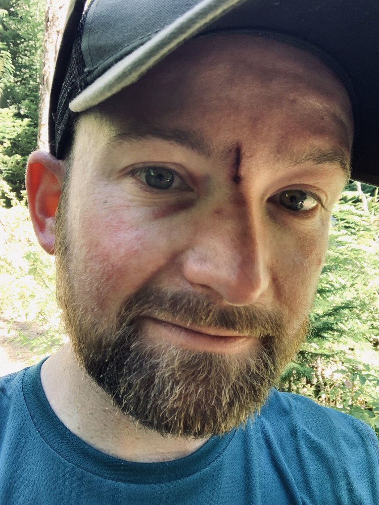
Blood started pouring from my face. I immediately applied pressure and ran back to the tent to grab my first aid kit. Thanks to a lot of pressure (and some Tylenol), the bleeding eventually subsided, and we were able to look at the damage. I had a deep cut, about an inch and a half long, right in between my eyebrows. I’m lucky – an inch to the left or right would’ve been truly awful. We resolved to check in the morning and make the call on whether to return to the car or continue onward. I hold the dubious honor of multiple head injuries from my deployments to Iraq and Afghanistan, so pushing through the pain is at least familiar territory.
Onward and upward
I awoke to a dull ache and minor swelling, and we made the decision to continue toward Mount Cameron. After spending most of the day traversing a ridgeline, we made it to the base of Cameron. We began our usual routine of setting camp while eyeing our objective, before beginning the summit push in the evening. True to form, several hours later we stood on stunning number 13, looking across the valleys to Mount Deception, Sentinel Peak, and Mount Olympus, and down at the incredible and aptly-named Thousand Acre Meadow. We scrambled down the rocky ridge to camp in the fading light.
On the morning of the third day, my head injury decided to punish me for previous decisions. I woke to a thumping headache, which only increased when I looked at the map to see what stood between us and the car: three mountain passes to climb up, over, and down. This was going to be rough.
The hike back to the car took its toll, and by the time I struggle-bussed up the final mountain pass, I was physically and mentally spent. The combination of 32+ miles of mostly off-trail travel, 12,000 feet of elevation gain, and a head injury (not to mention a low level of physical activity the previous four months) all crashed over me like a tsunami. But we’d done it.
Game on.
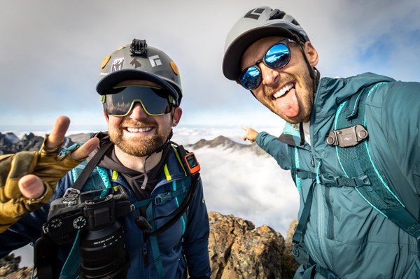
Nate and Collin on the summit of Mount Deception. Photo by Collin Blunk (@thewildoutsiders).
Winter is coming
With the late start to the 2020 climbing season, I had only a few months until winter arrived. I began knocking out as many summits as I could. After the three-peak start, I climbed Mount Deception, the second-highest peak in the Olympics. Then in early September, I successfully climbed Mount Stone, high above the Lake of the Angels. I squeezed in one last summit with North Petunia Peak, number 16, before the heavy snows blanketed the mountains.
When I began the project in the summer of 2019, I originally envisioned 10 peaks each year to finish in three years. If I wanted to complete the project in that same timeframe, I’d have to go back to the drawing board.
I used the winter months to plan and take care of all the behind-the-scenes logistics that often go overlooked. Things like purchasing backcountry permits, coordinating with climbing partners, gear maintenance, etc. But I didn’t spend the whole winter thinking about the mountains; I also strapped on my alpine touring skis and went into them.
Thanks to my skis, I climbed peak number 17, Colonel Bob Peak, in the middle of winter. I also explored places I’d already been, like Mount Deception, North Petunia Peak, and Mount Stone. Getting to these places in winter is infinitely more work, and more dangerous, but with the proper equipment and training, seeing a popular place like the Royal Basin completely empty and filled with snow is absolutely stunning.
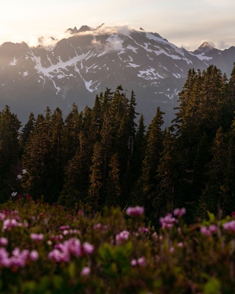 Mount Olympus seen from the Skyline Trail.
Pushing forward
In May 2021, the forest valleys had mostly thawed and it was time to go for the remaining 13 peaks. I planned to reduce the number of individual trips needed to save time and overall effort. Four of the peaks needed to be completed individually due to their location and difficulty, which left eight peaks that could be completed four-at-a-time, in two very long trips. My plan was certainly ambitious, but felt doable… assuming weather, conditions, and climbing partner availability all aligned.
I got to work right away, knocking out several big peaks in quick order. Mount Constance was the first up, where the theme of that climb is just yelling “rock!” repeatedly. A few weeks later, I attempted to complete the Skyline Traverse, but was forced to turn around due to the aforementioned dangerous river ford. Instead, I changed plans and summited Mount Anderson, which required 40 miles of travel for one peak. For the Fourth of July weekend, I had my eye on the crown jewel and namesake of the Olympic range: Mount Olympus.
I first climbed Olympus in 2016, the year I took the Basic Climbing Course, and that trip helped me fall in love with the range. This climb has no shortcuts. Mount Olympus makes you earn the summit with over 40 miles of hiking, glacier travel, and rock climbing up the summit pinnacle. Even so, it might be my favorite climb in the entire state, one I am always happy to return to.
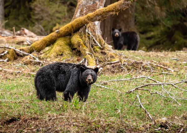 Two black bears in the Enchanted Valley.
The race to the finish
With 21 peaks completed by August 2021, I still had the toughest part ahead. I would attempt the remaining nine summits in just three trips: four peaks in a loop totaling over 60 miles, including the Skyline Traverse; a loop of the Bailey Traverse for another four peaks in 42 miles; and the final summit: Mount Steel.
I thought the last crux would be the effort needed to complete the two huge pushes. In reality, finding climbing partners proved most difficult. My usual partners either didn’t have the vacation time or just weren’t interested in a 5-day, 60 mile suffer-fest through the Olympics (understandably so). With the pressure of scheduled time off, and the end of climbing season looming, I made the decision to do the two big trips solo.
Before the Skyline Traverse, the most time I had spent alone in the wilderness was two days.
With a detailed itinerary at home and with the Olympic Park Rangers, and armed with a satellite communicator with an SOS button, bear spray, and many podcasts downloaded onto my phone, I headed out for the Skyline Traverse. I would be lying if I said I didn’t get bored or lonely over the five days, but I did enjoy the wonderful stillness and soul-cleansing of being alone with my thoughts. I questioned my sanity on more than one occasion (one particularly desperate evening I carried on a full conversation with a chatty Douglas Squirrel), but when I finally walked out of the wilderness, I had summits of Kimta Peak, Mount Zindorf, Mount Seattle, and Mount Christie under my belt.
I spent a week recovering, then geared back up for my second solo adventure to the Bailey Range. I had originally planned the Bailey as a thru-hike loop, starting in one location and finishing in a different one. As I was solo this was no longer an option. It became an out and back, increasing the distance from 42 to 50 miles.
I departed with sunny August weather, warm temperatures, and a solid week of good-looking weather. But as we all know, the mountains make their own weather, and this phrase goes double for the Olympics. Day one would be the only sunny, warm day of the trip. The first night at camp below Cat Peak, a wave of clouds rolled in from the west, bringing rain, wind, and cold temperatures. I wore every piece of clothing I packed for most of the trip. Thankfully, route finding was never much of an issue, even in whiteout conditions. Because I was so cold, and there were no views most of the time, I moved much faster than normal. As an unexpected silver-lining, I completed the trip in just four days instead of five. As a solo hiker who grossly under-packed for the conditions (my ultralight 40-degree quilt would have been fine if the weather forecast had been accurate), I welcomed the opportunity to hike a whopping 18 miles out on the fourth day. Less than ideal conditions aside, Bogachiel Peak, Cat Peak, Mount Carrie, and Mount Ferry were complete.
I was so spent after that trip that all I could muster on social media was six words: “29 peaks down, one to go.”
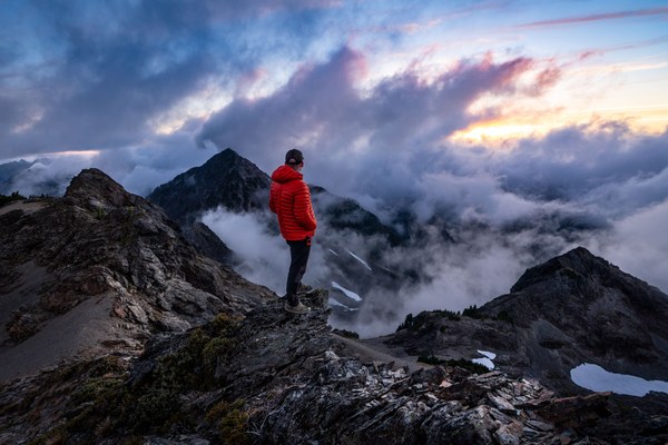 Nate on the final summit of the project, Mount Steel.
The Olympic send off
Mount Steel seemed simple in comparison to the 4-peak trips. Two days to cover 26 miles and 6,600 feet was easy on paper, but a huge part of me was bracing for impact. What if I didn’t make the summit? I had come so close, and having to turn around would be a huge morale crusher. With equal parts dread and excitement, a friend and I began our trek up the trail. After cruising up the trail, then bushwhacking, traversing, and clawing our way up steep talus, we arrived at the base of the summit pinnacle. A straight-forward class II scramble stood between us and the top, and finally it hit me.
After two years and five months, more than 500 miles, and over 160,000 feet of elevation gain, I was only a few hundred feet from completing my Olympic Mountain Project. I was vibrating with excitement.
I had planned to whoop a giant “whooohooo!” as soon as I reached the summit, but instead I stood there silently, unable to speak. A simple exclamation didn’t seem like enough; I wanted to hear the wind and let it speak for me.
We set up camp, having planned to sleep on the summit in our bivy sacks. The sunset created a spectacular show as we were enjoying dinner. Hearing my regret at not bringing a celebratory drink, my friend smiled and pulled two mini bottles of champagne from his pack. We cheered to the completion of my project and watched the sun go down.
In the early pre-dawn, I unzipped my bivy to find one of the most extraordinary scenes every mountaineer hopes for: the entire world below blanketed in an incredible cloud inversion layer. Only the peaks of the Olympics were visible, like massive mountaintop fortresses in a sea of clouds. I got out of my bivy and stood on the summit, eye-to-eye with each of the peaks I had climbed for my project. I could name each one without a map. On this quiet, final morning, it felt as though the peaks were standing in silent unison, giving me a final chance to behold them and reflect. One last morning where, for a moment, nothing else existed - just me and my Olympic Mountains.
This article originally appeared in our Spring 2022 issue of Mountaineer Magazine. To view the original article in magazine form and read more stories from our publication, visit our magazine archive.
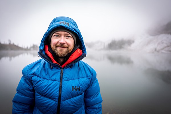
Lead image of Nate at Goat Lake below North Petunia Peak. All photos courtesy of Nate Brown.
Add a comment
Log in to add comments.Great story well-told. Thanks for sharing your adventure, Nate.
 Mountaineers Books
