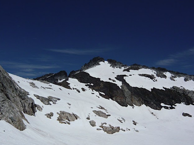
Little Devil Peak
Located on the western edge of the North Cascades near Marblemount, scrambling Little Devil Peak by way of Monogram Lake is over 14 miles round trip with approximately 7,000 feet of elevation gain.
Getting There
Drive the Cascade River road, 7 miles from SR-20 in Marblemount to the Lookout Mountain trailhead (1,200 ft).
approach & ascent
Hike the Lookout Mountain trail steeply uphill to reach a junction with a trail leading to Monogram Lake (2.8 mi, 4,100 ft). The trail heading west leads to the summit of Lookout Mountain, and the trail leading east leads to Monogram Lake. Follow the trail to Monogram Lake.
Cross to south side of Monogram Lake outlet stream. Scramble over Point 5009, then head in ~ESE direction to obtain crest of ridge trending southwest to northeast. Follow the boot path over Point 5685, then descend to saddle at 5,478 ft. Ascend rounded ridge NNW to ~6,150 ft (on descent a waypoint here is useful in hitting this ridge in whiteout conditions). Traverse northeast into the basin south of Little Devil Peak with a stagnant glacier.
Don crampons and head roughly north to cross the stagnant glacier being careful to avoid various slumps as well as small (and not so small) Moulins. Spotting these hazards is easiest in late summer or fall when snow has melted. After crossing onto rock, ascend ledges to the right until able to access other ledges leading up and to the left to reach the col at ~6,600 ft. Ascend the ridge to the east, then move a bit right up higher to reach a notch in the ridge trending SSE to NNW. From notch in ridge crest scramble a bit north to reach the summit.
- Suitable Activities: Scrambling
- Seasons: August, September, October
- Weather: View weather forecast
- Difficulty: Strenuous 5, Technical 3
- Length: 14.0 mi
- Elevation Gain: 7,000 ft
- 6,984 ft
- Land Manager: North Cascades National Park
- Parking Permit Required: Northwest Forest Pass
- Recommended Party Size: 12
- Maximum Party Size: 12
- Maximum Route/Place Capacity: 12
- Green Trails Marblemount No. 47
- USGS Big Devil Peak
There are no resources for this route/place. Log in and send us updates, images, or resources.
