In the peak of ski season, we asked the authors of our Backcountry Ski & Snowboard Routes guidebooks to spill the beans on their favorite routes. Following are their faves – out of the 100 or so tours in each of their books. Below is the beta and general route description as excerpted from each book.
BACKCOUNTRY SKI AND SNOWBOARD ROUTES: CALIFORNIA
By Jeremy Benson
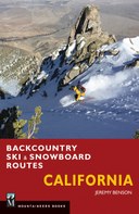
Jeremy: “I guess if I had to choose one I would go with Jakes Peak (this is broken into two routes in my book). Not only is Jakes close to my home and easily accessible, but there's a huge variety of terrain on numerous aspects and you can typically find good skiing here whether cold powder or spring snow is on the day's menu. The fact that Jakes Peak rises dramatically from the west shore of Lake Tahoe above Emerald Bay with incredible scenery in all directions helps take the ski experience to another level.”
Rt. 22 - Jakes Peak: Northeast Side
- Starting Point Pullout south of Lester Beach Road, 6850 feet
- High Point 9187 feet
- Distance 3 miles
- Elevation Gain 2300 feet
- Time 2 hours
- Difficulty Level Moderate
- Terrain Ratings 2–3
- Aspect Northeast-east
- Seasons Winter, spring
- Map USGS Emerald Bay
You’ve got to get up really early to beat the dawn patrollers to the northeast side of Jakes Peak on a powder day. The same handful of people put in this skin track virtually every time it snows. If you don’t like to hike in the dark, don’t worry: you’re guaranteed to have a track put in by the time you get there. The steep trees and open gullies that flank the northeast and east sides of Jakes Peak make this zone one of the most popular among backcountry skiers in the entire Lake Tahoe Basin. Named in honor of Jeffery James (Jake) Smith, a ski patroller who died in an avalanche at Alpine Meadows ski area in 1982, Jakes Peak is a Tahoe classic. Perched above D. L. Bliss State Park on Emerald Bay on Tahoe’s west shore and just inside the Desolation Wilderness, Jakes is also among the more beautiful places to ski in the world—not to be missed.
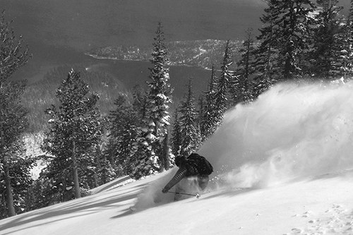
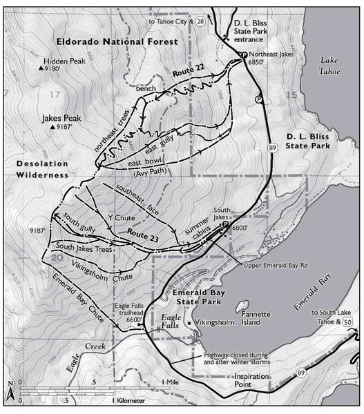 Photo: Fresh powder and great views on Jakes Peak
BACKCOUNTRY SKI AND SNOWBOARD ROUTES: COLORADO
By Brittany and Frank Konsella
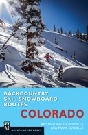
Brittany: “The Dead Squirrel is one of our most favorite routes for a few different reasons. First, the couloir is about aesthetic as they come. We noticed it years before from afar while skiing another peak in the area and it instantly got added to our list of places we needed to ski. Though it looks incredibly narrow from far away, the couloir is indeed plenty wide enough to ski and is not intimidatingly steep, consistently in the upper end of the 30-degree range. Second, naming it was fun. When we skied this line, there was no known name for the couloir. Some friends of ours had skied it a year before us and told us that they were joined on their descent by a frozen squirrel which proceeded to somersault down the mountain with them as they continued to ski. Hence, the name Dead Squirrel."
Rt. 85 - Unnamed 13,299: Dead Squirrel Couloir
- Starting Elevation 9600 feet
- High Point 13,299
- Vertical Gain/Loss 3680 feet
- Ascent Distance 4.8 miles
- Descent Distance 3.2 miles
- Time 6 to 8 hours
- Ski Skills Difficult
- Fitness Level Strenuous
- Technical Skills Moderate
- Gear The basics, plus ice axe and crampons
- Best Months March to early May
- USGS Map Redcloud Peak
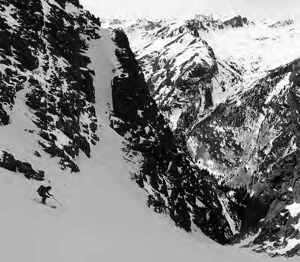
The Lake City zone of the San Juans may not get a lot of snow or a lot of press, but the hidden couloirs in this area are some of the best you can find. Nearly 3000 feet from top to bottom, the Dead Squirrel Couloir is an absolute gem in a remote setting.
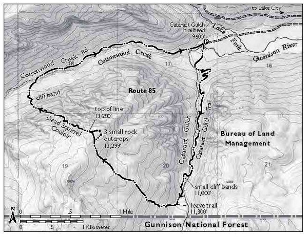 Photo: This skier has a long, long way to go to reach the bottom of the Dead Squirrel Couloir.
BACKCOUNTRY SKI AND SNOWBOARD ROUTES: OREGON
By Christopher Van Tilburg
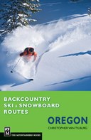
Christopher: “The Mount Hood Circumnavigation is one of the few ski mountaineering routes in Oregon that’s not a summit climb. The skiing can be excellent, the views are unparalleled, and the experience of skiing around the volcano is magical, because you enter terrain seldom seen and wildly punctuated by crags, seracs, glaciers, and open snowfields.”
Rt. 13 - Mount Hood Circumnavigation
- Start Point Timberline lodge, 6000 feet
- High Point 9000 feet, multiple glaciers
- Trail Distance 12 miles
- Trail Time 1 day
- Skill Level Expert
- Best Season Spring
- Maps USGS Mount Hood South, Mount Hood North
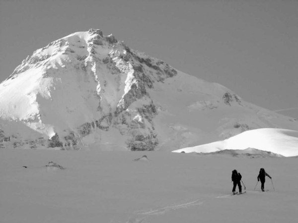 The Mount Hood Circumnavigation is an expert ski mountaineering objective. The 12-mile trip, which gains 6000 to 8000 feet, is for expert mountaineers only. Although not completed by this author, it’s worth mentioning as an excellent way to get to know the mountain and, sooner or later, a route the ski mountaineers either complete or at least have on their tick list. More burly and dangerous than the South Side summit routes (see Routes 6 and 7), this takes more planning, preparation, and guidance than listed here.
There are several starting points, but a round trip from Timberline Lodge is the most common. Most skiers head clockwise and stick between the 6000- and 9000-foot elevations.
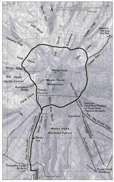 Photo: High pressure clarity in the high alpine
BACKCOUNTRY SKI AND SNOWBOARD ROUTES: UTAH
By Jared Hargrave
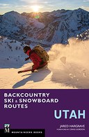
Jared: “Bonkers - When conditions align perfectly, the powder is soft, and the snowpack is stable, you would be hard-pressed to find a more fun descent than Bonkers in Big Cottonwood Canyon. I love this route because Bonkers is 2,000 vertical feet of perfect fall-line on a wide-open ramp."
Rt. 8 - Bonkers
- Start Point Broads Fork trailhead, 6200 feet
- High Point Broads Fork–Stairs Gulch Saddle, 10,200 feet
- Trail Distance 8 miles
- Trail Time 6 hours
- Skill Level Advanced/Expert
- Best Season Winter
- Maps USGS Mount Aire, Dromedary Peak; Wasatch Backcountry Skiing; Alpentech Wasatch Touring 1
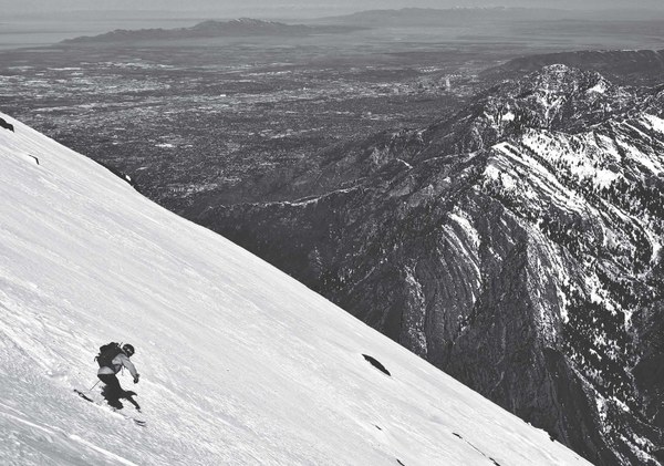 Bonkers, a massive ski line in upper Broads Fork, absolutely belongs on the list of classic descents in the Wasatch. A steep 4000-foot climb in four miles gets you to the top, where you’ll be rewarded with a nearly 2000-foot descent on a wide-open, northeast-facing ramp. The run is so long you can feasibly make a hundred turns from top to bottom. Just try to ski this thigh-burner without stopping. The saddle atop Bonkers also allows easy access into the expert-only Stairs Gulch, an enormous, glacier-carved gully that drops 5000 feet to the highway below. Both runs are pretty much snow-covered rock slabs, making for unusual avalanche danger (think glide cracks). Ski here only when the snowpack is highly stable.
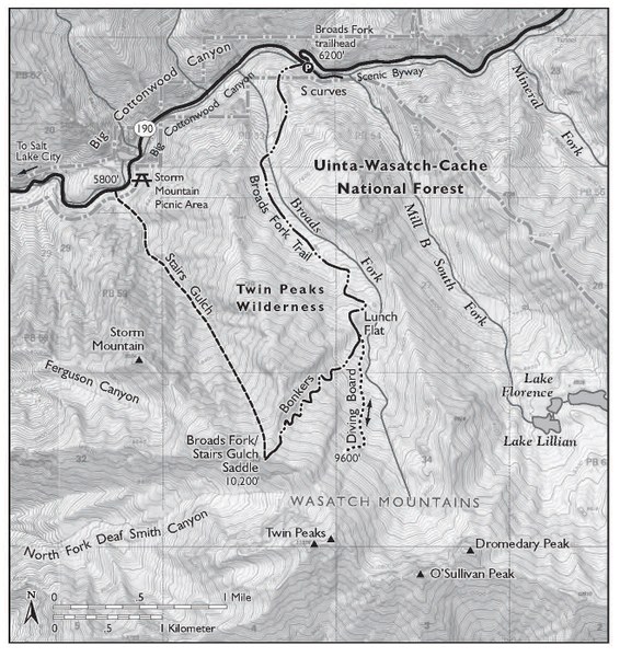 Photo: Salt Lake City buzzes in the valley far below the upper slopes of Broads Fork.
BACKCOUNTRY SKI AND SNOWBOARD ROUTES: WASHINGTON
By Martin Volken and the guides of Pro guiding service
Martin: “For me, that favorite would be the Forbidden Tour. The Forbidden Tour epitomizes the savage nature of ski mountaineering in the North Cascades and is surprisingly accessible for how remote it is."
Rt. 27 - The Forbidden Tour
- Starting Elevation 3100 feet (2400 feet if road is closed)
- High Point 8868 feet
- Vertical Gain/loss 10,315 feet/11,234 feet
- Distance 36 km (19 miles)
- Time 3–4 days
- Overall Difficulty Very difficult
- Ski Skills Difficult
- Fitness Level Very strenuous
- Technical Skills Very high
- Commitment Very high
- Gear: The basics, plus ski mountaineering and overnight equipment
- Best Season April–May
- USGS Maps Cascade Pass, Forbidden Peak, and Eldorado Peak
- Permits A free backcountry permit is required to stay overnight in North Cascades National Park and can be obtained at the Wilderness Information Center in Marblemount. A parking pass is not required anywhere along the Cascade River Road.
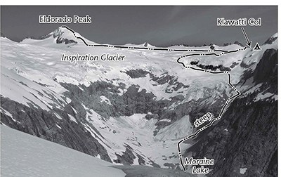 The Forbidden Tour epitomizes what makes the North Cascades a great skiing range. This tour crosses seven glaciers of substantial size and drops deep into Washington wilderness. You will find yourself touring, skiing, and camping in some of the most alpine environs of the Lower 48 on what is essentially a circumnavigation of Forbidden Peak. The tour’s commitment level increases substantially once you drop onto the Boston Glacier. All things considered, the Forbidden Tour is a real ski mountaineering adventure that requires skill and commitment.
 Mountaineers Books
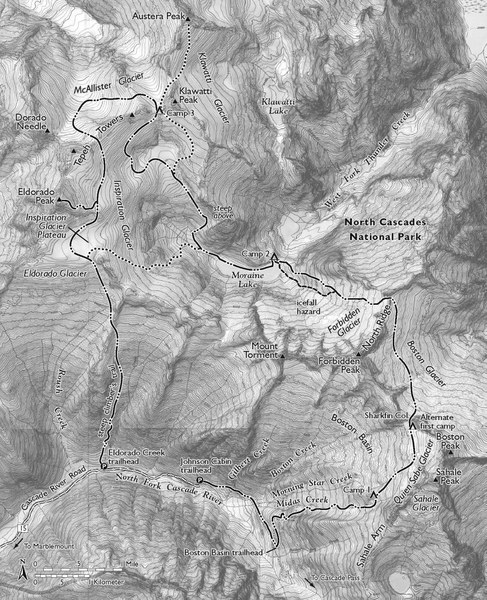 Photo: Inspiration Glacier from the south (photo by Andy Dappen)