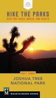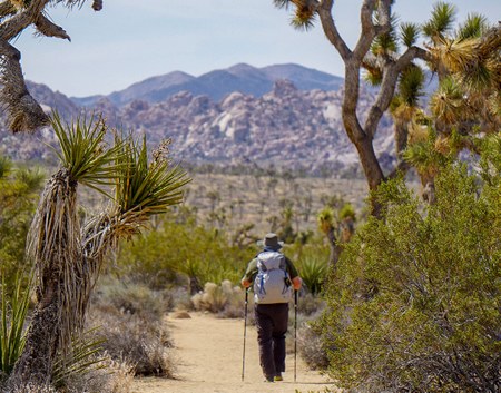
Featuring stunning, easy hikes to explore three distinct regions of Joshua Tree National Park (Lost Horse Valley, Queen Valley, and Pinto Basin), the following is excerpted from Scott Turner's Hike the Parks: Joshua Tree National Park. Excerpt edited for space and clarity.
Lost Horse Valley
When most people think of Joshua Tree, Lost Horse Valley, with its Joshua tree forests and towering granite formations, is the first place that comes to mind. Lost Horse Valley runs roughly north to south from the southern reaches of the Wonderland of Rocks to the windswept ridges along Lost Horse Mountain, and between the lofty heights of Quail Mountain in the west and Ryan Mountain on the east. Many of the park’s most popular destinations and hiking trails lie within the confines of the valley, and accordingly, most of its human activity occurs here as well.
In addition to containing many prime hiking destinations, Lost Horse Valley is also the epicenter of rock climbing in Joshua Tree. At any given boulder pile, in areas like Hemingway, Hidden Valley, Hall of Horrors, and the Oyster Bar, you will undoubtedly see climbers testing their skills and mettle on world-famous routes.
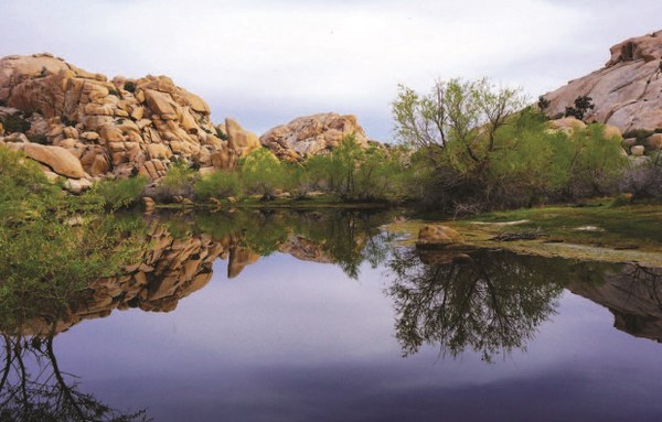
Barker Dam (Hike 13 in HIKE THE PARKS: JOSHUA TREE NATIONAL PARK)
- Distance: 1.3 miles (2.1 km)
- Elevation gain: 115 feet (35 m)
- High point: 4295 feet (1310 m)
- Difficulty: Easy
- Trail surface: Hard-packed sand
- Map: USGS 7.5-minute Indian Cove
- GPS: 34.024282º N, -116.141971º W
- Notes: Day use only; good for kids; pit toilets at trailhead; historical interest
This quintessential Joshua Tree experience focuses on one of the rarest spectacles the park can offer: a standing body of water. For decades, the Barker Dam has captured runoff coursing through the Wonderland of Rocks within a wide basin. The reservoir often dries up during the summer, but even a modest amount of water creates a beautiful scene with granite rock piles reflected in its still surface. Although the reservoir once hydrated thirsty cattle, today it is a vital water source for the Wonderland’s resident herd of bighorn sheep.
Queen Valley
Travel east from Lost Horse Valley and cross Sheep Pass, and you’ll enter a second, larger valley known as Queen Valley. Queen Valley runs from its northern boundary at Queen Mountain south to the highlands of the Little San Bernardinos. The valley is bound on the west by Ryan and Lost Horse Mountains and to the east by the Hexie Mountains. Like Lost Horse Valley, Queen Valley also contains thriving Joshua tree forests, and its margins are lined by monzogranite boulder piles that feature some of the park’s most popular hiking. Park Boulevard divides the northern third of the valley from the southern two-thirds, and the progressively bumpy dirt Geology Tour Road provides access to the southern reaches of the valley.
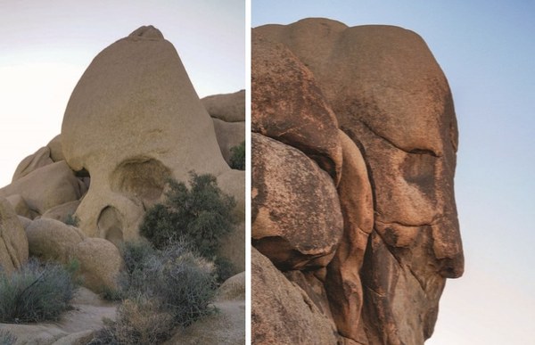 Skull Rock (left) and Face Rock (right)
Skull Rock Nature Trail (Hike 26)
- Distance: 1.7 miles (2.7 km)
- Elevation gain: 230 feet (70 m)
- High point: 4369 feet (1332 m)
- Difficulty: Easy
- Trail surface: Mostly dirt with one long stretch following the road through Jumbo Rocks Campground
- Maps: USGS 7.5-minute Queen Mountain, Malapai Hill
- GPS: 33.997908º N, -116.060084º W
- Notes: Day use only; interpretive trail; good for kids; pit toilets available within the campground
The Jumbo Rocks area features several popular anthropomorphic rock formations that fuel plenty of fascination and curiosity, but none do so quite as well as Skull Rock. The north face of this large oval boulder has cavities in all the right places and thus resembles a rather creepy-looking skull. The nature trail that begins and ends at the skull visits several other formations that, while not as instantly recognizable, are still among some of the most beautiful in the park.
Pinto Basin
The illusion of Joshua Tree as a benign playground full of boulder piles and Seussian trees melts away under the searing desert sun the moment you pass through the transition zone between the Mojave and Colorado Deserts. Here in the low desert, the boulder piles and Joshua trees vanish. In their place, you will find a more wicked assortment of cholla, ocotillo, and jagged ridges and hillsides riddled with a bewildering variety of rock types.
If this prospect makes you want to turn around and head straight back to Lost Horse Valley, look more closely. The low desert may not have the star power of the Wonderland of Rocks, but it provides a deep, varied, and forceful array of experiences all its own.
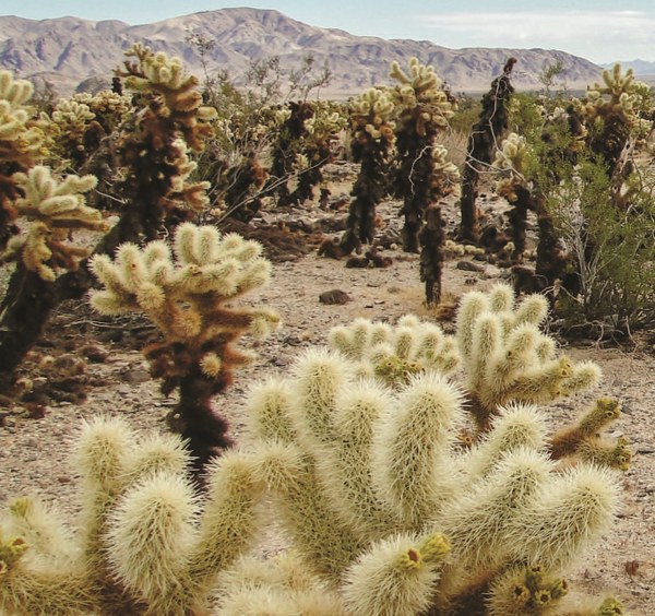
Cholla Cactus Garden (Hike 34)
- Distance: 0.3 mile (0.5 km)
- Elevation gain: Negligible
- High point: 2202 feet (671 m)
- Difficulty: Easy
- Trail surface: Dirt
- Map: USGS 7.5-minute Fried Liver Wash
- GPS: 33.925536º N, -115.928895º W
- Notes: Day use only; interpretive trail; no restroom at trailhead
One of botanists’ crueler jokes was the nicknaming of the most sinister plant in California after something that everybody loves to hug. This short nature loop explores a large patch of teddy bear cholla (a.k.a. jumping cholla) in a macabre hiking version of the children’s game “don’t touch the lava,” with cactus spines replacing the lava. With an introduction like that, you might wonder why you’d bother wandering through a patch of plants that would love to make you hurt.
Stop by on a cool early morning as the rising desert sun illuminates each vindictive needle in a warm glow. At times like that, you’ll forgive this teddy bear for its cruelty—unless you’re careless enough to make a closer acquaintance.
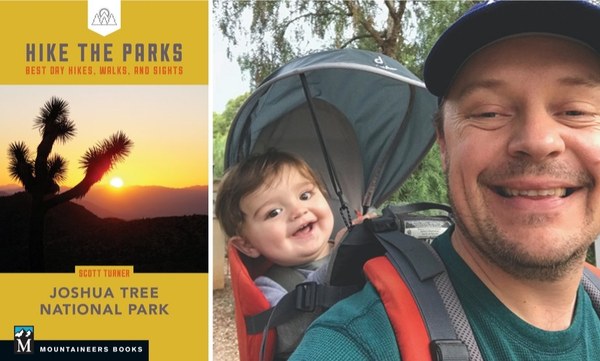 Find more information, including maps and turn-by-turn directions for 38 remarkable trails, in Hike the Parks: Joshua Tree National Park, and follow Scott Turner on Instagram @scottturnerhikes.
For more national park adventures, check out the rest of our Hike the Parks series.
 Mountaineers Books
