Seattle Wilderness Navigation Leader & Instructor Information
COURSE PAGE
Review the course description itself for information about how it's structured, required activities for students, and primary learning goals. Register as an instructor in the main course page, then register for the activities that you would like to instruct.
INSTRUCTOR TRAINING
Each year, we hold instructor training sessions for the field trip. They are "site-specific", relative to the location of the field trip. Thus, attending a training will not only help you hone your skills, but become familiar with the particulars of the location. These are highly recommended.
- Search for Instructor Training sessions for Wilderness Navigation
- NOTE: If the above search does not produce any results, try this all courses search: Search for the Seattle Wilderness Navigation Courses
Review the ONLINE MAP AND COMPASS COURSE
If you wish to review the Online Map and Compass course, please contact the Seattle Navigation Chairs to get a login to the learning management system. You need to be registered as an instructor in the current Seattle Wilderness Navigation Course(s)
Already (or interested in) instructing a online Map and Compass course? Read the following FAQ: ELearning FAQ and Tips for Leaders and Instructors
set up your own gaia gps
As an instructor, follow the instructor version of the guide. There are links directly to the GPX files for those that are confident in setting up their devices. The workshop GPX file is the same for both students and instructors. The field trip GPX file is different between instructors and students, so be sure to use the instructor field trip GPX file. You will also need to download to your smartphone a map of the field trip for offline use (see the setup guide for details).
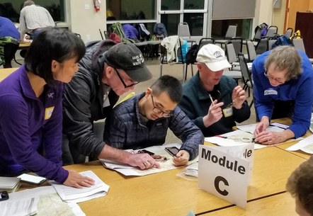
Review the in-person workshop material
Reviewing the instructor version of the workshop packet will prepare you to instruct at the In-Person Workshop.
Review the field trip material
Review the instructor version of the field trip packet.
Best Practices for Instructors
As volunteers, we're not trained instructors, but we do have skills to share. Certain practices have found to be helpful:
- If you are a small group leader, get your assistant instructors involved early and often. Let each of them take the lead on topics. Identify and recruit those assistants that you feel could lead a small group. If you are an assistant instructor and would like to become a small group leader, just let us know - we are always in need of small group leaders.
- First time instructors are seen as "assistant" instructors, and usually will be paired with an experienced instructor. This way, you get to help where you can while you "learn the ropes" of what and how we teach.
- Be supportive to students. Be a guide and a mentor.
- It's usually more important to "grasp the concept" than it is to "get the perfect right answer." For example, the "best route" question can have a variety of answers.
- Have questions? Grab a senior instructor or committee member.
- Identify Yourself -- We use name badges and/or colored tape to identify us as instructors.
- Watch the schedule. Gently nudge students forward when they're getting behind.
- There are lots of opinions and biases out there. Which tools? Which GPS? Which Apps? Which technique? Don't get too deeply into those. These come up quite often:
- UTM vs Latitude/Longitude -- UTM is more appropriate for terrestrial navigators on foot within relatively small areas (a typical map quadrangle at a scale of 1:24000). People can visualize distances in meters more easily than minutes/seconds. Lat/Long is introduced but is more appropriate for navigating much larger areas (ie an ocean).
- DATUMS & PAPER MAPS (NAD27 vs NAD83/WGS84) - At the workshop, we study with a USGS formatted map (NAD27 Datum). For the field trip we use Caltopo maps in WGS84, which are distributed at the trailhead.
- True, Grid, and Magnetic North -- We use UTM easting lines (not meridian lines) to establish the north reference line when the compass is on the map. We feel the grid declination error for our location as falling within acceptable tolerances with the caveat that we are practicing good dead reckoning skills, thereby negating the error.
- GAIA GPS vs. OTHER APPS vs. Dedicated Devices -- Gaia is our standard. It is a full-featured app and the Board obtained a pro-deal so members can get a GPS tool without additional cost, at least for one year. We don't recommend Gaia over other devices or apps, but it helps us teach the basic concepts of GPS. Students can transfer those same concepts to other devices and apps if they wish.
- "Do you really need a map and compass anymore?". Yes, you do. The Ethic of Self-Reliance is the overarching tenet that Situational Awareness and mastery of your instrumentation reside within. Dependency on ANY singular device means that you are operating within a Single Point Of Failure system, which does not honor the Ethic of Self-Reliance. GROUP-RELIANCE IS NOT SELF-RELIANCE.
- NEED MORE HELP?
Contact the Seattle Navigation Training Group
