Trip
Backpack - Ingalls Creek
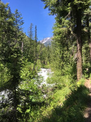
Easy family friendly 2.25 mile backpack along Ingalls Creek to a lovely large camp with a small shallow swimming hole and large talus field to explore. Priority registration to families enrolled in Backpacking with Kids 2023 course. On June 30, any adult with child may register (with leader permission) for any remaining spaces.
- Sat, Jul 22, 2023 — Sun, Jul 23, 2023
- Foothills Backpacking Committee
- Backpacking, Family
- Families
- Easy, Easy/Moderate
- Easy
- Mileage: 5.0 mi
- Elevation Gain: 800 ft
- High Point Elevation: 2,700 ft
- Pace: Kid pace
- 1 (11 capacity)
- Cancellation & Refund Policy
Meet at Ingalls Creek trailhead on Saturday, July 22 at 10:30 am.
Directions (Approximately 2hr 10 min drive from Seattle) GoogleMap
I-90 E to WA-970 (Exit 85). Take Highway 970 east for 7 miles to Highway 97. Go north topping Blewett Pass. At milepost 178, turn left onto Ingalls Creek Road. Cross Peshastin Creek, bear left. The trailhead is at the road's end.
Northwest Forest Pass required.
Gentle 2.25 mile backpack along Ingalls Creek with likely wildflowers in bloom. Relaxed afternoon water play (shallow swimming hole) and talus exploration. CalTopo map.
See detailed trip sheet for additional information.
Ingalls Creek
-
Green Trails Mt Stuart No. 209
Green Trails Alpine Lakes East (Stuart Range) No. 208SX
USGS Mount Stuart
Green Trails Liberty No. 210
USGS Liberty - See full route/place details.
Required Equipment
The Ten Essentials plus overnight gear. See detailed list in trip sheet.
