Trip Report
Mount Henderson/Southwest Ridge
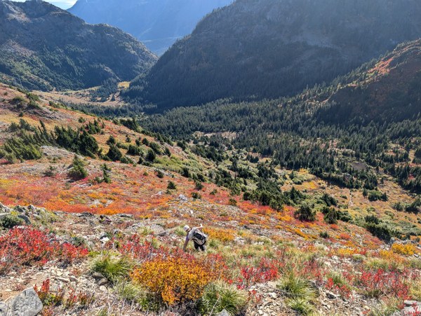
A group of 4 experienced climbers took the North Fork Skokomish trail to the Black & White Lakes way trail, then we went cross-kntry from B&W up steep heather slopes, through bushwhacks and a couple gendarme-hugging rock scrambles (2nd-3rd class) to the ridge that ascends Mount Gladys (where we saw a mama and baby bear below).
- Sat, Oct 12, 2024 — Sun, Oct 13, 2024
- Mount Henderson/Southwest Ridge
- Scrambling
- Successful
- Road suitable for all vehicles
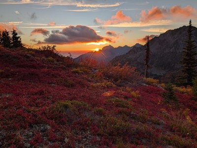
A group of 4 experienced climbers took the North Fork Skokomish trail to the Black & White Lakes way trail, then we went cross-kntry from B&W up steep heather slopes, through bushwhacks and a couple gendarme-hugging rock scrambles (2nd-3rd class) to the ridge that ascends Mount Gladys (where we saw a mama and baby bear below). The last of the blueberries, huckleberries and salal were delicious, but some were soft, and some were fermenting. We saw scat that suggested serious salal consumption (bear trots). The air smelled like berry pie the first day, though we could smell the rot on the second day. The hills were red, gold, orange and yellow - breathtaking!
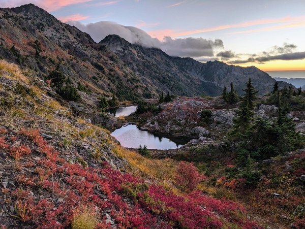
Instead of going straight to Gladys, we went partway across the ridge (heading south) and worked our way down a series of talus slopes, ledges and gullies/drainages to Murdock Lakes, where we camped at the far end of the lakes. Almost no one goes there, so let's keep it as pristine as possible, please!.
Our climbing objective, Mt. Henderson, is not a big climbing objective or an impressive summit, so I don't foresee a bunch of peakbaggers suddenly descending on this fragile area, but if you do go, please follow leave no trace principles!
Before sunset we hiked up to the ridge, faced due west and looked for the comet, but the cloud bank at the horizon skunked us. After a wonderful night's sleep, we went for the peak at sunrise.
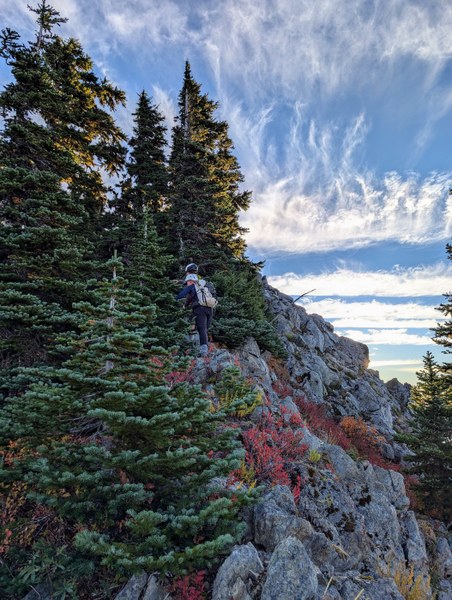
We found a bench with 2.5 unnamed tarns about 100ft above the Murdocks and hiked up the slope from there toward Henderson. The side slope looked cliffy, so we went toward the top and did more gendarme hugging, tree belaying and bushwhacking, back and forth on the left and right sides of the ridgeline. The handholds and footholds were good, though it was a "you fall, you die" cliff-below situation. At the transition between the lower and upper ridge, you punch out of a bushwhack on the left side of the ridge and there's a meadow where you can catch your breath, snack and scope the route up. I took a middle route up a scree slope to a trailish-looking thing and over the top to catch the left/north side of the upper ridge. I worked my way around more gendarmes and trees, where a fall would have been fatal, but the footwork and handwork felt easier than the lower ridge. My friends took a steep treed gully up on the south side and said it was slippery with exposure, but good trees to hold. We met about 300ft from the summit, which was like a 10yr old's birthday party. Wide benches, meadows and up to a treed summit with no markers or registries. We sat facing Skokomish, which we'd all climbed in the past, but which looked super imposing from this angle, had a snack and headed down.
On the descent, we stayed on the north side of the upper ridge, but crossed over earlier than my ascent route and took a scree slope back to the meadow. From the top of the lower ridge we decided to sidehill below the cliff bands on what was now climber's left of the ridgeline. One of our party went all the way down to a basin and then climbed back up 700ft to the 2 tarns/landmark. This made it tricky for the side-hillers because of potential for rockfall, but we made it work. We got back to the tarns and had a nice walk to the Murdock lakes.
For all that it felt like hours gripping those rocks and trees and trying not to slide out on scree and sidehill veg, we left camp at 7 and were back at camp by 11, having covered about 3mi and 1200ft of pretty technical scrambling.
We trended left up some ledges and talus from Murdock to the ridgeline for Gladys. We topped out on Mount Gladys' treed summit and descended to the Gladys Divide on a solid way trail. The Gladys Divide trail down to Flapjacks felt long, but the fall colors were stunning. We used the new privy at Flapjacks and then trudged the 7+mi and 4000ft down to the TH, exhausted


 Meryl Lassen