Trip Report
Inspiration Traverse
Crossed through some North Cascades high country, climbing peaks along the way.
- Thu, Jul 23, 2020 — Sun, Jul 26, 2020
- Inspiration-McAllister-Klawatti Ice Cap Traverse
- Climbing
- Successful
- Road suitable for all vehicles
-
- The bridge across Thunder Creek at the former McAllister Hiker Camp washed out 2017. Crossing now requires walking a series of logs, as described in the Primus Peak/Borealis Glacier approach except that the second channel is down to one log.
- The glacier conditions were excellent with lots of snow coverage and easily navigable crevasses.
- The final pitch of Dorado Needle used to end with a short fourth-class scramble over a nine foot tall block with a big vertical crack. About a year ago a piece of the block fell off and now requires some fifth-class moves to go over or around.
- We reinforced one rappel station on Austera Peak and three rappel stations on Klawatti Peak. The rappel stations on Dorado Needle were in good shape.
- The current way across the North Fork Cascade River near the Eldorado trailhead is a series of logs slightly downstream from the previous log. It's easy to see from the road side of the river; coming down from the trail may take a little bushwhacking.
Over four days we traveled from the Thunder Creek trailhead on the North Cascades Highway (SR 20) to the Eldorado trailhead on Cascade River Road. Along the way we climbed Tricouni Peak, Primus Peak, Austera Peak, Klawatti Peak, and Dorado Needle. We traversed the Borealis, North Klawatti, Klawatti, McAllister, Inspiration, and Eldorado glaciers.
Day 1 - Thursday. Thunder Creek Trail - Borealis Ridge
In the morning our party of four got a permit at the ranger station in Marblemount, staged a car at the Eldorado trailhead, and drove to the Thunder Creek trailhead at the back of the Colonial Creek campground.
The first six trail miles gained a gentle 700 feet. After we crossed Thunder Creek came the business: the faint climbers trail up to the lake below the Borealis glacier gained 4,000 feet in two miles accompanied by swarms of mosquitos. Brutal. We set up camp on a rock moraine above the lake around 6:30 p.m. and enjoyed the views.
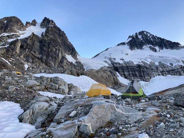
Day 2 - Friday. Tricouni Peak - Primus Peak - Austera Peak
Despite a forecast for good weather, we woke to swirling clouds that would come and go all day. We climbed up the west side of the Borealis glacier and traversed around to Lucky Pass (Primus-Tricouni col). We left our packs at the pass and picked our way up Tricouni, which was steep but not difficult.We arrived at the summit around 8:30 a.m.
After we retraced our steps to the pass, we reshouldered our packs and headed up the broad west ridge of Primus. After a long slog up loose talus we arrived on the large, flat summit around noon. There was not much to see other than clouds so we soon headed down in a southerly direction, making our way down to the North Klawatti glacier, almost directly north of Austera Peak.
Unfortunately, Austera Peak is climbed from the south, and the eastern arm of the Austera Towers divides the Klawatti and North Klawatti glaciers. So we headed east down the North Klawatti glacier, rounded the tip of the Austera Towers, and headed back west up the Klawatti glacier. It was a long, slow slog.
The climb up Austera Peak is a remarkably short scramble, although it is exposed fourth or low-fifth class in spots.
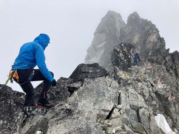
We summited around 5:30 p.m. As there were no views, summit register, or other inducements, we didn't linger. Two rappels and some scrambling brought us back to our packs. We set up camp on a nice snowfield a short distance away.
Day 3 - Saturday. Klawatti Peak/Southwest Buttress
We woke to crystal clear skies and amazing views everywhere. We headed south towards the Klawatti-Austera col that divides the Klawatti and McAllister glaciers.
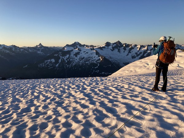
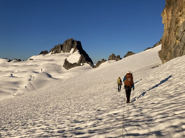
At the col we went to the far left and found a passage with some straightforward fourth class scrambling. Apparently this can be more difficult when the snow levels are lower. We continued south until we reached the southwest corner of Klawatti.
There appear to be several spots where the southwest buttress can be accessed. We picked one and headed up. We belayed the first two pitches, which were class five and four, and scrambled the rest. Although the climbing became easier, the rock quality was lousy and everything was loose.
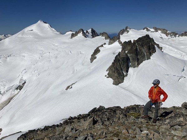
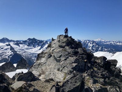
We arrived on the summit around 10:00 a.m. With clear skies and warm weather we spent some time soaking in the amazing views in every direction. The peakfinder app got a workout.
Eventually we gingerly made our way down until we spotted a rappel station. Three rappels brought us back down to the snow. We headed across the Inspiration glacier along the Tepeh Towers and set up camp at the pass where the Inspiration and McAllister glaciers meet.
Day 4 - Sunday. Dorado Needle/Northwest Ridge
After a starry starry night we headed over the Dorado Needle as the sky lightened and then glowed.
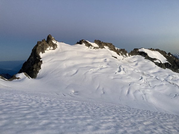
Arriving at the base of the climb, we could see that the snow over pitch one was falling apart. There were several large cracks running horizontally partway through the body of the snow; judging by the steps of earlier parties, one crack must have opened the previous day. We took a zigzag path around the cracks to the belay station for pitch two.
Two short pitches of rock took us past the cheval and we belayed a super-short final pitch to the summit. We arrived around 8:30 a.m. Since the summit area is tiny and we could hear other parties below, we quickly headed down. After three rappels and some down-climbing we started the long trek back to the car.
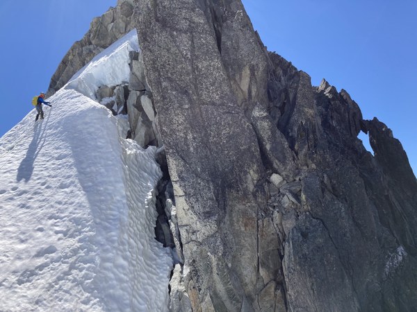
Gear: 60 m rope, small rack of cams to 2" and a half set of nuts, 3 pickets (used 2).
 Stephen Sugiyama