Trip Report
Backpack - Glacier Basin (Mount Rainier)
Leisurely trip into Glacier Basin with lots of marmots and an early taste of fall weather.
- Wed, Aug 21, 2024 — Thu, Aug 22, 2024
- Backpack - Glacier Basin (Mount Rainier)
- Glacier Basin (Mount Rainier)
- Backpacking
- Successful
-

- Road suitable for all vehicles
-
The route is in good shape, a gentle highway of a trail from White River camp all the way to Glacier Basin. The tread and drainage work is all top-notch. We also took the Emmons Moraine overlook trail on our way out - it is also in good shape, with just a hint of erosion/exposure after crossing the river.
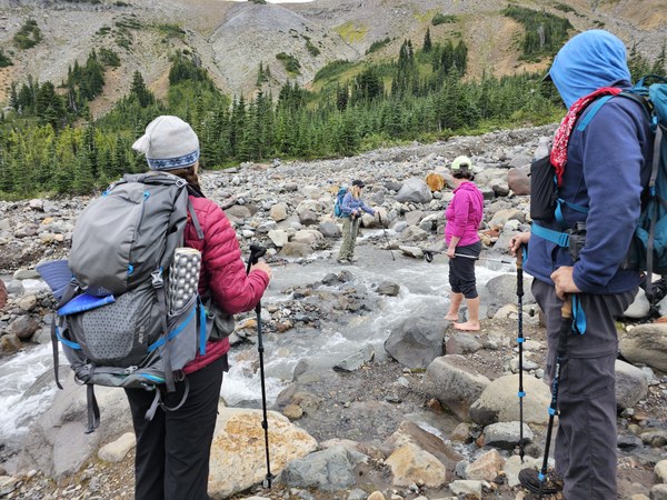
We intended to continue exploring beyond camp, either by crossing the Interfork River and heading up toward the ridge that approaches Mt Ruth (about 900' in .75 miles) or by continuing up the unmaintained section of the Glacier Basin trail to the end of the vegetation (about 600' in .6 miles). With no strong feelings either way, we decided at camp that we would assess the river crossing and let that determine our course.
We optimistically left our water crossing shoes at camp and the crossing ended up being too spicy for some in our group. If we had been more ambitious, we could have retrieved our water shoes or gone barefoot, but with the low clouds and an anticipated cold night, it was an easy choice to switch gears to the option that kept our feet dry.
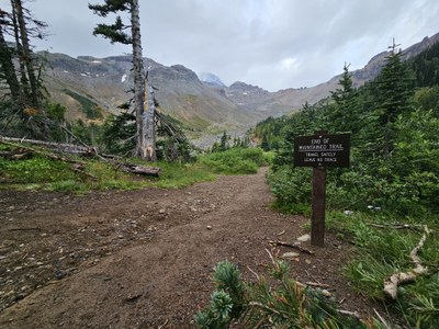
The unmaintained trail is very easy to follow, sometimes braiding across the former riverbed and eventually petering out at the end of the vegetation, creating a natural turnaround point.
 One option for crossing with a big step and the possibility of dry boots.
 Another more modest crossing Option with the promise of wet feet or boots.
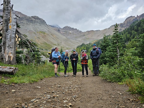
I picked up the Glacier Basin group site when the MRNP permits when on general sale in April. There were not many sites available on recreation.gov, but there was just one other group in the campground with us. It's possible that the rainy forecast kept some folks away (White River Camp also seemed to have plenty of space on both Wednesday and Thursday).
We caravaned from the Enumclaw Ranger Station into the park with each vehicle having a copy of the permit reservation. After picking up the permit, we convened at the White River day use and climbers parking lot, hitting the trail at 10:15am. We arrived at the Emmons glacier overlook (end of maintained trail) about an hour later and stopped there for a long snack break. We pushed on at a leisurely pace, arriving at camp around 1:30. Our afternoon exploration is documented above.

We saw and heard dozens of marmots, and encountered some very bold chipmunks in camp. There was a temporary warning sign at camp for recent bear activity. Unlike other food storage options within the park, this camp has bear barrels - large screwtop "garbage" cans.
 Bear barrels at Glacier Basin Camp. These two barrels are shared between all sites.
There were lots of water options near camp, but no obvious best option. The Inter Fork is a little silty and best filtered from the slower moving channels. The pond at camp was a little murky. And the closest running water was up the (easy) trail about a quarter mile. There was a lot of fast moving running water along the trail.
Despite rain and thunderstorms in the forecast, we never got more than a couple of drops of rain during daylight hours. Nighttime was quite chilly. We hit the trail at 8:55am, grateful again to break camp without precipitation, and were back at the cars around 11:15.

 Mckenzie Campbell Davies