Trip Report
Basic Alpine Climb - McMillan Spire/West Ridge
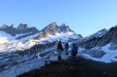
This was a 3-day, 2 nights climb of West McMillan Spire. It was a very strenuous climb of 19.4 miles with 9300 feet of gain. We had a fun and interesting team of 6 “mature” and experienced climbers.
- Fri, Jul 20, 2018 — Sun, Jul 22, 2018
- Basic Alpine Climb - McMillan Spire/West Ridge
- McMillan Spire/West Ridge
- Climbing
- Successful
-

- Road suitable for all vehicles
-
Trail head is on the second spur road on the left off Highway 20 as you enter Newhalem, exactly across from the Newhalem Campground and Visitor Center Road. This Upper Goodell Creek Group Campground is NOT on the same road as the well-marked Lower Goodell Creek Campground.
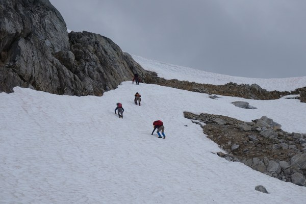
Snow is found shortly below the notch at 6200. A steep (60-70 degree) but short (20 feet) snow headwall must be down-climbed to reach camp.
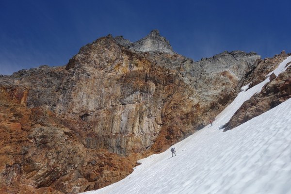 The Snow finger between Inspiration Peak and West McMillan Spire is currently 40-50 degree steep. We noticed some old rock fall on the left side. We stayed in the middle for the best run-out.
Link to Gaia GPS folder with 3 tracks of “car to camp”, McMillan climb (summit day), and “camp to car” is attached here. https://www.gaiagps.com/datasummary/folder/bc0c478b-514e-4369-bcc6-4431577b7b64/?layer=GaiaTopoRasterFeet,CalTopo
More pictures at https://www.facebook.com/emanuela.agosta/media_set?set=a.10210149290963605&type=3
All times listed below include long leisurely breaks.
Day 1: Approach to the Terror Basin (7.4 mi, 5835 ft ascent, 500 ft descent, 9 h)
After picking up our lottery-earned permit at the Ranger Station in Marblemount (to be noted there was already a line of 30+ people waiting for permits 15 minute before the 7 am opening), we headed to the trail head in the Upper Goodell Creek group campground. This is the second group campground off of Highway 20 and it is NOT on the same access road as the regular Goodell Creek group campground. (I am guessing the name upper is intended as in further up on Hwy 20, not at higher elevation on the same road as the lower Goodell Creek one). This is poorly signed on the road so just make sure you check on a map/GPS beforehand. We first went to the first road and realized we were in the wrong campground. The trail head is at 500 ft (sadly one of the lowest in the North Cascades) and there is a parking area on the right of the road, 500 feet from the end of the road. Park here since there is no space to park at the end of road near the outhouse and the group campground.
We begun hiking at 8:25 AM under cloudy skies. The weather forecast was for a dry cloudy day gradually clearing throughout the day but we were under cloud cover most of the day which actually made the strenuous approach much more bearable at least temperature-wise. Mosquitos were also not too bad in the forest.
The approach/climber’s trail is pretty easy to follow all the way to camp. For the description I am dividing the approach in 3 sections.
Section 1: Old forest road:
The first 3.75 are a gentle climb along the Goodell Creek on an old forest road. A bit brushy and some downed log in the first mile but overall this is a pleasant forest walk.
There is only one tricky spot (marked on our GPS track “car to camp”) where the trail crosses and follows for a short while a big washout with large boulders (waypoint on the track). We continued following as it turned uphill a bit until we realized we were off track and descended back down to find the trail again. It’s easy to miss, but on the way back we put a stack of wood debris on the wrong way and a new cairn at the corner so it should be easier to spot the wrong turn. Stay left of that wood blockage.
There are two major creek crossings. They were not bad in terms of crossing (just rock hopping). The first one is about 1.5 mile in and made for a glorious dunking hole on the hot day of the descent. Keep that in mind. Lovely place to refresh before the last push back to the trail head.
The second one is just before you leave the old road and take the trail climbing up. Last good spot for water for the next 3000 ft of gain, so fill up here.
Also to be noticed that about ¼ mile from the trail head there is a hornet nest (waypoint on the track). We were warned about it by a fellow hiker on our way back and all but one of our participants escaped the stings. It is on the ground near some downed Alder logs. May or may not be there if you go there soon. The first 2 went by and were not stung but the third was our sacrificial goat and the 3 of us in the back back-tracked and bush-wacked around it once we realized the hornets were swarming.
Section 2: The big steep climb
At 1637 feet a big rock cairn on the old road marks the place where the route starts climbing up (waypoint on the track). Very steeply up! This is the most strenuous part of the approach, gaining 3000 feet in 1.5 miles. It’s a Mailbox on steroids as Brian described it. The climber’s trail is pretty easy to follow though. It starts on open hemlock forest for the first 1000 feet, then it gets in a beautiful but brushy huckleberry understory (there are some great juicy ones already), then is runs briefly a rocky ridge with a few short up and down next to a lush draw. This area and up to 3500 is a great porcini foraging area. We collected 2.5 pounds of them on the way down!
There is another tricky spot in this section where it is easy to loose the trail. The trail briefly emerges from the forest at 4013 in a boulder field. The trail stays on climber’s left of the boulder field and skirts it. It was easy to see this on the way up but we got a little mixed up on the way down. Keep the boulder field right on the uphill and left on the way down.
This last section of the ascent is the steepest and hardest one. It climbs a few rock bands with 3rd class rock/root belays. 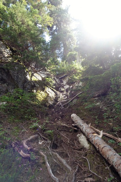 Easy enough but strenuous with an overnight pack. It finally tops at 5000 ft on a beautiful heather-covered bench with glorious views of Triumph and the Terror Basin that can be enjoyed on a rocky platform that makes an ideal lunch spot.
Section 3: The traverse to the notch
Shortly past this bench, there is a gully with water running under the boulders. One has to descend and cross the gully and then climb back up. Past this first gully there is a second one shortly afterwards. There are two different climber’s trails bot cairned here and both work. 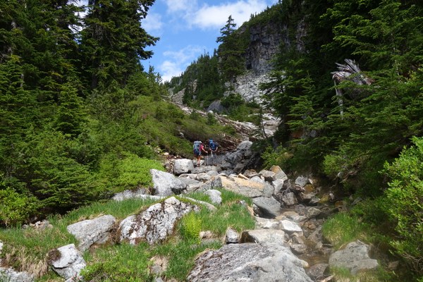 The main issue if that you need to follow this second gully up for a little while on either side of it or sometimes in the stream bed (rock-hopping, no fording needed). We took the route continuing up the gully longer (about 300 vertical feet total) on the way up but cut off lower on the way down. Both go, but make sure you follow cairns and a pretty well marked path.
After this gully the trail makes a gradual uphill traverse through heather meadows with fantastic views of Triumph, Pinnacle, Mount Baker and some of the peaks above the Terror Basin. This is a very pleasant section with several small creek crossings and rock benches.
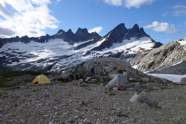
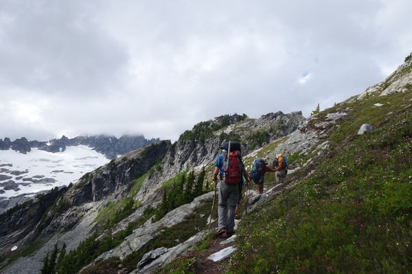 The traverse takes you to the famous notch at 6200 located right above camp. On our climb, there was a small remaining snow finger taking us up the last 200 feet to the notch that could be avoided if desired by staying on scree on climber’s right. At the notch the view into the Terror Basin and the camp below are well… terrific! The snow slope immediately below is a short (20 feet) section of 60-70 degrees that does not get sun for most of the day. It was still very firm. We down-climbed that part and kicked steps (with crampons on). It quickly mellowed out though in a 30-40 degree slope that descended all the way to camp. Camp is one of the best high elevation camps we ever saw. A flat wide gravel area with a stream running through it and 3 distinct bivy areas with rock walls. Good for multiple groups of climbers. We were joined later in the evening of the first night by a party of two and the second night by a party of 4 but given the large space available we had plenty of space for everyone.
Day 2: Summit Day (4.7 mi RT, 2950 ft ascent, 400 ft descent, 10.5 h)
Overnight the skies cleared, and we had a leisurely non-alpine start at 6:15 AM. Snow was very firm and crampons were all but necessary on the snow sections we had to traverse. The climber’s trails makes a gradual descending traverse on rock slabs and snow for about 400 vertical feet to the major gully which is the outlet of a small glacier lake lying below McMillan Spires. At this point in time, one can choose to follow rock and try to avoid snow which is what we did in the morning or follow snow and avoid rock and keep crampons on which is what we did on the way back. See GPS track. 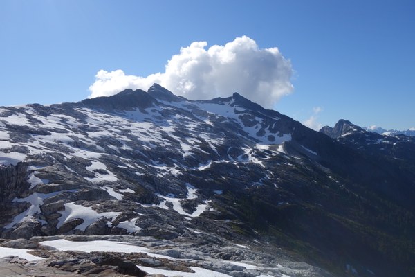 We should have done the opposite since the snow was firm in the morning and crampons were needed but it was easy to cross in the afternoon when it had softened. Either way, this is a pretty simple section that should not pose much challenge.
At the big gully, snow is still completely covering the stream. This will change in a few weeks and may make the crossing more difficult. 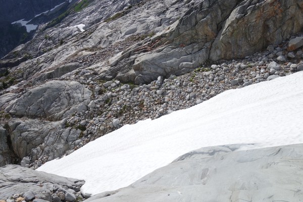 After the gully crossing the climb resumes alternating rock slabs and snow. Numerous rock cairns mark the path but anything goes as long as one aims to climb to the snow finger between the prominent rock wall below Inspiration Peak and West McMillan Spire itself.
Pretty soon it was all snow for a gradual climb to the snow finger. This is currently a 45-50 degree snow slope. It was quite firm in the morning and we climbed it carefully kicking steps to the final notch between Inspiration Peak and West McMillan Spire at 7200 feet.
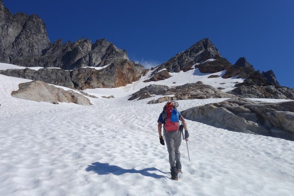
We stashed ice axes and crampons here and begun the summit block scramble. This is a fun class 3 scramble, with a bit of annoying loose rock and scree on the lower part but it gradually improves to solid and beautiful rock towards the top. It is metamorphic rock, alternating schist and ortho-gneiss (metamorphosed granite) with more schist in the lower part (looser). It is not particularly exposed except for a few final moves between the false summit and the true summit.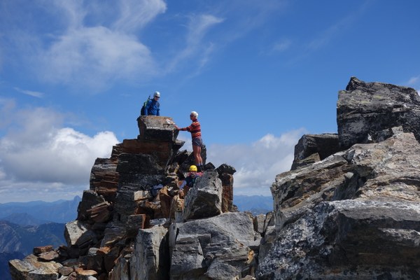 The views are spectacular. Even with some clouds moving in and out we could see so many fantastic peaks. Hozomeen, Spikard Redoubt, Luna to the NE and N, Fury and Challenger right in front of us on the north, Terror, Mt Degenhardt, Inspiration, right next to us to the West and Shuksan, Baker in the distance. Triumph, Little and Big Devil’s Peak, Glacier Peak, Eldorado and so many others to the South. Possibly the best summit views I ever seen.

The descent back to camp was much easier as the snow had softened quite a bit. We used crampons only for the first steeper part of the descent and were able to almost plunge-step down to the gully. We mostly followed snow fingers back to camp.
We had a lovely sunny evening at camp, ate well, had good conversation, watched the sun setting below the peaks and retired to our cozy tents.
Day 3: Camp to Car (7.4 mi, 5730 descent, 500 ft ascent, 8.5 h)
We started at 7 AM under clear skies. As much as we wanted to get down at the cars, it was sad to leave such a beautiful place! The climb to the notch was easier than expected since the snow was not so hard and it was easy to kick steps. After a short descent on snow on the other side of the notch we took off crampons and stowed our ice axes and begun the long descent back to the car. Other than being a long and steep trail, it was not too painful. We took nice long breaks, found a few alternative paths (see notes on the approach day), 2.5 pounds of porcini, a lovely dunking hole, a hornet nest and then wonderful food and brews at Mondo in Marblemount.
 Emma Agosta