Trip Report
Alpine Scramble - Wagonwheel Lake & Copper Mountain
A hidden gem of a scramble protected by a bit of a bushwhack.
- Sat, Jul 23, 2022
- Alpine Scramble - Wagonwheel Lake & Copper Mountain
- Wagonwheel Lake & Copper Mountain
- Scrambling
- Successful
-

- Road suitable for all vehicles
-
National Forest road 24 appears to have been freshly graded. No potholes were seen.
The Wagon Wheel lake trail is a bit overgrown in places. The final bit before the lake is heavily encroached upon by Devils club and slide alder.
The drive from Tacoma out to Staircase in the Olympics went well with little to no traffic. Surprisingly NF 24 appeared to have been freshly maintained and was free of potholes or ruts. The only issue encountered on the drive in was a deer that ran right at our car on NF 24. Luckily for us it decided jumping into our stopped car wasn't a great idea but we were getting a bit worried. Upon our arrival at Staircase at 7 am we were surprised to find the parking lots nearly full with only maybe 5 parking spaces still available.
After the entire team arrived we did a quick meet and greet, assigned our first aid person and headed up the trail. From what I have heard the Wagon Wheel lake trail is little used compared to the other trails in the area. Most likely because it is steep and doesn't really offer any views. I have only traveled this trail in winter so this was my first time going up it with vegetation in full bloom. The lack of usage shows on this trail due to how much the vegetation is encroaching on it. There were sections that left some of the participants on the trip wondering if we were still on the actual trail or missed a turn. The worst section of this trail was probably the final quarter mile before reaching the lake. In this section you are surrounded by Devil's club and Slide alder. The slide alder goes over the trail in places forcing you to step over it or on it to continue.
Upon arriving at Wagon Wheel lake we were not greeted with any awesome views. It is just another small lake surrounded by a forest of trees. As we passed the lake to continue on our route we did make note of good places to get water on our way back if we failed to find anymore on the route to Copper Mountain.
From the lake we initially started following the ridge line that heads towards Copper Mountain. At this point there wasn't a discernible boot track nor game trails but after a bit of travel we did start to see ribbon tied to trees indicating that people had traveled in this direction. It wasn't very long into our off trail travels that we came to a steep wide gully that appeared may block our progress. The gully was full of Devil's club and slide alder, what a great pairing. My initial thought was to break climbers left and explore that direction for a route up but that would take us away from our goal. Well exploring this option we noticed more ribbon that seemed to be marking a path climbers right directly up the ridge line. This seemed like a good idea to follow that ribbon since so far it had been leading us in the direction we wanted to go.
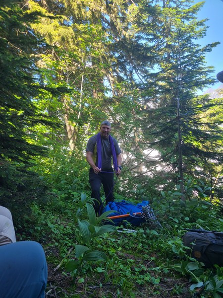
What followed was about an hour of intense bushwhacking uphill in very thick slide alder and devil's club. Our progress was slowed to a crawl and further hampered by hidden rock bands that blocked travel climbers left and a cliff climbers right. As a group we debated continuing on this route or turning around and going back to find a different route. Ultimately the unpleasantness of attempting to go back through what we had already done and the hope that it had to clear up soon kept us going up. Finally with one final steep slide alder covered section and the help of a hand line we came out into a nice clearing in the forest on top of the ridge line. From here I took a compass bearing to where we needed to go and explored that direction quickly finding a game trail heading the direction we wanted to go.
Stowing the rope, photo by Becca Boeh
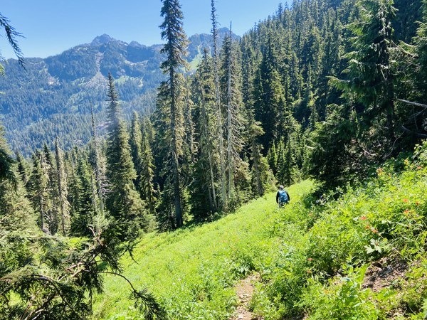
From the forest clearing we got onto the East side of the ridge and emerged into nice opening. We held the ridge on our right side and used it as a hand line to head towards Copper Mountain. As we proceeded to the end of this opening we saw progress would be blocked by rock bands lower so we headed up the ridge a bit and back into the woods. It didn't take long to find a game trail heading in the direction that we wanted to go and once again ribbon in the trees. Travel from this point on was much quicker and easier.
Finally progress, clearing just off ridge.
Photo by Zhihua Hu
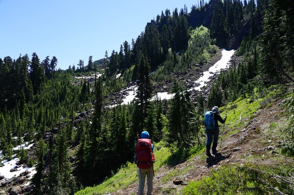
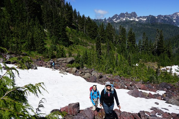
The final bits of forest went by without any further issue and we quickly emerged out in the open at tree line and were greeted by views. Navigation was now very easy since it was find best terrain to go up and reach our goal. From here on we had to occasionally cross snow fields but this probably made progress quicker since the snow was covering talus and boulders that we would have had to negotiate.
Just clearing treeline, Navigation now easy.
Upon arriving at the base of Copper mountain we helmeted up and set out to find the best route up it. From a distance Copper mountain appears imposing and more like a technical climb. As usual as we got closer to it we observed that the approach would be steep in places but not unmanageable.
Copper mountain. Approach gully located right edge of saddle.
Top of Copper is the imposing spire center of photo.
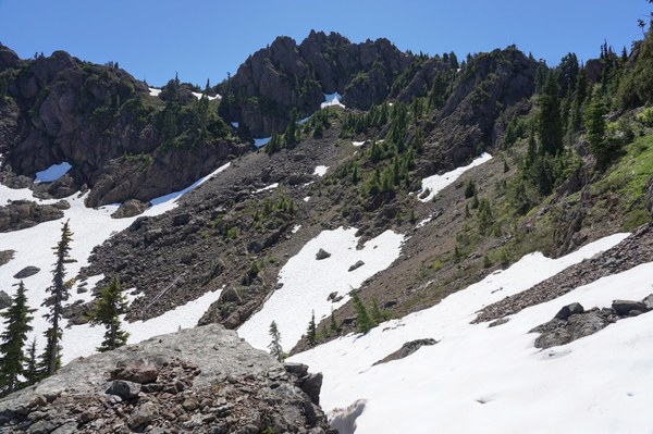
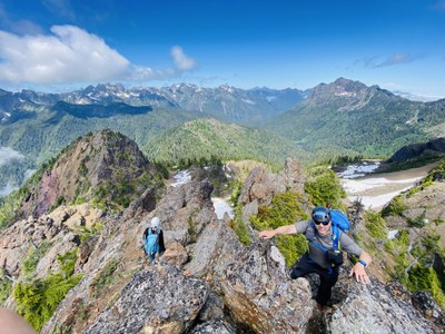
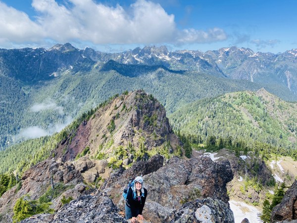
For our route we decided to hit a small saddle located climbers left of Copper mountain. This saddle easily gains the ridge to copper and lets you access the backside of it. The backside is a nice rock scramble heading towards the actual summit. It does have some exposure but is easily doable. The final summit block will require you to ascend a short nearly vertical section to gain a summit that had enough room for maybe 4 people on it. Views were very nice from the summit and our group which had doubts of making it were now elated that they had done something that appeared impossible from a distance.
View looking North from top of Copper.
Photos by Zhihua Hu

Our return route was identical to our entrance until we got to the open field on the side of the ridge. None of us wanted to even try going back the way we had come earlier so we decided to go further right and attempt the other side of the gully for our descent. Things were looking good since I found what appeared to be a game trail heading that way. Unfortunately this route was also very steep and had a section of devil's club and slide alder to deal with. However it was much better than our entry route but still ate up a bit of time dealing with it. From there it was back to the lake to top off our water and head out.
Total time for the trip was 11 hours with the main slow down being the bushwhacking sections.
Distance 8.5 to 9 miles
Elevation gain, 4,400 feet on one tracker 4,700 feet on another gps tracker.
 Jerrick Linde