Trip Report
Winter Scramble - Kendall Peak (winter)
Great trip under the right conditions
- Mon, Dec 31, 2018
- Winter Scramble - Kendall Peak (winter)
- Kendall Peak (winter)
- Scrambling
- Successful
-

- Road suitable for all vehicles
-
Overall -- Recent weather from the week before included snow, then lots and lots of rain and wind, and then several more inches of powdery snow with more heavy winds that blew the snow all over the place, potentially loading various slopes and gullies.
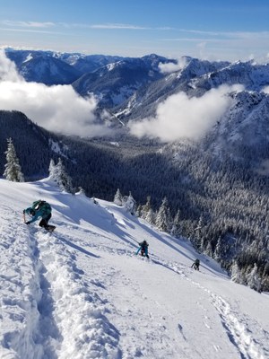
Commonwealth Basin and PCT - Our trip was on a Monday, after snows had ended on Sunday morning. The trail was packed down by skiers from the day before, all the way up to about 4200'. Then we left the trail and bee-lined easterly up to 4,800' where we broke out of the trees to a beautiful view of the peak.
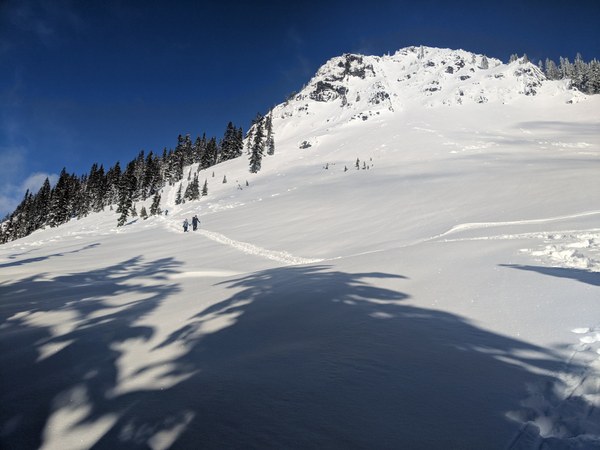
The Peak -- There was evidence of older snow slides, maybe not so old (possibly from the heavy rain storm that came through two days earlier). There was new snow on top of the chunky "snow boulders" that had come down a couple slide paths. But there was no evidence of instability in the snowpack today so far. The NWAC forecast was "moderate", with the main risks being wind loaded slabs on random aspects and maybe a loose-wet slide potential on sunny slopes. We found powdery snow on top, and a rain crust layer about 6-12 inches below the powder. The rain crust was where our snowshoes had solid footing. The rain crust was 2-4 inches thick and well bonded to another layer below that. That remained the case as we climbed from 4,800 to about 5,300'. We had entered a steep gully on the west side of the peak.
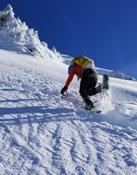 On each side of the gully, rocky ridges had been cleared of powdery snow, but the gully still had the powder on top of rain crust. Then for another few hundred feet, the snow alternated from powdery snow to exposed rain crust, then more powder and more exposed rain crust. Nearer the top, the rain layer was exposed, but was much thinner (like only an inch or less), and was not bonded to the powdery layer beneath. Our snowshoes either stayed on top of it or broke through to the powder below - not really a slab of ice, just a crusted top.
This climb was posted by Sherrie Trecker, before knowing the forecast for weather and avalanche hazards. She had Teneriffe as an alternative route. However, the forecasts turned out to be "sunny in the 20s" and "moderate avalanche risk with possibilities of wind slab and loose-wet slopes". Our group of 8 were very strong, competent, and experienced, and those skills turned out to be necessary on the last 700 feet.
We started at the Snoqualmie Ski Area (2,880') and summited at 5,696 or 5,794 feet, depending which map you're using. We stopped just a few feet short of the summit to avoid corniced terrain on top.
We parked at the bottom of the Snoqualmie Ski Area, near the Exit 52 interchange and walked under the interchange to the Pacific Crest Trail (PCT) trailhead. 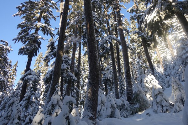 We carried avalanche beacon, probe, shovel, a 30m rope, helmet, snowshoes, crampons, ice axe, and warm layers. We expected to snowshoe up to 5,000' and also need crampons on top. We definitely needed crampons on the descent from the peak, and should have put them on at about 5,200' on the way up as well.
As mentioned above under "conditions", the Commonwealth Basin and Pacific Crest Trails were packed by skiers after the recent snowfall. The trail was not a highway by any means, but it really helped to snowshoe over recent ski tracks. Outside the ski tracks, we occassionally went into the snow to our knees. Glad we didn't have to break new trail all the way.
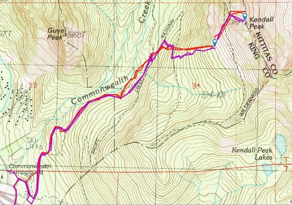
Our track is on Gaia GPS -- https://www.gaiagps.com/datasummary/track/d39201bc778cd2d18c00754c9e35fd6ad23f3c5d/.
On this snapshot, the purple track is ours, and the red track is an earlier attempt by Sherrie where they cliffed out just a couple hundred feet short of the summit. It seems like the northern ridgeline should take you to the summit, but this west-facing gully that we ascended took us directly to the summit. The gully definitely has potential for avalanche, so definitely assess the risk. Just getting up to the viewpoints on Kendall Knob were worth the trip. The summit was a bonus!
From our great viewpoint and rest stop at 4,800', we took a gradual ascent toward the north, passing under some recent avalanche activity buried under the fresher snow. This took us toward the western side of the peak at about 5,240', on the last PCT switchback. 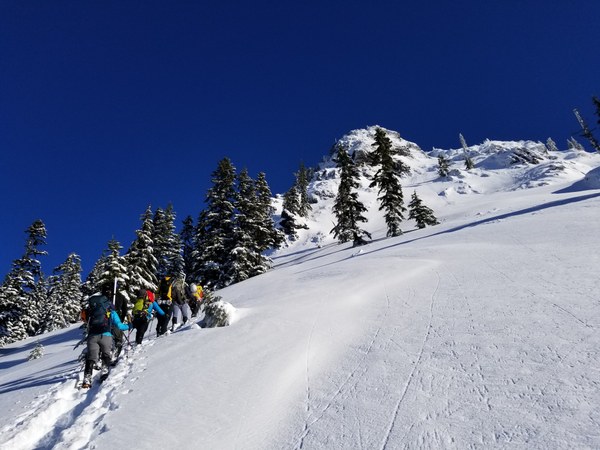 We saw a gully prior to the summertime "climbers path". We climbed that gully in snowshoes, which was okay for about 100', but then the powdery layer on top of a rain crust, and the steepness of the slope became a real slow-go. The first person could create a path in the snow, but could not kick steps that were useful to anyone else. Each of us had to basically kick our own new step. We should have put on crampons to kick into that frozen layer underneath. In a few cases, snowshoes slid out and someone slid back down the hill into the person beneath them, almost sliding further down the gully. But there wasn't a good place to stop and change gear, so we all continued upward at a slug's pace.
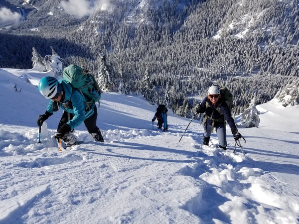
At about 5,500', we started finding alternating powder with exposed ice layer, depending how the snow had blown off the slope. Exposed sections had ice on top, while unexposed sections had ice under about 6 to 12 inches of powdery soft snow. Then, the final 100' was pretty much all icy on top. We even kicked through the ice to make seats at the summit.
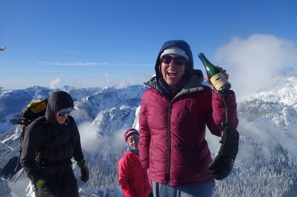
We toasted the new year with a very small bottle of bubbly! Then we switched snowshoes for crampons and downclimbed 500' back to the PCT at 5,274. Then a very enjoyable snowshoe trek back to the basin and the trailhead made for an excellent scramble day!
Stats -- 6 miles round trip and about 8 hours total. We had met in Issaquah at 6:30, started hiking at 8 AM, reached the top at about 12:30 to 1:00, and reached the cars again at about 4 PM
Happy New Years!
 Brian Starlin