Trip
Basic Snowshoe - Commonwealth Basin
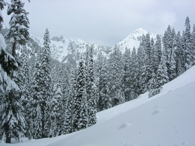
This moderately-paced 4-mile trip up the popular Commonwealth Creek drainage ascends gradually through a mature forest to an open, flat valley area with occasional views of the surrounding peaks beyond.
- Thu, Dec 28, 2023
- Tacoma Snowshoeing Committee
- Snowshoeing
- Basic
- Adults
- Moderate
- Moderate
- Mileage: 4.0 mi
- Elevation Gain: 800 ft
- High Point Elevation: 3,900 ft
- FULL, 2 on waitlist (6 capacity)
- FULL (2 capacity)
- Cancellation & Refund Policy
Plan to meet at 8:30am at the Laconia Market and Café, located at Snoqualmie Pass.
To get there, take Exit 52 off of I-90. At the end of the exit, turn left. The market is on the opposite/freeway side of the road from the ski lodge.
Mentored snowshoe for Nelson Hamre.
The route follows up the Old Commonwealth Trail gradually ascending the Commonwealth Creek drainage system to a flat, open forested area at an elevation of approximately 3,800' to 3900' surrounded by Guye Peak, Cave Ridge, Lundin Peak, Red Mountain & Kendell Ridge. There will be multiple snow bridges to navigate. With a few deviations, we backtrack to the Old Commonwealth Trail before branching off ending near the Sahalie Ski Club and then follow the road back to our starting point arriving back to the parking lot around 3pm or earlier.
More specifics to follow in pre-trip email posted by the evening of Tuesday 26th.
Commonwealth Basin
-
Green Trails Snoqualmie Pass Gateway No. 207S
Green Trails Snoqualmie Pass No. 207
USGS Snoqualmie Pass - See full route/place details.
Required Equipment
- The Ten Essentials
- Snowshoes
- microspikes (optional)
- Hiking poles (optional, but recommended)
- lunch/snacks
- Great attitude:)

