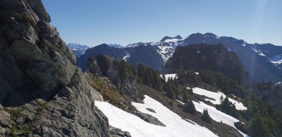
Anderson Lakes, Watson Lakes & Mount Watson
Hike to lakes high in the North Cascades Noisy-Diobsud Wilderness or scramble or climb a route on Mount Watson.
getting there
From SR-20, turn north onto Baker Lake Road (Forest Road 11). Just past the junction with Forest Road 12, turn right onto Forest Road 1106 and follow it around the south end of Baker Lake and then follow Forest Road 1107 to its end and the Anderson & Watson Lakes Trailhead.
On the Trail
There are three distinct day hiking or backpacking destinations that can be done individually or combined.
Anderson Butte Lookout
2.5 miles round trip, 1,000 feet of elevation gain
Hike the Anderson-Watson Lakes Trail for 0.6 mile, turn left, and hike 0.3 to Anderson Butte, the home of a former lookout site with glorious views of Mount Baker, Mount Shuksan, and the Baker River valley.
Anderson Lakes
4 miles round trip, 1,050 feet of elevation gain
Hike Anderson-Watson Lakes Trail 1.3 miles, head straight on the Anderson Lakes Trail, and hike 0.7 mile to Anderson Lakes.
Watson Lakes
6 miles round trip, 1,500 feet of elevation gain
Hike Anderson-Watson Lakes Trail 1.3 miles, turn left to continue on the Watson Lakes Trail, and hike 1.2 miles to Watson Lakes. There is a boot path around the eastern lake and there are multiple camping at the lakes but beware of bugs in the summer.
Mount Watson/Southwest Flank (6,234 ft)
6.0 miles round trip, 2,000 feet of elevation gain
Difficulty: In early season, when covered with snow, this route is an Alpine Scramble (Strenuous 3, Technical 4). In late season, when the snowpack has diminished to expose the glacier's surface (i.e. "blue ice"), this route is a Basic Alpine Climb.
Approach
Hike the Anderson-Watson Lakes Trail (No. 61), ~1.4 miles to the saddle above Watson Lakes (~4,800 ft). From the saddle ascend south on a boot path following a ridge high above Lower Anderson Lake. Contour south and southeast to Upper Anderson Lakes. At the open meadow at 5,000 ft the trail disappears and reappears on the north side of the meadow leading to Upper Anderson Lakes. At the north end of largest of the Anderson Lakes there is a small gully, ascending northeast, at the top where there is a saddle. Continue ~0.5 miles east and then southeast across the heather, rock slabs and ridges (may be snow covered) on an ascending traverse the base of the glacier on the north side of Mount Watson (~5,700 ft). Mount Watson peak is to the southwest with a large col just west of the summit.
Ascent
From the north side of Mount Watson ascend south to the saddle that separates the east and west summits of Mount Watson (not to be confused with Mount Watson East Peak). There is a snow finger that leads up to the saddle, and there may be a moat at the top of the snow finger. The east peak is the highest (true summit). Travel through thick alpine fir and a steep terraced slope on the southwest flank, and then cross a steep rocky gully that leads to the summit (6,234 ft).
Mount Watson/North Face (6,234 ft)
6.5 miles round trip, 2,000 feet of elevation gain
Difficulty: In early season, when covered with snow, this route is an Alpine Scramble (Strenuous 3, Technical 4). In late season, when the snowpack has diminished to expose the glacier's surface (i.e. "blue ice"), this route is a Basic Alpine Climb.
Approach
The approach is the same as for the Southwest flank route. See description above.
Ascent
From the north side of Mount Watson descend slightly then do a rising traverse to the large col (~5,900 ft) between the dominant Mount Watson East Peak and the jumbled summits of Mount Watson to the west. From the col head west and scramble the ridge to the west on the south side up easy heather and treed slopes to the basin below the true summit. Traverse the basin to a heather/dirt gully just to the south side of the summit block. Ascend to the top of the gully and through a very tight tree then continue to ascend an easy dirt gully for 10-15 feet to the summit ridge, a 30-foot, Class 2-3 ridge with considerable exposure on both sides (a fixed line is recommended).
Descent
Descend the climbing route.
Equipment
Standard glacier gear plus a couple double runners and a cordelette for a fixed line at the summit.
Notes
- If not for the glacier this would be a Technical 4 difficulty scramble.
- The summit is small and has just enough room for a party of 6.
- The views are amazing and this is a very seldom traveled area.
- This is a trip worth combining with a two-day climb of Bacon Peak.
- Suitable Activities: Backpacking, Climbing, Day Hiking, Scrambling
- Climbing Category: Basic Alpine
- Seasons: May, June, July, August, September, October
- Weather: View weather forecast
- Difficulty: Moderate, Strenuous 3, Technical 4, Basic Alpine Climb
- Length: 6.0 mi
- Elevation Gain: 1,500 ft
- 4,900 ft
-
Land Manager:
Mount Baker-Snoqualmie National Forest
Noisy-Diobsud Wilderness, Mount Baker Ranger District (MBSNF)
- Parking Permit Required: Northwest Forest Pass
- Recommended Party Size: 12
- Maximum Party Size: 12
- Maximum Route/Place Capacity: 12
- Green Trails Mount Baker Wilderness Climbing No. 13SX
- USGS Bacon Peak
This is a list of titles that represent the variations of trips you can take at this route/place. This includes side trips, extensions and peak combinations. Not seeing a title that fits your trip? Log in and send us updates, images, or resources.
- Anderson Lakes
- Watson Lakes
- Anderson Butte
- Anderson & Watson Lakes
- Anderson Lakes, Watson Lakes & Anderson Butte
- Mount Watson
- Mount Watson/Southwest Flank
- Mount Watson/North Face
| Name/Description |
|---|
| Mount Watson Topo Map A topo map showing both Mount Washington and Mount Washington East peak. |
