Aurora Peak
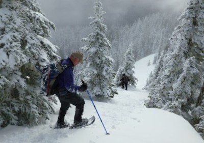
A beautiful and strenuous winter scramble from Lake Crescent shoreline to a peak overlooking the pristine North Fork Soleduc valley with Mount Olympus beckoning beyond.
getting there
The unmarked trailhead is near a turnout with room for 3-4 cars 2.6 miles west of the Storm King Ranger Station turnoff from Highway 101.
approach & ascent
aurora peak
The winter scramble route mostly follows the Aurora Ridge Trail to its junction with the Happy Ridge Trail at roughly 4,100 ft. Follow the Happy Ridge Trail to the east (on the south side of the ridge) before ascending the final 400 feet of elevation gain along the southwest ridge of Aurora Peak. It's 9 miles and 5,000 feet of elevation gain.
HAPPY LAKE RIDGE
A strenuous ridge route to vistas overlooking the scenic Soleduck River Valley and central Olympic Mountains. From the Storm King Ranger Station ascend the Barnes Creek trail for approximately 1.75 miles until just after crossing a stream which enters Barnes Creek from the southwest. Leave the trail and ascend in a southerly direction up a broad ridge which eventually narrows (and has a dip at roughly 4,500 ft) to reach the crest of Happy Lake Ridge. It's 8 miles and 4,300 feet of elevation gain. Descend the ascent route.
Barnes Creek to Aurora Peak Traverse
A strenuous one way traverse that ascends via Barnes Creek trail, follows Happy Lake Ridge to Aurora Peak, then descends to Highway 101 using the Aurora Creek Trail. It's 15 miles and 5,500 feet of elevation gain. This route is not recommend during the winter, because it is too long and difficult a traverse for winter conditions and short days. It is a good choice for summer, though.
notes
- The Aurora Ridge crest is sharply defined in several places which can lead to challenging winter scramble conditions. Wind blown crest with hard snow that requires crampons and deep, soft snow requiring snowshoes a few feet away.
- Suitable Activities: Scrambling
- Seasons: January, February, March, April, November, December
- Weather: View weather forecast
- View avalanche forecast.
- Difficulty: Winter Scramble
- Length: 9.0 mi
- Elevation Gain: 5,000 ft
- 4,720 ft
- Land Manager: Olympic National Park
- Parking Permit Required: National Park Entrance Fee
- Recommended Party Size: 12
- Maximum Party Size: 12
- Maximum Route/Place Capacity: 12
- USGS Lake Crescent
- Custom Correct Lake Crescent - Happy Lake Ridge
This is a list of titles that represent the variations of trips you can take at this route/place. This includes side trips, extensions and peak combinations. Not seeing a title that fits your trip? Log in and send us updates, images, or resources.
- Aurora Peak
- Barnes Creek to Aurora Peak Traverse
- Happy Lake Ridge
| Name/Description |
|---|
| Happy Lake Ridge Topo Map A map of the winter route from Barnes Creek to Happy Lake Ridge in the Olympics submitted by Dave Morgan, Nov 2017. |
