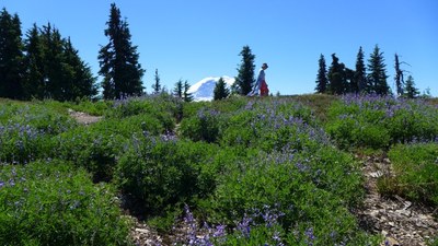
Bearhead & East Bearhead Mountains
A combination hike and scramble in the Carbon River area of Mount Rainier National Park, with 2,900 feet of elevation gain in a round trip of 8 miles. Good views of Summit Lake and one broad summit for lunch.
Getting there
From SR 165 turn left onto the Carbon River Road. Just before the entrance of Mount Rainier National Park, turn left on Forest Road 7810. Cross the bridge over Carbon River and follow the main road, which parallels the river, all the way to its end (4,400 ft).
on the trail
bearhead Mountain (6,089 ft)
Hike 0.8 mile to Twin Lake. Turn right at the trail junction to head towards Bearhead Mountain. In 1.4 mile, turn left and reach the summit (6,089 ft) in another 0.8 mile. It's a total of 6 miles round trip and 1,700 feet of elevation gain.
Summit Lake (5,400 ft)
Summit Lake is a destination in its own right as well as a great way to extend a trip to Bearhead Mountain. At Twin Lake on the return, turn right and reach Summit Lake in 1.7 miles and 800 feet of elevation gain. Enjoy a swim at the lake if it's not too cold!
scramble ROUTE
bearhead Mountain (6,089 ft)
Hike 0.8 mile to Twin Lake. Turn right at the trail junction to head towards Bearhead Mountain. In 1.4 mile, turn left and reach the summit (6,089 ft) in another 0.8 mile. Much of this may be snow early int he season.
east bearhead Mountain (6,041 ft)
Return to the trail and continue east on it. It drops another 250 feet as it contours along the hillside, where it rounds the ridge end (gaining the 250 feet again to 5,400 ft). Ascend grassy slopes 600 feet to the rock outcropping of East Bearhead Mountain's summit (6,041 ft). Much of this may be snow early in the season.
Route Difficulties and Hazards
- There is avalanche danger beyond Bearhead Mountain in early season.
- Do not try to run the ridge between the two summits as rock outcrops makes the route more than a scramble.
- Strenuous 3 | Technical 3 in in early season when it is a snow scramble
- Strenuous 3 |Technical 1 later in the season when it is a rock scramble
snowshoe route
bearhead Mountain (6,089 ft)
Notes
- Guidebook: Day Hiking Snoqualmie Region, 1st ed. by Dan A. Nelson (Mountaineers Books 2007).
Information FOr leaders
Permit information
As of 2017, the Snoqualmie Ranger District considers Mountaineers trips and courses to be "nominal use". Leaders should print and copy this designation letter to show rangers they may see on trail or carry a digital copy on their phone.
- Suitable Activities: Day Hiking, Scrambling, Snowshoeing
- Snowshoeing Category: Intermediate
- Seasons: March, April, May, June, July, August, September, October, November
- Weather: View weather forecast
- Difficulty: Technical 3, Strenuous 3, Moderate
- Length: 8.0 mi
- Elevation Gain: 2,900 ft
- 6,089 ft
-
Land Manager:
Mount Baker-Snoqualmie National Forest
Clearwater Wilderness, Snoqualmie Ranger District (MBSNF)
- Parking Permit Required: Northwest Forest Pass
- Recommended Party Size: 12
- Maximum Party Size: 12
- Maximum Route/Place Capacity: 12
- USGS Bearhead Mtn
- Green Trails Enumclaw No. 237
This is a list of titles that represent the variations of trips you can take at this route/place. This includes side trips, extensions and peak combinations. Not seeing a title that fits your trip? Log in and send us updates, images, or resources.
- Bearhead Mountain
- Bearhead Mountain & Summit Lake
There are no resources for this route/place. Log in and send us updates, images, or resources.
