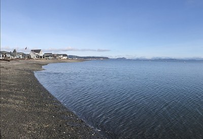
Camano Island
Sea kayak along an historic section of coast at the northern end of Camano Island. This area was once a major logging community and home to the first ship building operation in Puget Sound. It's a 7 nm round trip paddle.
Launch Points
- Utsalady Bay boat ramp
- English Boom
- Hand Boat Launch on the western edge of Leque Island, south of Sr-532. This has parking and a short carry to a dirt shore launch site.
- Eide Rd parking on the eastern edge of Leque Island. Launch from here is down a rocky shoreline.
- Hamilton landing Park on the Stillaguamish River.
On the Water
Utsalady Bay to English Boom
7.0 nm round trip, Difficulty: Sea Kayak II/II+
Sea kayak along an historic section of coast at the northern end of Camano Island. This area was once a major logging community and home to the first ship building operation in Puget Sound. There are spectacular mountain views on clear days, including Mount Baker, the North Cascades, the Olympics, and sometimes the peaks around Golden Ears Provincial Park in British Columbia. Follow the coastline of the bay around Brown Point and then east to English Boom. Be aware of extensive mudflats in this area, especially at lower tides (see NOAA chart 18441).
English Boom to Stanwood
9 NM ROUND TRIP, DIFFICULTY: SEA KAYAK II/II+
Paddle through a ghost forest of pilings along the northeast end of Camano Island, past a large heron nesting area, and ride the tide up the Stilliquamish River along the historic Stanwood waterfront. To avoid getting mired in the notorious mudflats of this area, plan to start and end when tides are 8 feet or higher and take advantage of tidal current assist each way by setting the mid-point of the paddle at a crest in the tidal cycle. This trip is not recommended during times of extreme river outflow.
Leque Island Wildlife Area
4 nm circumnavigation, Difficulty: Sea Kayak II and flatWater Packrafting
Paddle the slough and wetlands that divide Camino Island from the main land and contain the Leque Island Wildlife Area. At high tide a circumnavigation of Leque Island should be no more than 4 nm. This trip is best done at high tide at the Stanwood tide station, when the sloughs will be full and some of the wetlands flooded. The best navigation reference is an satellite photo of the area taken at low tide so that it shows which channels always hold water. The main channel (east of Leque) flows south on flood. Launching into this channel from Eide Rd is possible, but below 3 ft tide the shoreline is muddy. The extensive mud flats on the north side are covered by 3 ft tide. The salt marsh south of the highway is navigable at a 6 ft tide. The channel that defines the west side of Leque Island does connect to those in the southern salt marsh, making a circumnavigation possible.
- Suitable Activities: Packrafting, Sea Kayaking
- Seasons: Year-round
- Weather: View weather forecast
- Difficulty: Sea Kayak II, Class 0 Still Water
- Length: 7.0 nm
- Land Manager: Land Manager Varies
- Parking Permit Required: None
- Recommended Party Size: 12
- Maximum Party Size: 14
- Maximum Route/Place Capacity: 14
- NOAA Puget Sound: Northern Part No. 18441
This is a list of titles that represent the variations of trips you can take at this route/place. This includes side trips, extensions and peak combinations. Not seeing a title that fits your trip? Log in and send us updates, images, or resources.
- English Boom to Stanwood
- Utsalady Bay to English Boom
- Leque Island Wildlife Area
There are no resources for this route/place. Log in and send us updates, images, or resources.
