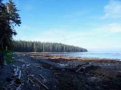
Cape Scott
Paddle from Port Hardy around Cape Scott to Coal Harbor. It's a challenging, multi-day sea kayaking trip around the northwestern point of Vancouver Island in British Columbia, Canada.
Launch points
- Launch in Port Hardy from the public water front and take out at Coal Harbor. Arrange a car shuttle between the two.
- Optional take out at San Josef Bay with shuttle from North Cost Trail Shuttle (northcosttrailshuttle.com).
on the water
A challenging multi-day trip around the north western most point of Vancouver island. Paddling varies from protected channels with strong currents to open coast and surf beaches. The waters in the Scott Channel (off Cape Scott) can be chaotic with strong currents and ocean swell.
Camping and route information is available from the BC Marine Trails website. Members can download detailed location information. This is an organization worth joining.
notes
- Consider paddling out to the Scott Islands as a side trip option.
- Guidebook Reference: BC Coast Explorer and Marine Trail Guide, Vol. 1 by John Kimantas (Wild Coast Publishing 2014).
- Guidebook Reference: The Wild Coast, Volume 1: A Kayaking, Hiking and Recreation Guide for North and West Vancouver Island by John Kimantas (Whitecap Books Ltd, 2010).
information for leaders
-
Considerations for travel to Canada
- Start by reviewing the latest regulations. Look for information on border crossing and travel to Canada on these websites:
- Everyone must have a passport or other valid ID like a NEXUS card.
- NEXUS cards can save a lot of time but only work if everyone in the car has one.
- Make sure your vehicle insurance is valid for Canada.
- Make sure your health insurance is valid for Canada.
- Border crossing regulations are strict in both directions. Know what you’re allowed to take and declare everything to avoid problems.
- You may be able to save time by checking alternate border crossings.
- See the Travel Industry Council of Ontario's 9 Travel Tips for Crossing the Canadian/U.S. Land Border blog post for some good tips on traveling to Canada.
- Start by reviewing the latest regulations. Look for information on border crossing and travel to Canada on these websites:
- Suitable Activities: Sea Kayaking
- Seasons: June, July, August, September
- Weather: View weather forecast
- Length: 100.0 nm
- Land Manager: Cape Scott Provincial Park
- Parking Permit Required: None
- Recommended Party Size: 12
- Maximum Party Size: 12
- Maximum Route/Place Capacity: 12
- CHS No. 3605 - Quatsino Sound to Queen Charlotte Strait
- CHS No. 3624 - Cape Cook to Cape Scott
- CHS No. 3549 - Queen Charlotte Strait West
- CHS No. 3625 - Scott Islands
- CHS No. 3679 - Quatsino Sound
There are no resources for this route/place. Log in and send us updates, images, or resources.
