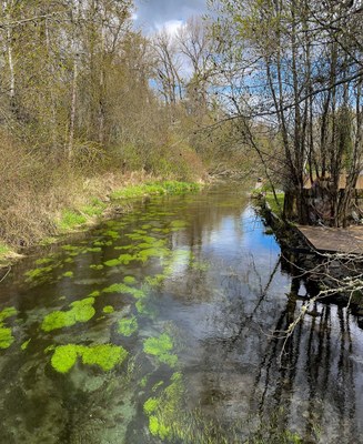
Clark's Creek Park
Explore a gem of nature in a 5.5-mile loop hike with 270 feet of elevation gain through six Puyallup city parks joined in 2016 by a trail constructed by the Washington Trails Association. At the half way point, the route goes by a viewpoint overlooking the city that makes a nice lunch spot.
getting there
The Silver Creek Trailhead of South Clark's Creek Park, 1710 12th AVE SW in Puyallup, makes a nice starting place for this urban loop hike, because there is ample parking and there are four restrooms there.
on the trail
From the trailhead hike out to DeCoursey Park, where the trail loops around a pond, and back. Then hike a large counter clockwise loop, initially heading south and uphill along Clark's Creek, loop east to a viewpoint and then downhill and north through several other parks and on some residential sidewalks to return to the trailhead.
Information for Leaders
scheduling & permitting
- This route allows multiple bookings. Please check scheduled trips listed below in the "Activities" tab to see if there is another group already booked on the same day. Leaders are expected to contact the leader(s) of existing trips to ensure there are no concerns or conflicts, according to The Mountaineers Outdoor Ethics Policy. Please review our Group Size & Multiple Bookings page for guidance.
- Suitable Activities: Day Hiking, Urban Walking, Urban Adventure
- Seasons: Year-round
- Weather: View weather forecast
- Difficulty: Easy
- Length: 5.5 mi
- Elevation Gain: 270 ft
- 300 ft
- Land Manager: City of Puyallup Parks & Recreation
- Parking Permit Required: None
- Recommended Party Size: 12
- Maximum Party Size: 20
- Maximum Route/Place Capacity: 20
- see Land Manager
This is a list of titles that represent the variations of trips you can take at this route/place. This includes side trips, extensions and peak combinations. Not seeing a title that fits your trip? Log in and send us updates, images, or resources.
- Clark's Creek Park Loop
There are no resources for this route/place. Log in and send us updates, images, or resources.
