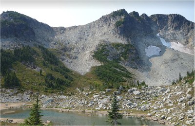
Crescent Mountain & Tyee Peak
A long, moderate scramble with high ridges, meadows, big views of Mount Rainier and even a bike ride.
getting there
From Enumclaw drive SR-410 to Buckley and then SR-165 to its end traveling through Wilkeson and Carbonado. Follow the signs to the Carbon River Ranger Station (1,900 ft).
approach & ascent
Crescent Mountain (6,715 ft)
26 miles round trip, 4,600 feet of elevation Gain
Difficulty: Strenuous 4, Technical 3
Bike 5.5 miles and 600 feet of elevation gain on the washed-out Carbon River Road to the Ipsut Creek Campground. Hike 1.7 miles to the lower crossing over the Carbon River. Cross the river and hike the Northern Loop Trail, passing the spur trail to Yellowstone Cliffs and the boot path to Tyee Peak. At 5,795 ft, before a small lake just to the west of Windy Gap, leave the trail and travel southeast. Then head to south up the slopes of Crescent Mountain until reaching the ridge east of the summit. Once on the ridge at ~6,470 ft, head west to the summit (6,715 ft).
Tyee Peak (6,000 FT)
24 miles round trip, 4,100 feet of elevation gain
Difficulty: Strenuous 4, Technical 2
Bike 5.5 miles and 600 feet of elevation gain on the washed-out Carbon River Road to the Ipsut Creek Campground. Hike 1.7 miles to the lower crossing over the Carbon River. Cross the river and hike the Northern Loop Trail, passing the spur to Yellowstone Cliffs Camp. Continue hiking to flat terrain at 5,775 ft. If you reach Windy Gap, hike back ~300 yards. Leave the trail and head north on a boot path. Follow this footpath over the saddle, descend ~200 feet on the north side of the ridge east of Tyee Peak, and continue on a boot path heading west. The route goes beyond Tyee Peak but loops back from the west near Tyee Peak's summit.
Notes
- Helmets are recommended on the summit block.
notes
- Mountain or hybrid bikes are recommended for the easy 5.5-mile round trip to and from Ipsut Creek Campground on the washed-out Carbon River Road.
- Crescent Mountain and Tyee Peak can also be combined with Crescent for a very long day or nice overnight.
- A very nice side trip (assuming you have biked the Carbon River Road portion) is to head toward Windy Gap and follow the trail to the Natural Bridge. The Natural Bridge is a unique and seldom visited place in the park. This extra attraction adds 2 miles round-trip and 300’ of elevation.
- Suitable Activities: Scrambling
- Seasons: June, July, August, September, October
- Weather: View weather forecast
- Difficulty: Strenuous 4, Technical 3
- Length: 14.0 mi
- Elevation Gain: 4,400 ft
- 6,715 ft
- Land Manager: Mount Rainier National Park
- Parking Permit Required: National Park Entrance Fee
- Recommended Party Size: 12
- Maximum Party Size: 12
- Maximum Route/Place Capacity: 12
- USGS Golden Lakes
- Green Trails Mt Rainier West No. 269
- Green Trails Mount Rainier Wonderland No. 269SX
- USGS Mowich Lake
- USGS Sunrise
This is a list of titles that represent the variations of trips you can take at this route/place. This includes side trips, extensions and peak combinations. Not seeing a title that fits your trip? Log in and send us updates, images, or resources.
- Crescent Mountain
- Tyee Peak
- Crescent Mountain & Tyee Peak
There are no resources for this route/place. Log in and send us updates, images, or resources.
