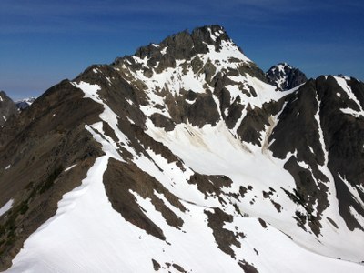
Deception, Mystery, Fricaba & Hal Foss
Scrambles and climbs up to four peaks in the Olympic Mountains from an approach along the Dungeness River.
getting there
From US 101 near Sequim Bay State Park, turn west onto Luella Road and then left onto Palo Alto Road. In 6 miles, turn right onto Forest Road 2880 and then turn left onto Forest Road 2870 in 1.7 miles. In 9 miles, reach the large parking area just past the Dungeness River Bridge (2,500 ft).
Approach
Hike the Dungeness River Trail to the fork in the trail near Camp Handy (3.2 mi, 3,100 ft). Continue following the trail along the Dungeness River until reaching the spot affording the best progress and crossing of the Dungeness River to reach the Northeast Ridge of Mount Fricaba (~4.0 mi, 3,250 ft). After achieving this ridge (4.4 mi, 4,400 ft), continue over Point 6138 (5.1 mi, 6,138 ft) and follow the ridge crest to reach the summit of Mount Fricaba (6.3 mi, 7,139 ft). Descend the southwest ridge a short distance (6.5 mi, 6,600) to finally descend to campsites in the upper Deception Basin (6.7 mi, 6,200 ft).
Ascent
Leave campsites (6,200 ft) and descend to 6,000 ft in a westerly direction until afforded a direct line to the col east of Mount Mystery by way of the stagnant glacier. Being mindful of cliffs below, ascend from the col (~6,700 ft) and traverse through mixed rock and snow to reach more open snow slopes that are ~200 feet to the south of the col. Ascend these snow slopes upward (staying south of the blocky rock area immediately above the col) to reach the final 4th class section to reach the summit (7,639 ft).
Descent
Descend the climbing route. Parties may choose to scramble Hal Foss Peak (7,179 ft) when returning to camp. Parties can exit using the approach route, but an interesting variation is to return to the cars by way of the popular Royal Basin.
notes
- Due to unpredictable snow and rock conditions, parties should bring gear affording roped team travel that includes picket placements and rock protection.
- Suitable Activities: Climbing, Scrambling
- Climbing Category: Basic Alpine
- Seasons: May, June, July, August, September
- Weather: View weather forecast
- Difficulty: Basic Alpine Climb
- Length: 18.0 mi
- Elevation Gain: 8,500 ft
- 7,639 ft
-
Land Manager:
Olympic National Park
Buckhorn Wilderness
- Parking Permit Required: National Park Entrance Fee
- Recommended Party Size: 12
- Maximum Party Size: 12
- Maximum Route/Place Capacity: 12
- Green Trails Olympic Mountains East No. 168S
- Custom Correct Gray Wolf - Dosewallips
- USGS Mt Deception
This is a list of titles that represent the variations of trips you can take at this route/place. This includes side trips, extensions and peak combinations. Not seeing a title that fits your trip? Log in and send us updates, images, or resources.
- Mount Mystery/East Col
- Mount Mystery & Mount Fricaba
- Mystery & Fricaba
- Mount Deception
There are no resources for this route/place. Log in and send us updates, images, or resources.
