Deception Pass State Park
Easy and moderate day hikes for people of all ages along beaches and to the the highest point on Whidbey Island in the southern half of Deception Pass State Park.
getting there
From Seattle, follow I-5 N to WA-20 W/Avon Cutoff in Burlington. Take exit 230 from I-5 N. Follow WA-20 for about 15 miles and follow signs for Deception Pass State Park.
on the trail
Goose Rock
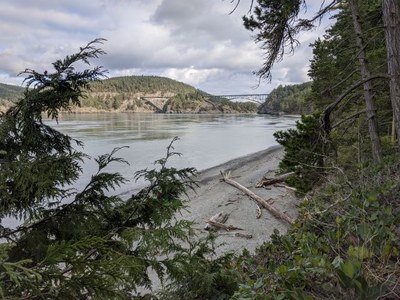
Begin on the West Point of Rosario Straight following the beach trail up and under Deception Pass Bridge to Goose Rock and down to Cornet Bay. Return using several well maintained and popular trails.
north beach
Hike from east to west or west to east and back along the North Beach Trail
west beach
Hike out and back along West Beach and consider taking the Dunes Interpretive Loop Trail along Rosario Strait and Cranberry Lake, respectively.
amenities
- Hiking Trails
- Sandy Beaches
- Interpretive Center
- Fishing Dock
- Campground
notes
- Some of the roads in the park are closed for winter which opens up a bunch of loop options that would be a little more dangerous otherwise (i.e. a risk of cars). See the Land Manager for closures.
- For day hikes in the north part of Deception Pass State Park, use the Bowman Bay route/place.
Information for Leaders
Scheduling & Permits
- If you are scheduling this as a non-course related activity, please limit your group size to the recommended party size. The maximum party size is for use by course field trips only, and includes both students and instructors. Group size maximums do not reflect how course field trips are run (in smaller groups of students and instructors), but allow for course leaders to register the course in our system.
- The Mountaineers has a commercial use permit with Washington State Parks for all free and fee-based outings at state parks. Leaders should carry a print or digital copy of our commercial use permit to show rangers they may encounter.
- If you are scheduling a course field trip, please contact our Member Services Team to confirm the field trip and any added permitting regulations.
- Suitable Activities: Day Hiking, Trail Running
- Seasons: Year-round
- Weather: View weather forecast
- Difficulty: Easy, Easy/Moderate
- Length: 4.3 mi
- Elevation Gain: 484 ft
- 484 ft
- Land Manager: Deception Pass State Park
- Parking Permit Required: Discover Pass
- Recommended Party Size: 12
- Maximum Party Size: 30
- Maximum Route/Place Capacity: 30
- Green Trails Deception Pass No. 41S
This is a list of titles that represent the variations of trips you can take at this route/place. This includes side trips, extensions and peak combinations. Not seeing a title that fits your trip? Log in and send us updates, images, or resources.
- Deception Pass State Park: Goose Rock
- Goose Rock
- Deception Pass State Park: North Beach
- North Beach
- Deception Pass State Park: West Beach
- West Beach
There are no resources for this route/place. Log in and send us updates, images, or resources.
