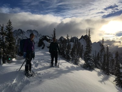
First Top & Point 4795 Loop
Beautiful mountain and sea views on a very strenuous winter scramble of 12 mi and 6,000 feet that visits First Top as well as Point 4795 above Lake Angeles. This shared outing is made possible by utilizing portions of the Heather Park Trail as well as the Lake Angeles/Kalhane Ridge Trail which both begin at the Heart of the Hills parking area.
Getting There
From Hood Canal Bridge, drive west toward Port Angeles on SR 104, then US 101. After entering Port Angeles, turn left on S. Race Street and proceed for approximately 0.5 mi to reach the Olympic National Park Wilderness Information Center (WIC) whose heated restrooms are usually open before business hours. From the WIC travel 5 mi uphill to reach the Heart of the Hills parking area (turn right just before the fee both).
Approach and Ascent
From the Heart of the Hills parking area follow the Lake Angeles Trail to an elevation of 4,000 ft. Turn west and head uphill to reach the ridge crest, then follow the ridge crest uphill to reach Point 4795. To reach the next section of the loop descend your ascent route to reach the west side of Ennis Creek (~2,500 ft). Just after crossing Ennis Creek, head uphill in a mostly westerly direction in a line affording the best progress through brush (it quickly thins as you gain elevation) to reach the 3,500 ft elevation on the ridge crest trending NNE between First Top and the Heart of the Hills parking area. Ascend this ridge crest in a SSW direction to reach the summit of First Top (5,510 ft), taking very careful note of your crossing of the Heather Park Trail at the 4,500 ft. elevation. Descend your track from First Top to reach the Heather Park Trail at 4,500 ft, then follow this trail to the Heart of the Hills parking lot.
NOTES
This loop can be done in either direction, but the key determinant as to the best direction for a particular day are the snow conditions on the steep portion of the cross country section between the two trails. This section is between the ~2,500 ft elevation on the Lake Angeles Trail, to the ~3,500 ft elevation on the ridge crest that trends NNE between First Top and the Heart of the Hills parking area. For mostly bare ground or hard snow conditions it is best to travel this section east to west (uphill). For non-consolidated snow that lends itself to plunge stepping (either snowshoes or on foot), it is best to travel this section west to east (downhill).
- Suitable Activities: Scrambling
- Seasons: January, February, March, November, December
- Weather: View weather forecast
- View avalanche forecast.
- Difficulty: Strenuous 5, Technical 3
- Length: 12.0 mi
- Elevation Gain: 6,000 ft
- 5,510 ft
- Land Manager: Olympic National Park
- Parking Permit Required: National Park Entrance Fee
- Recommended Party Size: 12
- Maximum Party Size: 12
- Maximum Route/Place Capacity: 12
- Green Trails Hurricane Ridge/Elwha North No. 134S
- Custom Correct Hurricane Ridge
- USGS Port Angeles
This is a list of titles that represent the variations of trips you can take at this route/place. This includes side trips, extensions and peak combinations. Not seeing a title that fits your trip? Log in and send us updates, images, or resources.
- First Top
- Point 4795
There are no resources for this route/place. Log in and send us updates, images, or resources.
