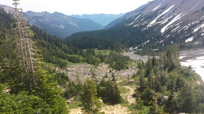
Glacier Basin (Mount Rainier)
A moderate, 7 mile round trip hike with 1,700 feet of elevation gain. The trail ascends the upper White River valley through forest, past mining relics, flower meadows and ends in glacial moraine with views of Mount Rainier and Saint Elmo Pass. Make it a challenging loop trip by hiking up to Sunrise across Burroughs Mountain and looping back to the White River Campground through Glacier Basin.
This hike is in Mount Rainier National Park. The National Park Service preserves unimpaired the natural and cultural resources and values of the National Park System for the enjoyment, education, and inspiration of this and future generations. The National Park Service cooperates with partners to extend the benefits of natural and cultural resource conservation and outdoor recreation throughout this country and the world.
All participants should orient themselves to the unique geologic hazards at Mt. Rainier, an active volcano.
GETTING THERE
Drive SR-410 to the White River entrance of Mount Rainier National Park. Turn right on Sunrise Rd, then turn left onto White River Rd and follow it until it ends at White River Campground. The trailhead is located at the upper end of the "D" campground loop (4,300 ft).
on the trail
Glacier Basin
6.8 miles round trip with 1,650 feet of elevation gain, 5,975 ft high point
Hike the Glacier Basin Trail 3.4 mile to Glacier Basin Camp and spectacular views of Mount Rainier.
Emmons Moraine
3 miles round trip with 880 feet of elevation gain, 5,100 ft high point
Hike the Glacier Basin Trail 0.9 mile, bear left onto the Emmons Moraine Trail, and continue 0.6 mile to the edge of the Emmons Moraine at 5,400 ft.
Sunrise & Glacier Basin Loop
10 miles round trip with 3,200 feet of elevation gain, 7,400 ft high point
Explore Sunrise the old-fashioned way, by foot! This strenuous hike starts at the White River campground and climbs up 2.5 miles to just west and below the Sunrise parking lot. From the Sunrise meadows, turn left (west) and hike 2.3 miles up the ridge towards Burroughs. Hike up to Second Burroughs for another mile, then continue out towards Third Burroughs. If time allows, climb up Third Burroughs. Descend 1.5 miles to the Glacier Basin trail and then follow that trail 2.6 miles back to White River campground.
- Southern exposure of the trail up to the ridge may allow for earlier hiking, possibly before the road to Sunrise opens (usually around July 4th).
- The above description is for the loop counter-clockwise. It could also be done clockwise.
- Suitable Activities: Day Hiking
- Seasons: July, August, September, October
- Weather: View weather forecast
- Difficulty: Moderate
- Length: 7.0 mi
- Elevation Gain: 1,700 ft
- 6,000 ft
- Land Manager: Mount Rainier National Park
- Parking Permit Required: National Park Entrance Fee
- Recommended Party Size: 12
- Maximum Party Size: 12
- Maximum Route/Place Capacity: 12
- Green Trails Mount Rainier Wonderland No. 269SX
- Green Trails Mt Rainier East No. 270
This is a list of titles that represent the variations of trips you can take at this route/place. This includes side trips, extensions and peak combinations. Not seeing a title that fits your trip? Log in and send us updates, images, or resources.
- Glacier Basin
- Emmons Moraine
- Emmons Moraine Trail
- Sunrise Loop
- Glacier Basin Loop
- Sunrise & Glacier Basin Loop
- Glacier Basin & Sunrise Loop
There are no resources for this route/place. Log in and send us updates, images, or resources.
