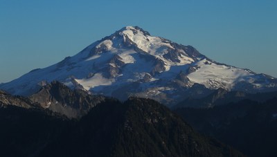
Glacier Peak/Frostbite Ridge
A climb of Glacier Peak via the Frostbite Ridge, Vista Glacier and Kennedy Glacier is an early season Basic Alpine Climb and a late season Intermediate Ice Climb with long approach, heaps of elevation gain, some Class 3 scrambling, steep snow and possibly a few pitches of ice climbing.
getting there
Drive the Suiattle River Road (Forest Road 26) from Darrington to its end at the Sulfur Creek Campground (~1,800 ft). A pit toilet available.
APPROACH
From the Campground, follow the Suiattle Pass Trail (No. 784) ~7 mi to the new bridge across the Suiattle River (replacing the one further upstream that was destroyed in the great floods of 2003). Follow the Pacific Crest Trail (PCT) southbound for ~9 mi to East Fork Milk Creek basin to a PCT camp (5,600 ft). Bivy spots can be found at a flat spot on the ridge at the top of the basin at 6,500 ft (no water later in the season) or even further near the lower Vista glacier.
ASCENT ROUTE
From the PCT camp ascend SSE up the basin to a flat saddle in the ridge at 6,500 ft. From the saddle follow the ridge west for a short distance until it is suitable to start traversing on the south side on heather and scree slope towards lower Vista glacier. On the traverse easier terrain can be found near the cliffs above. Things get easier after about 1,000 feet and the Vista glacier can be easily accessed around 6,200 ft elevation. The lower Vista glacier is low angle but might be icy late season. Ascend the glacier towards Vista-Kennedy saddle (8,000 ft).
From this saddle, ascend the Kennedy Glacier (a few small crevasses) to an 8,800 ft saddle between the Kennedy and Ermine Glaciers. From here, Frostbite Ridge becomes more prominent and the route is obvious for the next 1,000 feet. Running belays with pickets may be advisable in a few of the steeper sections.
From the 8,800 ft saddle (the last bivy site before the summit crater), ascend on pumice or snow (steep near the top) up the ridge to the "Rabbit Ears" feature. This feature is not visible until one is immediately below it slightly east from the ridge crest. Climb through the ears and then climb down on the other side to a saddle (Class 3).
From the col between the upper Kennedy Glacier and the Rabbit Ears, climb ~150 feet of steep snow to the false summit. Descend into the crater over snow/ice or talus. (Bivvy site in the crater with meltwater). After crossing the crater, climb several pitches of steep snow or ice up to 60 degrees to the south portion of the crater rim. (Probably ice after early season in a normal snow year). Bring 3-4 ice screw or pickets to protect this and be prepared to rappel on the descent. The summit is a short walk to the west after climbing this steep snow/ice.
DeSCENT ROUTE
Descend the climbing route.
TRIP PROFILE
| SEGMENT | TIME (HR) | ELEVATION GAIN (FT) | ELEVATION LOSS (FT) | DISTANCE (MI) |
|---|---|---|---|---|
| Trailhead to Camp | 8-10 | 4,000 | 200 | 16 |
| Camp to Summit | 7-10 | 4,900 | 6 | |
| Summit to Camp | 6-8 | 4,900 | 6 | |
| Camp to Trailhead | 6-8 | 200 | 4,000 | 16 |
EQUIPMENT
Standard glacier equipment. Ice screws, 60m rope for rappels down to the crater, pickets, second ice tool for a late season climb.
notes
- The Milk Creek Trail would give a shorter approach, but this trail is currently (as of Aug 2015) in disrepair and there are no plans to repair it.
- Suitable Activities: Climbing
- Climbing Category: Intermediate Alpine
- Seasons: June, July, August, September
- Weather: View weather forecast
- Difficulty: Intermediate Ice Climb, Basic Glacier Climb, Basic Experience Climb
- Length: 44.0 mi
- Elevation Gain: 8,900 ft
- 10,500 ft
-
Land Manager:
Mount Baker-Snoqualmie National Forest
Glacier Peak Wilderness, Darrington Ranger District (MBSNF)
- Parking Permit Required: Northwest Forest Pass
- Recommended Party Size: 12
- Maximum Party Size: 12
- Maximum Route/Place Capacity: 12
- Green Trails Glacier Peak No. 112
- Trails Illustrated Glacier Peak Wilderness
- USGS Lime Mountain
- USGS Gamma Peak
- USGS Glacier Peak East
- USGS Glacier Peak West
There are no resources for this route/place. Log in and send us updates, images, or resources.
