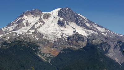
Gobblers Knob
A 10 mile hike with 1,100 feet of elevation gain to a fire lookout on the west side of Mount Rainier National Park. The trail, mostly in Mount Baker-Snoqualmie National Forest, passes by Lake Christine and Goat Lake before ascending to the knobby summit in Mount Rainier National Park. Extend your trip by descending to Lake George.
getting there
Drive east on SR 7 (National Park Highway), continuing east when it becomes SR 706. Turn left (north) onto Forest Road 59 (Copper Creek Road) shortly before the Mount Rainier National Park entrance. In 3.4 miles stay on Forest Road 59 by taking the left fork. In 1.5 miles turn right onto Forest Road 5920. Continue 2.4 miles to the Lake Christine trailhead (4,400 ft).
notes
- Looking to hike to Gobblers Knob from Westside Road? See our Emerald Ridge, Klapatche Park & Gobblers Knob route/place.
- Suitable Activities: Day Hiking
- Seasons: July, August, September, October
- Weather: View weather forecast
- Difficulty: Strenuous
- Length: 10.0 mi
- Elevation Gain: 1,100 ft
- 5,485 ft
-
Land Manager:
Gifford Pinchot National Forest
Glacier View Wilderness, Cowlitz Valley Ranger District (GPNF)
- Parking Permit Required: Northwest Forest Pass
- Recommended Party Size: 12
- Maximum Party Size: 12
- Maximum Route/Place Capacity: 12
- Green Trails Mt Rainier West No. 269
- Green Trails Mount Rainier Wonderland No. 269SX
This is a list of titles that represent the variations of trips you can take at this route/place. This includes side trips, extensions and peak combinations. Not seeing a title that fits your trip? Log in and send us updates, images, or resources.
- Lake George
- Gobblers Knob & Lake George
- Mount Beljica
- Mount Beljica & Gobblers Knob
There are no resources for this route/place. Log in and send us updates, images, or resources.
