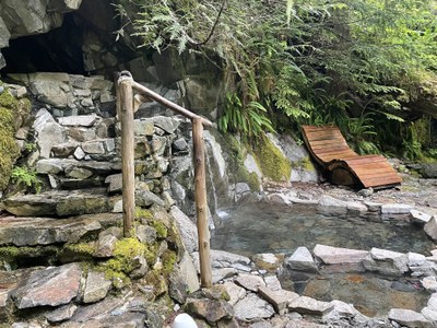
Goldmyer Hot Springs
A 9 mile round trip hike to pristine, well-maintained backcountry hot springs 25 miles east of North Bend.
getting there
Goldmyer Hot Springs will provide specific driving instructions after completing your reservation. They recommend using these.
Alternatively, take Exit 34 off of I-90 and turn north onto 468 Ave SE. In a half mile, turn right onto SE Middle Fork Road (Forest Road 56). Drive 12 miles to the junction with Taylor River Road, turn right onto Forest Road 5620 and drive 5 miles to the Dingford Creek Trailhead (1,500 ft).
about the hot springs
Reservations are required to use the hot springs. Visit the Goldmyer Hot Springs website for costs, groups size limits, camping information, and to make a reservation. There is a caretaker on the property who orchestrates check-in and check-out for groups.
on the trail
This hike travels through Mount Baker-Snoqualmie National Forest and along the edge of the Alpine Lakes Wilderness. From the Dingford Creek Trailhead, hike east on either the Middle Fork Trail (No. 1003) or the Dutch Miller Gap Trail (No. 1030). Make a loop trip by hiking out one and back the other. Out-and-back either trail or the loop are all ~11 miles round trip.
Follow any instructions from Goldmyer Hot Springs and look for signs at trail junctions labeled for Goldmyer. Several small, easy stream crossings are required and major creeks like Thunder Creek and Burntboot Creek have log bridges. Once across Burntboot Creek, you are on Goldmyer Property. Here a sign will welcome you and layout property expectations. If you do not have a reservation, and the hot spring is full for the day, this is where you must turn around.
Notes
- If you're looking for a longer trip, consider starting at the Middle Fork Campground.
- Suitable Activities: Backpacking, Bikepacking, Day Hiking
- Seasons: Year-round
- Weather: View weather forecast
- Difficulty: Easy, Bikepacking MTB I, Bikepacking MTB II
- Length: 9.0 mi
- Elevation Gain: 250 ft
- 2,050 ft
- Land Manager: Goldmyer Hot Springs
- Parking Permit Required: Northwest Forest Pass
- Recommended Party Size: 8
- Maximum Party Size: 20
- Maximum Route/Place Capacity: 20
- Green Trails Middle Fork Snoqualmie No. 174SX
There are no resources for this route/place. Log in and send us updates, images, or resources.
