Grants Pass Area Siskiyous
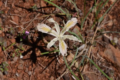
Just south of Grants Pass, Oregon near Selma and Cave Junction are several short, easy trails renowned for their spring wildflowers, colorful serpentine flora, and spectacular fens (wetlands).
on the trail
Here are some of the best waysides and trails in this area:
- Limpy Creek Botanical Trail (southwest of Grants Pass): 1 mile loop with 120 feet elevation gain. Travel through several plant communities, from wet and dry serpentine meadows to pine-oak woodlands to a cool creek bottom with a cascade. Wildflower bloom season is early April to early June, with peak mid-April to early May. Interpretive signs are helpful along the trail. Look for special April highlights: Henderson's fawn lily (lavender) and Oregon fawn lily, spring gold, fritillary, balsamroot, cat's ear, onion, Hooker's Indian pink, lomatium, death camas, orchid, trillium and more.
- Eight Dollar Mountain (south of Selma): Jeffrey Pine Loop Trail is a 1 mile loop with minimal elevation gain, and Eight Dollar Mountain Boardwalk is a wheelchair-accessible 1/8 mile trail. Both are in a fen (wetland).
- Waters Creek Trail (south of Grants Pass): 3.4 mile loop with 400 feet of elevation gain. Travel through a number of riparian-area habitats: fern-covered slopes, small meadow, rocky grassland, mixed forest of oak and conifer. A long spring wildflower season extends from March to early June, with peak in April. The 1-mile graveled trail is graveled with interpretive signs, or hiked as part of a longer 2+ mile loop. Enjoy the coolness and music of Waters Creek. Lichens are draped on trees near the creek. Look for false Solomon's seal, great hound's tongue, candyflower, wild rose, trillium, giant wake robin, Nuttall's larkspur, waterleaf, lupine, buttercup, lomatium, calypso, mock orange and more.
- Illinois River National Recreation Trail (near Selma): The entire trail is 27+ miles, but the first few (~4 miles and ~900 feet of elevation gain) are a great addition to a spring wildflower trip.
- Star Flat (west of Selma): 1 mile with 300 feet of elevation gain. Colorful serpentine flora and spectacular fen showcase California pitcher plants along Deer Creek. The route,descending to the fen, follows an abandoned mining and logging road. Bloom season is April to early June, with peak blooms and varieties in April. During April, you'll likely see lemon-colored fawn lily, Hendeson's shooting star, death camas, ceanothus, western buttercups, Waldo rock cress, wedge leaf violets, onions, manzanita, monkeyflowers, pennycress, biscuitroot, carnivorous California pitcher plants and broomrape awaiting insects in the large fen.
- Rough & Ready Botanical Wayside Trail (south of Cave Junction): 1 mile with minimal elevation gain. A special botanical site with a rich, diverse assemblage of wildflowers. A broad, flat plain borders Rough and Ready Creek. The underlying soil is serpentine, in which species rarely found elsewhere have adapted to and thrive. The bloom season runs from March through early July, with peak blooms and varieties about mid-April. New plant blooms appear each week. Among Jeffrey pines and Oregon white oaks, during peak bloom period: you'll likely see Waldo rock cress, phlox, shooting stars, manzanitas, ceanothus, blue dicks, balsamroot, blue-eyed Mary, popcorn flowers, Hall's violet, fritillary, and many more.
References
- 100 Hikes in Southern Oregon, 3rd ed. by William L. Sullivan (Navillus Press, 2010).
- Oregon's Best Wildflower Hikes, Southwest Region by Elizabeth Horn (Westcliffe Publishers, 2006).
- Wildflowers of the Pacific Northwest by Mark Turner & Phyllis Gustafson (Timber Press, 2006).
- Suitable Activities: Day Hiking
- Seasons: Year-round
- Weather: View weather forecast
- Difficulty: Easy/Moderate
- Length: 4.0 mi
- Elevation Gain: 400 ft
- 1,300 ft
- Land Manager: Rogue River–Siskiyou National Forest
- Parking Permit Required: None
- Recommended Party Size: 8
- Maximum Party Size: 12
- Maximum Route/Place Capacity: 12
- USFS Rogue River National Forest
- USFS Siskiyou National Forest
This is a list of titles that represent the variations of trips you can take at this route/place. This includes side trips, extensions and peak combinations. Not seeing a title that fits your trip? Log in and send us updates, images, or resources.
- Upper Illinois River Valley Waysides & Trails (Oregon)
- Upper Illinois River Valley Waysides & Trails
- Grants Pass Area Siskiyous
- Limpy Creek Botanical Trail
- Eight Dollar Mountain
- Eight Dollar Mountain: Jeffrey Pine Loop Trail
- Jeffrey Pine Loop Trail
- Eight Dollar Mountain Boardwalk
- Waters Creek Trail
- Illinois River National Recreation Trail
- Illinois River Valley Botanical Trails (Oregon)
- Illinois River Valley Botanical Trails
- Star Flat
- Rough & Ready Botanical Wayside Trail
- Rough & Ready Botanical Wayside Trail and Star Flat
There are no resources for this route/place. Log in and send us updates, images, or resources.
