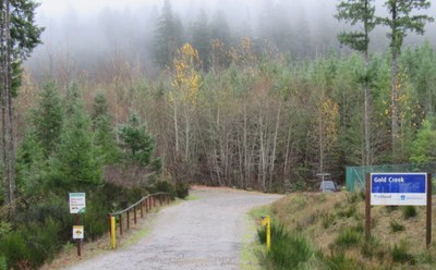
Green Mountain: Gold Creek Trail
On the Kitsap Peninsula, this is a moderate, 5-9 mile loop day hike with 1,000 feet of elevation gain. The trail goes from the Gold Creek Trailhead through forests and meadows up to Green Mountain with views of Seattle and the Olympics.
Getting There
From Bremerton, drive SR-310 West for 3 miles to Kitsap Lake. Turn left onto Northlake Way, then left onto the Seabeck Highway. After 3 miles, turn left onto Holly Road. In 3 miles, turn left onto Lake Tahuya Road, and then turn left onto Gold Creek Road. Drive 2 miles to the trailhead (650 ft) with a large parking lot and restrooms.
on the trail
Green Mountain is the second highest point on the Kitsap Peninsula with two loop hike options from the Gold Creek trailhead.
Gold Creek-Vista-Plummer
Hike the Gold Creek Trail to the Vista Trail and the summit of Green Mountain. Return the way you came for a round trip day hike or after descending the Vista Trail, take the trail towards Beaver Pond and then turn left to return via the Plummer Trail to make a loop trip. This is 5 miles and 1,000 feet of elevation gain.
Gold Creek-Vista-Wildcat-Beaver Pond-Plummer
Hike the Gold Creek Trail to the Vista Trail and the summit of Green Mountain. Descend the Vista Trail and take the Wildcat Trail to the Beaver Pond Trail. Shortly past Beaver Pond, turn right on the Plummer Trail to return. This day hike is 9 miles and 1,000 feet of elevation gain.
notes
- The trail is open to dogs, horses, mountain bikes, motorbikes, and ATVs. Watch for traffic!
- Map Reference: Green Mountain State Forest Trail System
INFORMATION FOR LEADERS
- Permits are required in this area for all fee-based (course-related) activities, regardless of group size, and all free activities involving 25 or more people. Leaders may list trips at this route/place with the understanding that they need to verify that a permit has been obtained before running the trip (if required as outlined above). Permit applications are submitted to WA Department of Natural Resources annually in December. Please contact info@mountaineers.org with any additional questions. More details about permitting on WA DNR land as it applies to Mountaineers trips, as well as our current year Land Use License, can be found here.
- If you are hiking the entire trail as a day hike, please keep your party's size to 12. If you're using the area for a field trip, you can take up to 50 but please do break into a few smaller groups.
- Suitable Activities: Day Hiking, Trail Running
- Seasons: Year-round
- Weather: View weather forecast
- Difficulty: Easy/Moderate
- Length: 5.0 mi
- Elevation Gain: 1,000 ft
- 1,639 ft
- Land Manager: Green Mountain and Tahuya State Forest
- Parking Permit Required: Discover Pass
- Recommended Party Size: 12
- Maximum Party Size: 50
- Maximum Route/Place Capacity: 50
- USGS Holly
- USGS Wildcat Lake
- WA DNR Green Mountain State Forest
- see Notes
There are no resources for this route/place. Log in and send us updates, images, or resources.
