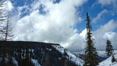
Haney Meadow Loop, Diamond Head & Windy Knob
A strenuous snowshoe or ski of 7-12 miles with up to 2,000 feet of elevation gain. This route takes you along ski trails and through meadows up to a saddle. From there two peaks may be climbed, ski routes descended and a loop to the north to complete your trip.
getting there
Drive to the Blewett Pass SnoPark on US-97 roughly 27 miles north of Cle Elum.
SNOWSHOE routes
The snowshoe route parallels Forest Road 9716, staying above it most of the way until around 4,400 ft. At this point Diamond Head will appear and you'll want to veer left and slightly southeast to climb around its northern flank. As you cross over to the east side of the mountain you may find a poorly blazed ski trail which you can follow or simply keep going up and around until you are heading south. It's helpful to stay well above the creek that runs in a broad valley on the east side of Diamond Head.
haney meadow loop
From the end of the valley (5,500 ft) continue arounf the south flank of Windy Knob and on to Haney Meadow to its north. Head west to return to Blewett Pass. Depending on the route chose this is a 7 to 12 mile loop with roughly 1,600 ft of elevation gain and a high point of 5,700 ft. The route takes you through pleasant meadows, with plenty of opportunity for camping around the base of Diamond Head and in Haney Meadow.
diamond head
Once you reach the low saddle (around 5,500 ft) at the end of the valley follow the ridgeline west to the summit of Diamond Head. It's 8.0 miles round trip with 1,800 feet of elevation gain to a high point of 5,915 ft.
windy knob
Once you reach the low saddle (around 5,500 ft) at the end of the valley follow the ridgeline east to the summit of Windy Knob. It's 6.25 miles round trip with 2,000 feet of elevation gain to a high point of 5,840 ft.
SKI ASCENT & DESCENT
Ski in along Forest Road 9716 for 2 miles to access west face approach to summit. Good skiing on west and northeast faces. Alternate route in on Forest Road 7245 at Tronsen Meadows. There are many options of descent, with steep gullies on the western bulwark, open slopes on the north and gladed and clearcut runs to the south and southeast. Watch out for avalanches in the steep gullies. See the "Resources" tab below for a map, elevation profile, and trip segments for the best ski routes.
- Suitable Activities: Backcountry Skiing, Snowshoeing
- Snowshoeing Category: Intermediate
- Seasons: January, February, March, December
- Weather: View weather forecast
- View avalanche forecast.
- Difficulty: Moderate, M1-M2 Intermediate-Advanced Ski
- Length: 8.0 mi
- Elevation Gain: 1,800 ft
- 5,915 ft
-
Land Manager:
Okanogan-Wenatchee National Forests
Cle Elum Ranger District (OWNF)
- Parking Permit Required: SnoPark Pass
- Recommended Party Size: 12
- Maximum Party Size: 12
- Maximum Route/Place Capacity: 12
- USGS Blewett Pass
- Green Trails Liberty No. 210
- Green Trails Wenatchee No. 211S
This is a list of titles that represent the variations of trips you can take at this route/place. This includes side trips, extensions and peak combinations. Not seeing a title that fits your trip? Log in and send us updates, images, or resources.
- Haney Meadow Loop
- Diamond Head
- Windy Knob
- Diamond Head & Windy Knob
| Name/Description |
|---|
| Diamond Head-Windy Knob Topo Map A topo map of the Diamond Head-Windy Knob ski routes by Darryl Olson created via CalTopo Feb 2020. |
| North Windy Knob Elevation Profile An elevation profile of the ski descent route from the north side of Windy Knob by Darryl Olson Feb 2020. |
| Norhteast Diamond Head Elevation Profile An elevation profile of the ski descent route from the northeast side of Diamond Head by Darryl Olson Feb 2020. |
| Northwest Windy Knob Elevation Profile An elevation profile of the ski descent route from the northwest side of Windy Knob by Darryl Olson Feb 2020. |
| Diamond Head & Windy Knob Elevation Profile An elevation profile of the ski ascent and descent route for Diamond Head & Windy Knob by Darryl Olson Feb 2020. |
| Diamond Head & Windy Knob Ski Route Trip Segments An Excel spreadsheet of trip segments with direction, distance, etc. for the Diamond Head & Windy Knob ski routes by Darryl Olson Feb 2020. |
