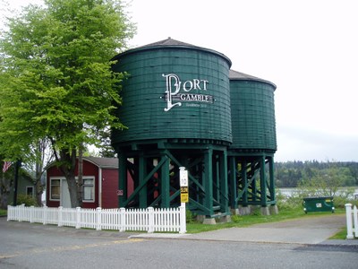
Port Gamble Bay
A great bay in North Puget Sound and near North Kitsap for sea kayaking training. Paddle in the bay or to Foulweather Bluff or Hood Head in North Hood Canal. If you are new to the sport you can also rent kayaks here from Olympic Outdoor Center.
launch points
- Olympic Outdoor Center (32379 N Rainier Ave, Port Gamble, WA 98634)
- Salsbury Point County Park (Kitsap County)
- Shine Tidelands State Park (Squamish Harbor)
on the water
Port Gamble Bay
8.0 nm round trip, difficulty: sea kayak II
Port Gamble to Foulweather Bluff Preserve
9.0 nm round trip, difficulty: sea kayak III
Cross the mouth of Port Gamble and paddle up the shoreline of the Hansville Peninsula to the Foulweather Bluff Preserve, an undeveloped nature preserve managed by The Nature Conservancy. Enjoy a side trip into Driftwood Key, formerly known and often still shown as Coon Bay, a no-facilities boat harbor.
Port Gamble to Foulweather Bluff Preserve & Hood Head
North Hood Canal Double Cross
12.5 nm round trip, Difficulty: Sea Kayak III/IV
Launch from the historic Port Gamble spit, paddle north to the Nature Conservancy's sunny Foulweather Bluff Preserve, cross Hood Canal to Tala Point, paddle south to Hood Head to explore Wolf Property State Park before crossing at the Hood Canal Bridge and returning to Port Gamble.
Salsbury Point to Squamish Harbor
10.0 nm, difficulty: sea kayak iii
From Salsbury Point County Park, cross Hood Canal and paddle around Squamish Harbor, then visit Bridgehaven before crossing back to Kitsap Peninsula and returning. Be sure to keep a safe distance from the bridge if crossing in its vicinity.
Squamish Harbor to White Rock
8 nm round trip, difficulty: Sea Kayak II/III
Launch at Shine Tidelands State Park in Squamish Harbor, paddle around Hood Head and turn around at White Rock.
Notes
- There is little to no current when traveling north as long as you stay close to shore.
- There is a back eddy of sorts both north and south of Driftwood Key.
- On Google Earth, look at the narrow part of Foulweather Bluff peninsula and see a lake. At the southwest tip of the lake where it nearly stretches to the beach is a good place to land in the preserve with walking trails to the road. This landing spot is also the shortest walk with your boat and is a sandy surface rather than mud.
- There is privacy in the woods but otherwise no toilet facilities.
Notes
- See our Northern Hood Canal route/place for sea kayak routes in in the northern section of Hood Canal south of Port Gamble Bay.
Information for Leaders
Scheduling & Permits
- If you are scheduling this as a non-course related activity, please limit your group size to the recommended party size. The maximum party size is for use by course field trips only, and includes both students and instructors. Group size maximums do not reflect how course field trips are run (in smaller groups of students and instructors), but allow for course leaders to register the course in our system.
- If you are scheduling a course field trip, please contact our Member Services Team to confirm the field trip and any permitting regulations.
- Suitable Activities: Sea Kayaking
- Seasons: Year-round
- Weather: View weather forecast
- Difficulty: Sea Kayak II, Sea Kayak III/IV
- Length: 8.0 nm
- Land Manager: Land Manager Varies
- Parking Permit Required: see Land Manager
- Recommended Party Size: 12
- Maximum Party Size: 45
- Maximum Route/Place Capacity: 45
- MapTech Oak Bay to Commencement Bay No. 102
This is a list of titles that represent the variations of trips you can take at this route/place. This includes side trips, extensions and peak combinations. Not seeing a title that fits your trip? Log in and send us updates, images, or resources.
- Port Gamble to Foulweather Bluff Preserve
- Port Gamble to Foulweather Bluff Preserve & Hood Head
- North Hood Canal Double Cross
- Salsbury Point to Squamish Harbor
- Hood Canal: Salsbury Point to Squamish Harbor
- Squamish Harbor to White Rock
- Squamish Harbor around Hood Head
- Squamish Harbor to Hood Head
There are no resources for this route/place. Log in and send us updates, images, or resources.
