DeRoux Creek
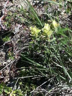
Follow DeRoux Creek out of De Roux campground and hike to Gallagher Head Lake. Enjoy the incredible spring and summer wildflower display. Shorten this hike a bit to enjoy the wildflowers or make it longer to hike around Esmeralda Peaks. Or scramble Esmerelda Peaks, DeRoux Peak or Koppen Mountain.
getting there
From SR-970 turn onto Teanaway River Road bearing right as it becomes North Fork Teanaway River Road. Just past 29 Pines Campground, it becomes a dirt road, Forest Road 9737. Continue 8.3 mi and then turn left and drive into the De Roux campground and trailhead (3,800 ft).
on the trail
DeRoux Creek-Gallagher Head Lake
8 miles round trip with 1,900 feet of elevation gain, 5,600 ft high point
The Boulder-De Roux Trail (No. 1392) starts in forest with a field of coralroot orchids on the right. At 0.75 mi is a junction, stay right, and switchback up De Roux Creek to a falls as it passes over a rock buttress where Columbia lewisia may be found. At 2.25 mi and 5,300 ft the trail crosses a creek and enters a green vale, and at 4 mi enters the Gallagher Head Lake basin at 5,600 ft. The DeRoux Creek-Gallagher Head Lake hike can be shortened to 4-5 mi round trip and 1,500 ft elevation gain for the incredible spring and summer wildflower display.
Esmeralda Basin–Gallagher Head Lake Loop
15 mile loop with 3,000 feet of elevation gain, 5,960 ft high point
This route loops around the Esmeralda Peaks, up through some of Washington’s best wildflower meadows and rock gardens, past tumbling creeks, to ridge crests offering dramatic views of near and distant peaks, including Mount Rainier, Mount Daniel, Glacier Peak, and others the Cascade Crest. A short, optional side trip along the County Line Trail leads to a high overlook above tiny Lake Ann. The main loop then continues across serpentine barrens over Fortune Creek Pass, down to Gallagher Head Lake, and then through De Roux Basin back to the trailhead. For the most part, the route climbs and descends steadily, but there are a few short, steep sections and some creek crossings (none hazardous).
approach & ascent
Esmerelda Peaks (6,480 ft)
8 miles round trip, 3,000 feet of elevation gain, difficulty: strenuous 2, technical 3
Follow Boulder/DeRoux trail 2.3 miles to open meadow area at ~5,000 ft. Shortly after crossing creek head right NNW up steep, open slope into trees with talus on right, break onto open again and pass large rock formation and gain ridge, then up into basin full of boulders. Ascended towards the right most summit, then move left to follow southeast-northwest trending ridge to the pair of summits.
DeRoux Peak (6,260 ft)
6 miles round trip, 2,500 feet of elevation gain, difficulty: strenuous 2, technical 3
Jolly Mountain (6,440)
Hike the DeRoux Creek Trail, the DeRoux Spur Trail, and then the Middle Fork Teanaway Trail to the pass between DeRoux Peak (6,260 ft) and Point 6084. Follow a boot path south along the ridge avoiding obstacles by dropping west of the ridge line. At the 6,000 ft col between Mount Skookum and Point 6084 there are two options: (1) traverse southeast, side-hilling across brushy slopes, into the basin to the northeast of Mount Skookum, then ascend a heather slope to the summit, or (2) follow the ridgeline directly to the summit.
Koppen Mountain (6,031 ft)
7 miles round trip, 2,300 feet of elevation gain, difficulty: winter scramble
Notes
- The DeRoux area is used by horses.
- Suitable Activities: Day Hiking, Scrambling
- Seasons: Year-round
- Weather: View weather forecast
- View avalanche forecast.
- Difficulty: *Varies*, Easy/Moderate, Very Strenuous, Strenuous 2, Technical 3, Winter Scramble
- Length: 6.0 mi
- Elevation Gain: 2,500 ft
- 6,260 ft
- Land Manager: Okanogan-Wenatchee National Forests
- Parking Permit Required: Northwest Forest Pass
- Recommended Party Size: 12
- Maximum Party Size: 12
- Maximum Route/Place Capacity: 12
- Green Trails Alpine Lakes East (Stuart Range) No. 208SX
- Green Trails Mt Stuart No. 209
- USGS Mount Stuart
This is a list of titles that represent the variations of trips you can take at this route/place. This includes side trips, extensions and peak combinations. Not seeing a title that fits your trip? Log in and send us updates, images, or resources.
- DeRoux Creek-Gallagher Head Lake
- Esmeralda Basin–Gallagher Head Lake Loop
- DeRoux Peak
- Koppen Mountain
- DeRoux Peak & Koppen Mountain
- Esmeralda Peaks
- Esmeralda Peaks/West Peak
- Esmeralda Peaks/East Peak
There are no resources for this route/place. Log in and send us updates, images, or resources.
