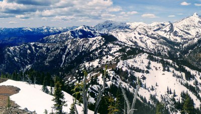
Iron Bear & Miller Peak
Iron Bear and Miller Peak done together is a 13-mile strenuous loop dayy hike. Hike the loop counterclockwise through alpine terrain up to the Teanaway Ridge, skirting the top of Miller Peak. Or hike out-and-back on either the Iron Bear or Miller Peak trails.
getting there
Take Exit 85 off of I-90, near Cle Elum. Drive six miles on State Route 970 to the Teanaway River Road. Turn left immediately after crossing the Teanaway River - there is a left turn lane onto this road. Follow Forest Road 9737 (North Fork Teanaway River Road) to 29 Pines Campground. Take the right fork just past the campground, continuing on Forest Road 9737. Then turn right on Forest Road 9703 (Stafford Creek Road) and drive to the trailhead at the end of the road (3,200 ft).
on the trail
Iron Bear
6 miles round trip, 1,900 feet of elevation gain, 4,400 ft high point difficulty: moderate
Miller Peak
8 miles round trip, 3,200 feet of elevation gain, 6,400 ft high point, difficulty: strenuous
Iron Bear/Miller Peak Loop
13 miles round trip, 3,800 feet of elevation gain, 6,400 ft high point, difficulty: very strenuous
- Suitable Activities: Day Hiking
- Seasons: July, August, September, October
- Weather: View weather forecast
- Difficulty: Very Strenuous
- Length: 6.0 mi
- Elevation Gain: 1,900 ft
- 4,400 ft
- Land Manager: Okanogan-Wenatchee National Forests
- Parking Permit Required: Northwest Forest Pass
- Recommended Party Size: 12
- Maximum Party Size: 12
- Maximum Route/Place Capacity: 12
- Green Trails Alpine Lakes East (Stuart Range) No. 208SX
- Green Trails Mt Stuart No. 209
- Green Trails Liberty No. 210
- USGS Red Top Mtn
- USGS Liberty
- USGS Enchantment Lakes
- USGS Blewett
This is a list of titles that represent the variations of trips you can take at this route/place. This includes side trips, extensions and peak combinations. Not seeing a title that fits your trip? Log in and send us updates, images, or resources.
- Iron Bear
- Miller Peak
- Miller Peak/Iron Bear Loop
There are no resources for this route/place. Log in and send us updates, images, or resources.
