Jim Hill Mountain
A strenuous approach along Henry Creek to the large north facing basin of Jim Hill, recently made less difficult by clear-cutting near Highway 2. The best skiing is in Jim Hill's north bowl.
getting there
Lanham Lake approach
Drive to the Stevens Pass Nordic Center and Lanham Lake trailhead, 5.8 miles east of Stevens Pass (3,000 ft). There is plenty of parking here. Head up towards Lanham Lake to start your tour from here. If you plan use this approach, please check the Lanham Lake & Sam Hill Peak route/place to avoid conflicts with others using this approach.
henry creek approach
Drive to the west end of the east tunnel entrance, approximately 7 miles east of Stevens Pass. Park in pullouts along the shoulder. Note that these are not designated winter parking areas, so look for "no parking" signs and avoid parking where you would impede snowplows. To start the tour from here, walk west to the logging road, Forest Road 687 that heads ESE. This is the preferred approach for winter trips.
Ascent
Lanham Lake
Cross Lanham Creek at the outlet of the lake. Head east for roughly 100 yards to where terrain steepens, then follow a bearing of 116° to a saddle. Turn right and follow the ridge to 6,400 ft and head for the notch to the left of Jim Hill Mountain--the true summit is the third bump from the left. Just below the notch, ascend a gully 40 feet to the right by ascending a lightly vegetated knoll and then the gully. Scramble 20 feet of Class 3 rock on the right side of the ridge. Continue following the ridge to the summit.
ski descent
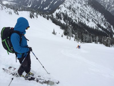
The best skiing is in Jim Hill's north bowl. Spend the day there or look farther afield to Arrowhead Mountain and descents along both sides of the ridge connecting Jim Hill and Arrowhead Mountain, especially if you've taken the Henry Creek approach.
- Suitable Activities: Backcountry Skiing, Scrambling
- Seasons: January, February, March, April, December
- Weather: View weather forecast
- View avalanche forecast.
- Difficulty: M2 Advanced Ski, Winter Scramble, Strenuous 4, Technical 4
- Length: 8.0 mi
- Elevation Gain: 3,800 ft
- 6,765 ft
- Land Manager: Okanogan-Wenatchee National Forests
- Parking Permit Required: Northwest Forest Pass
- Recommended Party Size: 12
- Maximum Party Size: 12
- Maximum Route/Place Capacity: 12
- USGS Chiwaukum Mountains
- USGS Mt Howard
- USGS Stevens Pass
- USGS Labyrinth Mtn
- Green Trails Alpine Lakes West (Stevens Pass) No. 176S
- Green Trails Alpine Lakes East (Stuart Range) No. 208SX
This is a list of titles that represent the variations of trips you can take at this route/place. This includes side trips, extensions and peak combinations. Not seeing a title that fits your trip? Log in and send us updates, images, or resources.
- Jim Hill Mountain
There are no resources for this route/place. Log in and send us updates, images, or resources.
