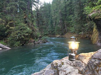
La Wis Wis Campground
A campground at the confluence of the Clear Fork Cowlitz River, the Ohanapecosh Rivers, and Purcell Creek near Mount Rainier and just north east of Packwood. Campsites are among towering Douglas firs and red cedars.
Getting There
From the intersection of US-12 and Skate Rd in Packwood, drive US-12 east 6.6 miles, turn left at the campground sign, and drive 0.4 mile to the campground.
About the Campground
This is a large campground with 109 sites. Most sites offer good privacy. The Purcell Falls Trail (No. 162A) and the Blue Hole Trail (No. 167) leave from the campground and offer short trips with views of the falls and the Blue Hole along the Ohanapecosh River.
- Suitable Activities: Day Hiking
- Seasons: May, June, July, August, September
- Weather: View weather forecast
-
Land Manager:
Gifford Pinchot National Forest
Cowlitz Valley Ranger District (GPNF)
- Parking Permit Required: None
- Recommended Party Size: 12
- Maximum Party Size: 200
- Maximum Route/Place Capacity: 200
- Green Trails Packwood No. 302
This is a list of titles that represent the variations of trips you can take at this route/place. This includes side trips, extensions and peak combinations. Not seeing a title that fits your trip? Log in and send us updates, images, or resources.
- Blue Hole
- Purcell Falls
- Blue Hole & Purcell Falls
- La Wis Wis, Blue Hole & Purcell Falls
There are no resources for this route/place. Log in and send us updates, images, or resources.
