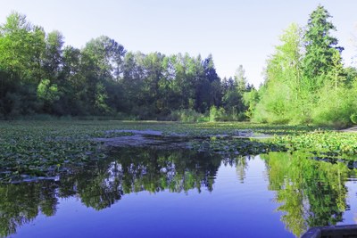
Lake Fenwick via the Rabbit Loop
An in-town walk in Kent that feels more like the countryside as you travel to Lake Fenwick.
on the trail
From Russell Road Park follow Russell Road south to W Meeker St. Then turn right and travel to the Green River Bridge. Take a left at the Green River Trail (do not cross the bridge) and walk east alongside the par 3 golf course. You are now following the Rabbit Loop, part of the new Kent Valley Loops Trail System.
Cross the footbridge under SR 516 and head back west along Frager Rd (the opposite side of the river) to reach the Old Fishing Hole after about 2 miles. Take the loop clockwise around the pond and rejoin Frager Rd to turn left at W Meeker St. Cross SR 516 (crosswalk) and turn left just before the Woodlands Estate Apartments. Look for a discolored sign stating "Lake Fenwick Park" where there is a small roadside trailhead parking lot and start of a trail running south into the park. Follow this trail. It combines boardwalk, dirt and gravel sections.
As the secluded trail turns to the right (north) you climb a steep metal staircase of 179 steps. After a short flat section the path descends quite steeply to the lakeside giving glimpses of the lake to your left. Follow sections of the trail, grass and roadside south close to the lakeside including a boardwalk section to reach the Fenwick Park Boat Launch. You can go a bit further along the lakeside to find some picnic tables for a lunch stop with a toilet close by.
Return by the same route until you re-cross SR 516. Then go under the road bridge and cross the footbridge to rejoin the Green River Trail on the east bank of the river. Follow this trail north and then east alongside the River Bend Golf Course to where the trail meets Russell Road. Cross the road with care (no crosswalk) and turn right to re-enter Russell Road Park on your left to complete the hike. This is approximately 6 miles round trip and 180 feet of elevation gain. There are sections of road shoulder, sidewalk, paved, boardwalk gravel, grass and dirt trail: the latter which can be muddy in parts in winter and after rain.
- Suitable Activities: Day Hiking, Urban Walking
- Seasons: Year-round
- Weather: View weather forecast
- Difficulty: Easy/Moderate
- Length: 6.0 mi
- Land Manager: City of Kent
- Parking Permit Required: None
- Recommended Party Size: 12
- Maximum Party Size: 12
- Maximum Route/Place Capacity: 12
There are no resources for this route/place. Log in and send us updates, images, or resources.
