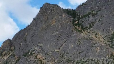
Le Petit Cheval/Spontaneity Arête
Le Petit Cheval via Spontaneity Arete has a difficulty of Grade III, 5.7.
Getting There
Drive SR-20 east to Washington Pass and continue ~2 miles to Milepost 165 and park in a turnout here.
APPROACH
Look for a climber's trail on the west side of the turnout leading steeply down loose dirt and rocks to a trail marked by cairns through the forest. The trail will cross the Early Winters Creek on logs and resume on the far side before heading up into an open, rocky drainage. Continue up the drainage, passing a cave on your right, and follow cairns. The trail steepens here significantly.
Along the way you should encounter two to three fixed lines (three as of 9/2012) before the trail tops out on a flat area. The lines are separated by gaps (trail). If you continue too far on the trail you will enter the gully (descent route). Before the gully look on your left for some tree snags. Choose one for a belay anchor, ideally on the far left/exposed portion of the ridge you are about to ascend. Rope up here for the first pitch.
ASCENT ROUTE
- P1: follow cracks up and then left. Belay below the obvious roof.
- P2: climb under the roof and out to the right and belay.
- Unrope and scramble class 2-3 up until the terrain steepens and you are not comfortable scrambling.
- P3: climb cracks and look for a 10 ft crack. Belay here.
- P4: climb the short, 10 ft crack (place pro on the left), then follow finger and hand cracks until you pass a gully with bushes. Belay at a flat section.
- P5: climb the crack in the corner/dihedral, or cracks straight up above to a tree. Climb the corner that the tree is in and continue up a few feet. The terrain moderates here before getting steep again. Belay here.
- P6: follow cracks on the right where the terrain steepens until you get to less steep ground again and belay. This pitch is about 140 ft.
- P7: climb the excellent 3 in crack on the left (5.7), or avoid it and climb a class 4 gully on the right. Unrope and scramble to the summit. The last few moves to the true summit are exposed.
DESCENT ROUTE
Rappel the climbing route to the base of the third pitch (about 5-6 rappels). Descend the gully staying high and skiers right to avoid looseness for a bit, then cross into and to skiers left of the gully. Descend until you come to the flat spot that marks the area of the first pitch. Retrace the climber's trail from here to the cars.
TRIP PROFILE
EQUIPMENT
Standard rack up to 3 in. Ice axe and crampons early season.
NOTES
An excellent first rock climb for new leaders. No pitch is above 5.7 and all difficult sections are short. It is possible to bail at any point on this route.
- Suitable Activities: Climbing
- Climbing Category: Intermediate Alpine
- Weather: View weather forecast
- Difficulty: Intermediate Rock Climb
- Elevation Gain: 1,800 ft
- 6,480 ft
-
Land Manager:
Okanogan-Wenatchee National Forests
Methow Valley Ranger District (OWNF)
- Parking Permit Required: Northwest Forest Pass
- Recommended Party Size: 4
- Maximum Party Size: 12
- Maximum Route/Place Capacity: 12
- USGS Silver Star Mtn
- USGS Washington Pass
There are no resources for this route/place. Log in and send us updates, images, or resources.
