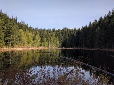
Lily & Lizard Lakes
A moderate day hike or bikepack just south of Bellingham in the Chuckanut Mountains. Enjoy a trip to two unique lakes in Blanchard Forest. Hike up the Lily Lake Trail, then in to Lizard Lake and return making a loop via the British Army Trail.
getting there
Take Exit 240 off ofI-5 and turn northwest onto Lake Samish Road. Drive 0.5 mile, turn left onto Barrel Springs Road, and drive 0.7 mile. Turn right onto DNR Road BL-ML, drive 0.7 miles to the lower trailhead (700 ft). For the upper trailhead (900 ft) continue another mile on DNR Road BL-ML, turn right, and drive 0.2 mile.
on the trail
suggested bikepack route
12-mile loop with 3,100 feet of elevation gain
Start at the Blanchard Forest Upper Parking Lot and ride north on Road B-1000, then take the left fork onto Road B-1500, and bike to the Service Trail Trailhead. Ride the trail to Lizard Lake and camp at Lizard Lake or Lily Lake—the campsites are available on first-come, first-serve basis. Using the WA DNR Blanchard Trail System Map, ride to Checkpoint V and then to Checkpoint U, take a short detour on foot to go see the view (remember to lock your bikes), then retrace your route to Checkpoint V and ride Max's Shortcut to Checkpoint X. Ride the Larry Reed Trail to the Samish Overlook for another viewpoint stop (Checkpoint Y). Ride back to Checkpoint X and take the Lily Max Connector Trail, then the Lily Lizard Trail, finally the Lily Lake Trail left back to camp. Pack up camp and reload your bikes. Ride to the Lily Lizard Trail and take a left at Checkpoint T. Ride the Alternate Incline Trail down to Road B-1000 and descend it to the Blanchard Upper Parking lot.
- Suitable Activities: Backpacking, Bikepacking, Day Hiking
- Seasons: Year-round
- Weather: View weather forecast
- Difficulty: Moderate, Bikepacking MTB I, Bikepacking MTB II
- Length: 9.4 mi
- Elevation Gain: 1,530 ft
- 1,864 ft
- Land Manager: Blanchard Forest
- Parking Permit Required: Discover Pass
- Recommended Party Size: 12
- Maximum Party Size: 12
- Maximum Route/Place Capacity: 12
- USGS Bow
- USGS Bellingham South
- Trails of the Chuckanut Mountains
- Chuckanut Mountain Recreation Map
- see Land Manager
This is a list of titles that represent the variations of trips you can take at this route/place. This includes side trips, extensions and peak combinations. Not seeing a title that fits your trip? Log in and send us updates, images, or resources.
- Lizard Lake
- Lily Lakes
- Lily Lakes Loop
- Lizard & Lily Lakes Loop
- Blanchard Forest
- Chuckanut Mountain
- Chuckanut Mountain, Blanchard Forest
