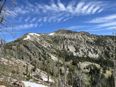
McLeod Mountain
McLeod Mountain is a high peak (one of the 200 highest in Washington) north of Mazama with wide views in all directions. There is no trail, but apart from a bit of brush at the beginning, most of the trip is a hike on open ridges.
Park at a junction shortly before the road (NF-500) crosses Whiteface Creek at about 5300'. The junction is with a gated road that goes up the valley. Ascend directly up the brushy slope to the east for about 300' until the ridge becomes more defined. At this point, the ridge is quite open; any downed trees are easily stepped over or avoided (at least as of 2024). From there, it's easy ridge walking with one bit of minor scrambling the rest of the way. There are great views in all directions.
- Suitable Activities: Scrambling
- Seasons: Year-round, May, June, July, August, September, October
- Weather: View weather forecast
- Difficulty: Strenuous 2, Technical 2
- Length: 7.0 mi
- Elevation Gain: 2,800 ft
- 8,099 ft
-
Land Manager:
Okanogan-Wenatchee National Forests
Methow Valley Ranger District (OWNF)
- Parking Permit Required: Northwest Forest Pass
- Recommended Party Size: 6
- Maximum Party Size: 12
- Maximum Route/Place Capacity: 12
- USGS McLeod Mountain
There are no resources for this route/place. Log in and send us updates, images, or resources.
