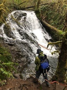
Mima Falls
An easy loop hike in Olympia's Capitol State Forest near Olympia. It is a great year round hike.
getting there
Take Exit 95 off of I-5 and drive west on Maytown Rd. In 2.9 miles turn left onto 128th Ave SW and then in 0.8 mile left onto Mima Rd SW. In 1.3 miles, turn right onto Bordeaux Rd SW, in 0.7 mile turn right onto Marksman St SW, and in 0.8 mile turn left into the Mima Falls Trailhead entrance and continue o.3 miles to the trailhead.
notes
- The trail is a multi use trail that is shared with horses and bikes.
- A shooting range is located within earshot of the trailhead and can be heard during the early part of the hike.
- The Littlerock Grocery, on the corner of Maytown and Littlerock Roads, sells the DNR trail map of Capitol State Forest.
INFORMATION FOR LEADERS
- Permits are required in this area for all fee-based (course-related) activities, regardless of group size. Leaders may list trips at this route/place with the understanding that they need to verify that a permit has been obtained before running the trip (if required as outlined above). Permit applications are submitted to WA Department of Natural Resources annually in December. Please contact info@mountaineers.org with any additional questions. More details about permitting on WA DNR land as it applies to Mountaineers trips, as well as our current year Land Use License, can be found here.
- Suitable Activities: Day Hiking, Trail Running, Bikepacking
- Seasons: Year-round
- Weather: View weather forecast
- Difficulty: Easy
- Length: 6.5 mi
- Elevation Gain: 400 ft
- 650 ft
- Land Manager: Capitol State Forest
- Parking Permit Required: Discover Pass
- Recommended Party Size: 12
- Maximum Party Size: 12
- Maximum Route/Place Capacity: 12
- WA DNR Capitol State Forest
There are no resources for this route/place. Log in and send us updates, images, or resources.
