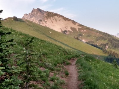
Miners Ridge, Image Lake & Plummer Mountain
A multi-day trip to the famed Image Lake area with a scramble of 7870-foot Plummer Mountain east of the lake. The approach along the Suiattle River is long but beautiful. It's 35 miles rounf trip with 6,400 feet of elevation gain.
getting there
Drive SR-530 north from Darrington or south from Rockport to the Sauk River bridge. Turn east on the North Fork Sauk River Road (Forest Road 49) and drive to the Sloan Creek campground. Leave a vehicle here. Then return to SR-530, turn right and continue north to the Suiattle River Road (Forest Road 26). Turn on Suiattle River road and drive 23 miles to the road's end and the trailhead (1,600 ft).
approach & ascent
Hike the Suiattle River Trail in the river valley for ~8 miles at low elevation before beginning a steep climb on trail toward Miners Ridge. Reach the ridge is reached at ~6,000 ft elevation, and continue east to Image Lake and good camping. From the lake, head east, ascedning the west ridge of Plummer Mountain. There are usually snowfields well into summer.
- Suitable Activities: Backpacking, Scrambling
- Seasons: May, June, July, August, September, October
- Weather: View weather forecast
- Difficulty: Strenuous, Snow Scramble, Strenuous 4, Technical 2
- Length: 35.0 mi
- Elevation Gain: 6,400 ft
- 7,870 ft
-
Land Manager:
Mount Baker-Snoqualmie National Forest
Glacier Peak Wilderness, Darrington Ranger District (MBSNF)
- Parking Permit Required: Northwest Forest Pass
- Recommended Party Size: 12
- Maximum Party Size: 12
- Maximum Route/Place Capacity: 12
- Green Trails Mountain Loop Highway No. 111SX
- Green Trails Glacier Peak No. 112
- Green Trails Holden No. 113
- USGS Lime Mountain
- USGS Gamma Peak
- USGS Suiattle Pass
This is a list of titles that represent the variations of trips you can take at this route/place. This includes side trips, extensions and peak combinations. Not seeing a title that fits your trip? Log in and send us updates, images, or resources.
- Miners Ridge
- Image Lake
- Plummer Mountain
- Miners Ridge & Image Lake
- Image Lake & Plummer Mountain
There are no resources for this route/place. Log in and send us updates, images, or resources.
