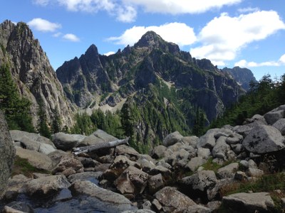
Morning Star Peak/South Ridge
A seldom climbed peak with spectacular views of Mountain Loop Highway summits. Good route-finding skills required to navigate approach along the south fork Stillaguamish river.
Getting There
Drive the Mountain Loop Highway east from Granite Falls for approximately 28 miles, turn right on Sunrise Mine Road (Forest Road 4065), and drive 2.3 miles to its end at the Sunrise Mine Trailhead (2,350 ft).
approach & ascent
Follow the Sunrise Mine Trail for ~0.5 mile until just prior to crossing South Fork Stillaguamish River. Look for an abandoned trail on east side of river. Follow this trail if found or more likely follow path of least resistance along east side of river. The initial section of the route has a reputation for thick brush.
Option 1: Continue ascending the Stillaguamish River Valley until finding a house-sized boulder (3,100 ft). Cross the river and ascend southwest up a ridge ramp to gain the ridge and the upper basin (4,000 ft). Ascend snow covered slabs eastward to find a “notch” in Morning Star’s southeast ridge at ~5,600 ft.
Option 2 : Continue working up Stillaguamish River Valley past a house-sized boulder until reaching broad basin at ~3,700 ft, then ascend a steep gully (or slabs to the right of gully) directly east of the basin. Exit the gully to the right when it's easy to do so. Ascend snow-covered slabs northwestward to find a “notch” in Morning Star’s southeast ridge at ~5,600 ft.
From the “notch”, descend approximately 200 feet through trees to the south side of the ridge into southeast basin at 5,400 ft and traverse to the right, below cliffs until reaching the first broad gully. Ascend this gully to intersect south ridge 250 feet below summit and ascend on or near south ridge to the summit (6,020 ft).
DESCENT ROUTE
Descend the climbing route.
TRIP PROFILE
Notes
- Steep snow-covered slabs make avalanche awareness a priority along route.
- Early season conditions can turn this into a basic alpine climb.
- Suitable Activities: Scrambling
- Seasons: April, May, June, July, August, September, October
- Weather: View weather forecast
- View avalanche forecast.
- Difficulty: Strenuous 4, Technical 3
- Length: 6.0 mi
- Elevation Gain: 4,200 ft
- 6,020 ft
-
Land Manager:
Mount Baker-Snoqualmie National Forest
Darrington Ranger District (MBSNF)
- Parking Permit Required: Northwest Forest Pass
- Recommended Party Size: 12
- Maximum Party Size: 12
- Maximum Route/Place Capacity: 12
- Green Trails Mountain Loop Highway No. 111SX
- USGS Bedal
There are no resources for this route/place. Log in and send us updates, images, or resources.
