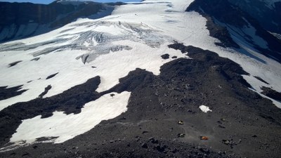
Mount Adams/Mazama Glacier
A moderate 4,300 foot glacier climb up 35 degree slopes. Much of the approach, and the entire glacier climb lies within the Yakama Nation. Climb can be done in a long day. Many climbers have difficulties with the altitude. Times: 3-4 hr trailhead to camp, 5 hr camp to summit.
THIS AREA is CLOSED UNTIL FURTHER NOTICE
June 4, 2019
The Mount Adams Recreation Area remains closed to all recreation, at least through mid-September 2019. Further assessment and completion of maintenance from the Cougar Creek Fire is needed prior to opening. This page will be updated as needed.
July 23, 2018
Due to ongoing cleanup and restoration efforts associated with the 2015 Cougar Creek Fire, the Yakama Nation has closed the entire Mount Adams Recreation Area to all recreation for 2018. Please refer to this map to see the boundaries of the Mount Adams Recreation Area.
getting there
Bird Creek Meadows
Drive on I-5 to Vancouver, Washington then east via SR 1 to just past Underwood. Take SR 141 to Trout Lake. From Trout Lake, proceed 0.25 mi to Trout Lake Ranger Station to register climb. Consider carpooling from here. Return to gas station. Turn left and continue on this road, Forest Road 82 (then Forest Road 8290) to Bird Creek Meadows, on the Yakama Indian Reservation. A Yakama Indian Reservation Tract-D tribal-use permit ($10.00 per vehicle) is required at the Mirror Lake Gate. Gate may be locked, which will add to the hike in. After gate, continue to parking lot.
Alternate Route to Bird Creek meadows
Take US 12 to Randle, then Forest Road 23 to Trout Lake. From Trout Lake, proceed 0.25 mi to Trout Lake Ranger Station to register climb. Consider carpooling from here. Return to gas station. Turn left and continue on this road, Forest Road 82 (then Forest Road 8290) to Bird Creek Meadows, on the Yakama Indian Reservation. A Yakama Indian Reservation Tract-D tribal-use permit ($10.00 per vehicle) is required at the Mirror Lake Gate. Gate may be locked, which will add to the hike in. After gate, continue to parking lot.
alternate route to Cold Springs Trailhead
From I-5 south take SR 12 east for 48 miles to Randle. Turn south on Forest Road 23 and follow it 56 miles to Trout Lake. From Trout Lake, proceed 0.25 mi to Trout Lake Ranger Station to register climb. Consider carpooling from here. Then travel north from Trout Lake 1 mile to Forest Road 80, then left on Forest Road 8040 and follow it to the Cold Springs Campground and south route trailhead (5,600 ft).
APPROACH
From parking lot at Bird Creek Meadows (5,576 ft) follow trail for 0.15 mi to fork. Take the right fork—Trail No. 20. Though steeper, this climbers trail is also 0.75 mi shorter than the other fork. Continue northwest along the ridge, up the moraine, traveling parallel to it at its base, into scrubby pines, where a climber's trail leads up to a low point on the morraine crest, and then travel down to a large relatively flat basin. Camp here (7,600 ft) or traverse across basin, angling up onto the snow slopes to the saddle just below the Mazama Glacier. This area, Sunrise Camp, is a good fair weather camp (~8,600 ft). A higher camp is possible at about 9,500 ft.
Alternative Approach
Start from Cold Springs Trailhead and follow South Spur Trail to Round the Mountain Trail (1.75 mi). Then follow the Round the Mountain Trail east across lava flows and to border of Yakama Indian Reservation. Go 0.25 mi to beginning of Bird Creek Meadows, turn left and climb up the moraine. Travel parallel to it at its base, into scrubby pines, where a climber's trail leads up to a low point on the morraine crest, and then travel down to a large relatively flat basin. Camp here (7,600 ft) or traverse across basin, angling up onto the snow slopes to the saddle just below the Mazama Glacier. This area, Sunrise Camp, is a good fair weather camp (~8,600 ft). A higher camp is possible at about 9,500 ft.
ASCENT ROUTE
Proceed up the glacier to the snowfield above, then onto a ridge. Ascend northwest up the ridge to the false summit. Cross the false summit and climb northwest about 900 ft to the summit. Use wands to mark the route for the descent.
DESCENT ROUTE
Descend the climbing route.
TRIP PROFILE
EQUIPMENT
Standard glacier equipment.
NOTES
- Note that this is a long climb with considerable elevation gain. It can be done car to car in one day, but camping at the 7,600 ft or 8,600 ft level makes it more pleasant. The climb is often done in two days, but due to the long drive, many parties allow three days.
- The climbing season is restricted to July 1 to October 1 for non-members of the Yakama Nation. A Cascade Volcano Pass is required for each climber. Purchase them at the Trout River Ranger District office. The Yakama Nation permit is also available at the Trout River Ranger District office.
- Suitable Activities: Climbing
- Climbing Category: Basic Alpine
- Seasons: July, August
- Weather: View weather forecast
- Difficulty: Technical 3, Strenuous 3, Basic Experience Climb
- Elevation Gain: 6,400 ft
- 12,276 ft
-
Land Manager:
Yakama Nation
Mount Adams Recreation Area
- Parking Permit Required: Indian Reservation
- Recommended Party Size: 12
- Maximum Party Size: 12
- Maximum Route/Place Capacity: 12
- USGS Mt Adams West
- Green Trails Mt Adams West No. 366
- USGS Mt Adams East
There are no resources for this route/place. Log in and send us updates, images, or resources.
