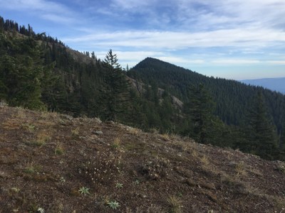
Mount Baldy
Mount Baldy is a strenuous, 8 mile round trip day hike with 3,000 ft in elevation gain. The trail goes up through forests and meadows to a peak with panoramic views.
getting there
From the north side of I-90, Exit 70, turn left and follow Sparks Road, parallel to the highway. At 0.7 mile go right on Kachess Dam Road, and follow it first north, then northeast for about a mile. Turn right on the gravel road that leads to Trail Nos. 1212, 1308 and 1315.
on the trail
The trailhead is a few hundred feet up stream from the parking area. The trail is signed as the Easton Ridge Trail (No. 1212). After crossing the footbridge do not stay low on the old logging road. Instead keep choosing trails going eastward and up-slope. The trail switchbacks for about 0.5 mile to an obvious logging road. Turn left onto the logging road. Within 200 feet come to the end of the logging road switchback, where the trail picks up again.
The trail continues in switchback fashion and turns north a few hundred feet prior to arriving at a sign on a tree at the edge of the watershed after about 0.6 mile (The sign marks Domerie Trail and the Easton Ridge Trail). Go left at the sign and follow the trail north to northeast along the ridge for about 1.2 mile to Peak 4,942. Be sure to stay on the trail or to the right of the ridge top (if trail obscured by snow), because there are steep cliffs to the left (west). At a moderate pace and a mostly bare trail it takes about 2.5 hr to reach the summit of Peak 4,942. Turn right and follow the ridge trail on a bearing of 117° southeast for about 1.2 mile to the summit of Mount Baldy.
NOTES
- Mount Baldy is a snow scramble only in early spring when there is still snow covering the trail..
- Routefinding can be difficult on snow, but much of the ridge trail to Peak 4,942 is very steep, so the going may be easier with snow.
- Extend your trip by following the ridge further westward to Domerie Peak.
- Suitable Activities: Day Hiking, Scrambling
- Seasons: June, July, August, September, October
- Weather: View weather forecast
- Difficulty: Strenuous, Strenuous 3, Technical 2
- Length: 8.0 mi
- Elevation Gain: 3,000 ft
- 5,100 ft
-
Land Manager:
Okanogan-Wenatchee National Forests
Cle Elum Ranger District (OWNF)
- Parking Permit Required: Northwest Forest Pass
- Recommended Party Size: 12
- Maximum Party Size: 12
- Maximum Route/Place Capacity: 12
- Green Trails Kachess Lake No. 208
- USGS Kachess Lake
This is a list of titles that represent the variations of trips you can take at this route/place. This includes side trips, extensions and peak combinations. Not seeing a title that fits your trip? Log in and send us updates, images, or resources.
- Mount Baldy & Domerie Peak
