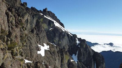
Mount Constance/South Chute
Mount Constance's South Chute route is rated Grade II, class 3.
getting there
Head east on the Dosewallips River Road from US-101. It's about 9 miles to the trailhead where the road is washed out (600 ft).
APPROACH
Walk the road to the primitive Lake Constance Trail. Hike up the trail 2 miles and 3,350 feet of elevation gain to the lake (4,650 ft) where you'll find the best camping.
ASCENT ROUTE
Follow aptly named Avalanche Canyon north for 0.6 mile from the lake. Climb east up the broad South Chute, gaining 1,200 feet, to the notch of the low point in the South Ridge. Cross to the east side and traverse north for 200 yards. Ascend a broad scree gully system to obvious notch in a minor east-west ridge. Pass through notch and descend a short distance to a scree or snow ledge. Contour north 0.25 mile, across heather or snow slopes, gullies, and finally a steep cirque. Then, climb an ascending ledge, past a rock outcropping to open slopes just southeast of the summit. The 60-foot high summit block is climbed on the north side.
DESCENT ROUTE
Descend the climbing route.
TRIP PROFILE
| SEGMENT | TIME (HOURS) | ELEVATION GAIN (FEET) |
|---|---|---|
| Trailhead to Camp | 4 | 4,200 |
| Camp to Summit | 7 | 3,100 |
| Summit to Camp | 4 | |
| Camp to Trailhead | 4 |
EQUIPMENT
Ice axe and crampons.
NOTES
- Check with the land manager about camping quotas and restrictions.
- Beware of serious early season avalanche exposure in Avalanche Canyon and on the South Chute.
- A strenuous, interesting, and beautiful alpine climb.
- It's a long summit day. Some may want a third day.
- Suitable Activities: Climbing
- Climbing Category: Basic Alpine
- Seasons: June, July, August, September, October
- Weather: View weather forecast
- Difficulty: Basic Alpine Climb, Strenuous 4, Technical 3, Basic Experience Climb
- Elevation Gain: 7,300 ft
- 7,743 ft
-
Land Manager:
Olympic National Park
Olympic Wilderness
- Parking Permit Required: National Park Entrance Fee
- Recommended Party Size: 12
- Maximum Party Size: 12
- Maximum Route/Place Capacity: 12
- USGS Mt Deception
- USGS Mt Townsend
- USGS The Brothers
- Green Trails Olympic Mountains East No. 168S
- Trails Illustrated Olympic National Park
There are no resources for this route/place. Log in and send us updates, images, or resources.
